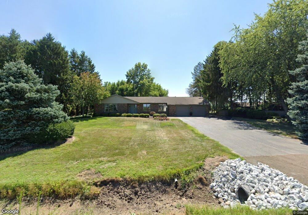
1950 W Rockey Weed Rd Stevensville, MI 49127
Estimated Value: $409,873 - $453,000
3
Beds
3
Baths
2,032
Sq Ft
$215/Sq Ft
Est. Value
About This Home
This home is located at 1950 W Rockey Weed Rd, Stevensville, MI 49127 and is currently estimated at $436,718, approximately $214 per square foot. 1950 W Rockey Weed Rd is a home located in Berrien County with nearby schools including Lakeshore High School and St. Paul's Lutheran School.
Ownership History
Date
Name
Owned For
Owner Type
Purchase Details
Closed on
Dec 21, 2012
Sold by
Fisher Thomas G and Fisher Janice M
Bought by
Knuth Philip J and Knuth Christine A
Current Estimated Value
Home Financials for this Owner
Home Financials are based on the most recent Mortgage that was taken out on this home.
Original Mortgage
$216,750
Outstanding Balance
$149,960
Interest Rate
3.34%
Mortgage Type
New Conventional
Estimated Equity
$286,758
Purchase Details
Closed on
Feb 5, 1999
Purchase Details
Closed on
Jun 6, 1997
Purchase Details
Closed on
Oct 19, 1995
Purchase Details
Closed on
Aug 31, 1989
Create a Home Valuation Report for This Property
The Home Valuation Report is an in-depth analysis detailing your home's value as well as a comparison with similar homes in the area
Home Values in the Area
Average Home Value in this Area
Purchase History
| Date | Buyer | Sale Price | Title Company |
|---|---|---|---|
| Knuth Philip J | -- | Multiple | |
| -- | $120,000 | -- | |
| -- | $164,600 | -- | |
| -- | $165,500 | -- | |
| -- | $125,900 | -- |
Source: Public Records
Mortgage History
| Date | Status | Borrower | Loan Amount |
|---|---|---|---|
| Open | Knuth Philip J | $216,750 |
Source: Public Records
Tax History Compared to Growth
Tax History
| Year | Tax Paid | Tax Assessment Tax Assessment Total Assessment is a certain percentage of the fair market value that is determined by local assessors to be the total taxable value of land and additions on the property. | Land | Improvement |
|---|---|---|---|---|
| 2025 | $4,070 | $202,400 | $0 | $0 |
| 2024 | $2,967 | $179,700 | $0 | $0 |
| 2023 | $2,826 | $155,900 | $0 | $0 |
| 2022 | $2,678 | $146,600 | $0 | $0 |
| 2021 | $3,562 | $137,500 | $30,300 | $107,200 |
| 2020 | $3,518 | $131,500 | $0 | $0 |
| 2019 | $3,263 | $129,700 | $21,500 | $108,200 |
| 2018 | $3,357 | $129,700 | $0 | $0 |
| 2017 | $3,493 | $133,000 | $0 | $0 |
| 2016 | $3,382 | $128,700 | $0 | $0 |
| 2015 | $3,345 | $126,400 | $0 | $0 |
| 2014 | $2,735 | $130,800 | $0 | $0 |
Source: Public Records
Map
Nearby Homes
- 6225 Comiskey Rd
- 6211 Comiskey Rd
- 6199 Comiskey Rd
- 6157 Longhorn Trail
- 2025 Joni Ln
- 6257 Lara Ln
- 6035 Racine Dr
- 6175 Lara Ln
- 2430 Ulrich Ln
- 2394 Ulrich Ln
- 5906 Wacker Dr
- 2516 Heritage Way
- 2600 Bell Cir
- 5801 Wacker Dr
- Integrity 2280 Plan at Wyndstone Estates - Integrity
- Elements 2090 Plan at Wyndstone Estates
- Traditions 3400 V8.0b Plan at Wyndstone Estates - Traditions
- Traditions 1600 V8.0b Plan at Wyndstone Estates - Traditions
- Traditions 2330 V8.0b Plan at Wyndstone Estates - Traditions
- Elements 2700 Plan at Wyndstone Estates
- 1947 W Rockey Weed Rd
- 1978 W Rockey Weed Rd
- 2012 W Rockey Weed Rd
- 2040 W Rockey Weed Rd
- 2060 W Rockey Weed Rd
- 6303 Comiskey Rd
- 2089 W Rockey Weed Rd
- 2039 W Rockey Weed Rd
- 2090 W Rockey Weed Rd
- 6306 Comiskey Rd
- 1791 W Rockey Weed Rd
- 6299 Comiskey Rd
- 6298 Comiskey Rd
- 6281 Comiskey Rd
- 6276 Comiskey Rd
- 6800 Cleveland Ave
- 6267 Comiskey Rd
- 6262 Comiskey Rd
- 6684 Cleveland Ave
- 6253 Comiskey Rd