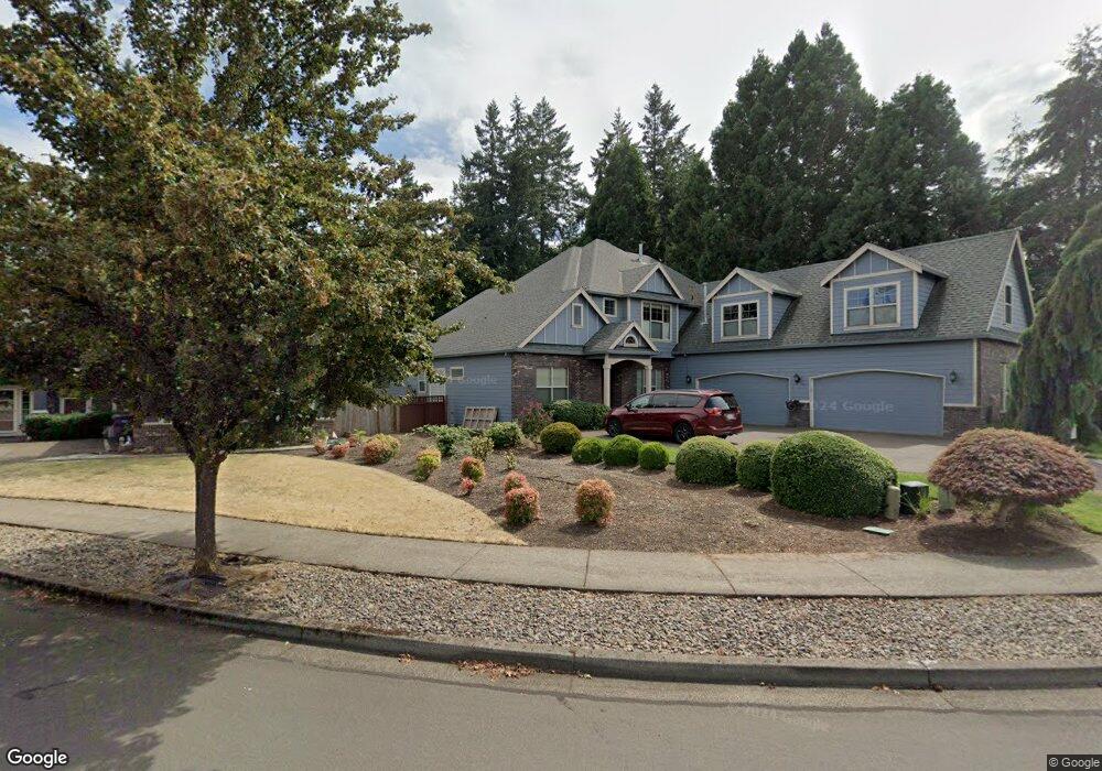
19500 Orchard Grove Dr Oregon City, OR 97045
Hazel Grove-Westling Farm NeighborhoodEstimated Value: $850,000 - $980,000
4
Beds
5
Baths
4,322
Sq Ft
$207/Sq Ft
Est. Value
About This Home
This home is located at 19500 Orchard Grove Dr, Oregon City, OR 97045 and is currently estimated at $895,509, approximately $207 per square foot. 19500 Orchard Grove Dr is a home located in Clackamas County with nearby schools including John McLoughlin Elementary School, Gardiner Middle School, and Oregon City Senior High School.
Ownership History
Date
Name
Owned For
Owner Type
Purchase Details
Closed on
Sep 22, 2025
Sold by
West Susan Rictor Trust and Rictor Andrew Richard
Bought by
Rictor Andrew Richard West
Current Estimated Value
Purchase Details
Closed on
Aug 19, 2024
Sold by
Rictor West S
Bought by
West Susan Rictor Trust and Rictor
Purchase Details
Closed on
May 15, 2003
Sold by
Icon Construction & Development Llc
Bought by
Rictor Richard T and Rictor West S
Home Financials for this Owner
Home Financials are based on the most recent Mortgage that was taken out on this home.
Original Mortgage
$303,200
Interest Rate
5.75%
Mortgage Type
Construction
Purchase Details
Closed on
Nov 18, 2002
Sold by
Hazelwood Farms Development Llc
Bought by
Icon Construction & Development Llc
Create a Home Valuation Report for This Property
The Home Valuation Report is an in-depth analysis detailing your home's value as well as a comparison with similar homes in the area
Home Values in the Area
Average Home Value in this Area
Purchase History
| Date | Buyer | Sale Price | Title Company |
|---|---|---|---|
| Rictor Andrew Richard West | -- | None Listed On Document | |
| West Susan Rictor Trust | -- | None Listed On Document | |
| Rictor Richard T | $72,675 | Fidelity Natl Title Co Of Or | |
| Icon Construction & Development Llc | $72,675 | Fidelity Natl Title Co Of Or |
Source: Public Records
Mortgage History
| Date | Status | Borrower | Loan Amount |
|---|---|---|---|
| Previous Owner | Rictor Richard T | $303,200 |
Source: Public Records
Tax History Compared to Growth
Tax History
| Year | Tax Paid | Tax Assessment Tax Assessment Total Assessment is a certain percentage of the fair market value that is determined by local assessors to be the total taxable value of land and additions on the property. | Land | Improvement |
|---|---|---|---|---|
| 2024 | $10,357 | $553,328 | -- | -- |
| 2023 | $10,357 | $537,212 | $0 | $0 |
| 2022 | $9,530 | $521,566 | $0 | $0 |
| 2021 | $9,146 | $506,375 | $0 | $0 |
| 2020 | $8,885 | $491,627 | $0 | $0 |
| 2019 | $8,697 | $477,308 | $0 | $0 |
| 2018 | $8,264 | $463,406 | $0 | $0 |
| 2017 | $8,051 | $449,909 | $0 | $0 |
| 2016 | $7,904 | $436,805 | $0 | $0 |
| 2015 | $7,704 | $424,083 | $0 | $0 |
| 2014 | $7,485 | $411,731 | $0 | $0 |
Source: Public Records
Map
Nearby Homes
- 19457 Sunset Springs Dr
- 19390 Westwood Dr
- 19370 Westwood Dr
- 19693 Leland Rd
- 19338 Inishbride Ct
- 19327 Reddaway Ave
- 19477 Hummingbird Loop
- 12618 Villard Place
- 12795 Lindsay Anne Ln
- 19144 Gentry Highlands Ln
- 19108 Sunrise Way
- 19326 Silverfox Pkwy
- 19903 Leland Rd
- 12288 Meadowlawn Dr
- 12270 Meadowlawn Dr
- 12252 Meadowlawn Dr
- 12246 Meadowlawn Dr
- 18940 Allegheny Dr
- 19537 Morrie Dr
- 18915 Allegheny Dr
- 19512 Orchard Grove Dr
- 19496 Orchard Grove Dr
- 19524 Orchard Grove Dr
- 19492 Orchard Grove Dr
- 12140 Hazeldell Ave
- 19536 Orchard Grove Dr
- 19493 Orchard Grove Dr
- 12141 Hazeldell Ave
- 19548 Orchard Grove Dr
- 12130 Hazeldell Ave
- 19488 Orchard Grove Dr
- 12129 Hazel Park Dr
- 12131 Hazeldell Ave
- 19549 Orchard Grove Dr
- 19560 Orchard Grove Dr
- 19483 Orchard Grove Dr
- 12120 Hazeldell Ave
- 19561 Orchard Grove Dr
- 12119 Hazel Park Dr
- 12121 Hazeldell Ave