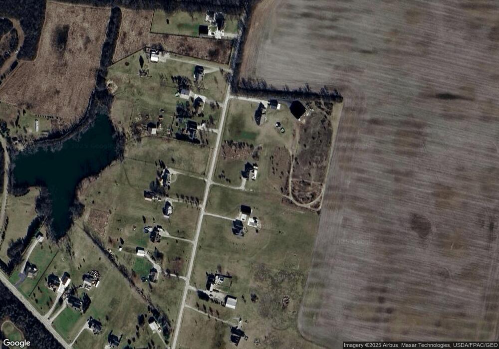
19502 Jones Rd Mount Sterling, OH 43143
Estimated Value: $350,000 - $511,556
3
Beds
3
Baths
2,002
Sq Ft
$220/Sq Ft
Est. Value
About This Home
This home is located at 19502 Jones Rd, Mount Sterling, OH 43143 and is currently estimated at $440,185, approximately $219 per square foot. 19502 Jones Rd is a home located in Pickaway County with nearby schools including Westfall Elementary School, Westfall Middle School, and Westfall High School.
Ownership History
Date
Name
Owned For
Owner Type
Purchase Details
Closed on
Oct 3, 2022
Sold by
Smith William L
Bought by
Smith William L and Bullock Alayne
Current Estimated Value
Purchase Details
Closed on
Jan 10, 2014
Sold by
Smith William L and Smith Shannon M
Bought by
Smith William L
Home Financials for this Owner
Home Financials are based on the most recent Mortgage that was taken out on this home.
Original Mortgage
$209,900
Interest Rate
3.55%
Mortgage Type
New Conventional
Create a Home Valuation Report for This Property
The Home Valuation Report is an in-depth analysis detailing your home's value as well as a comparison with similar homes in the area
Home Values in the Area
Average Home Value in this Area
Purchase History
| Date | Buyer | Sale Price | Title Company |
|---|---|---|---|
| Smith William L | $166 | -- | |
| Smith William L | $166 | None Listed On Document | |
| Smith William L | -- | Attorney |
Source: Public Records
Mortgage History
| Date | Status | Borrower | Loan Amount |
|---|---|---|---|
| Previous Owner | Smith William L | $209,900 |
Source: Public Records
Tax History Compared to Growth
Tax History
| Year | Tax Paid | Tax Assessment Tax Assessment Total Assessment is a certain percentage of the fair market value that is determined by local assessors to be the total taxable value of land and additions on the property. | Land | Improvement |
|---|---|---|---|---|
| 2024 | -- | $142,890 | $23,100 | $119,790 |
| 2023 | $4,540 | $142,890 | $23,100 | $119,790 |
| 2022 | $4,030 | $109,150 | $18,690 | $90,460 |
| 2021 | $4,070 | $109,150 | $18,690 | $90,460 |
| 2020 | $4,077 | $109,150 | $18,690 | $90,460 |
| 2019 | $3,179 | $88,240 | $17,150 | $71,090 |
| 2018 | $3,244 | $88,240 | $17,150 | $71,090 |
| 2017 | $5,281 | $88,240 | $17,150 | $71,090 |
| 2016 | $3,129 | $83,420 | $15,050 | $68,370 |
| 2015 | $3,194 | $83,420 | $15,050 | $68,370 |
| 2014 | $3,226 | $83,420 | $15,050 | $68,370 |
| 2013 | $3,525 | $84,300 | $14,490 | $69,810 |
Source: Public Records
Map
Nearby Homes
- 16270 Cook Yankeetown Rd NE
- 8713 State Route 207
- 21651 Hannawalt Rd
- 0 Yankeetown Pike Unit 225019293
- 16185 State Route 207
- 500 Wingate Place N
- 15561 Blain Rd
- 12343 State Route 316
- 230 W Columbus St
- 233 W Main St
- 223 W Main St
- 67 W Columbus St
- 3508 Knight Rd NE
- 60 N London St
- 11821 State Route 56 W
- 94 Jefferson St
- 233 Rosewood Ave
- 178 Poplar St
- 0 Rockwell Rd Unit 225016734
- 11744 Yankeetown Pike
- 19536 Jones Rd
- 19386 Jones Rd
- 19425 Jones Rd
- 19395 Jones Rd
- 19531 Jones Rd
- 19373 Jones Rd
- 19567 Jones Rd
- 19634 Jones Rd
- 19629 Jones Rd
- 19299 Jones Rd
- 19660 Jones Rd
- 16270 Yankeetown Pike
- 16240 Yankeetown Pike
- 19730 Jones Rd
- 16176 Yankeetown Pike
- 19755 Jones Rd
- 16244 Yankeetown Pike
- 16256 Yankeetown Pike
- 16212 Yankeetown Pike
- 19800 Jones Rd
