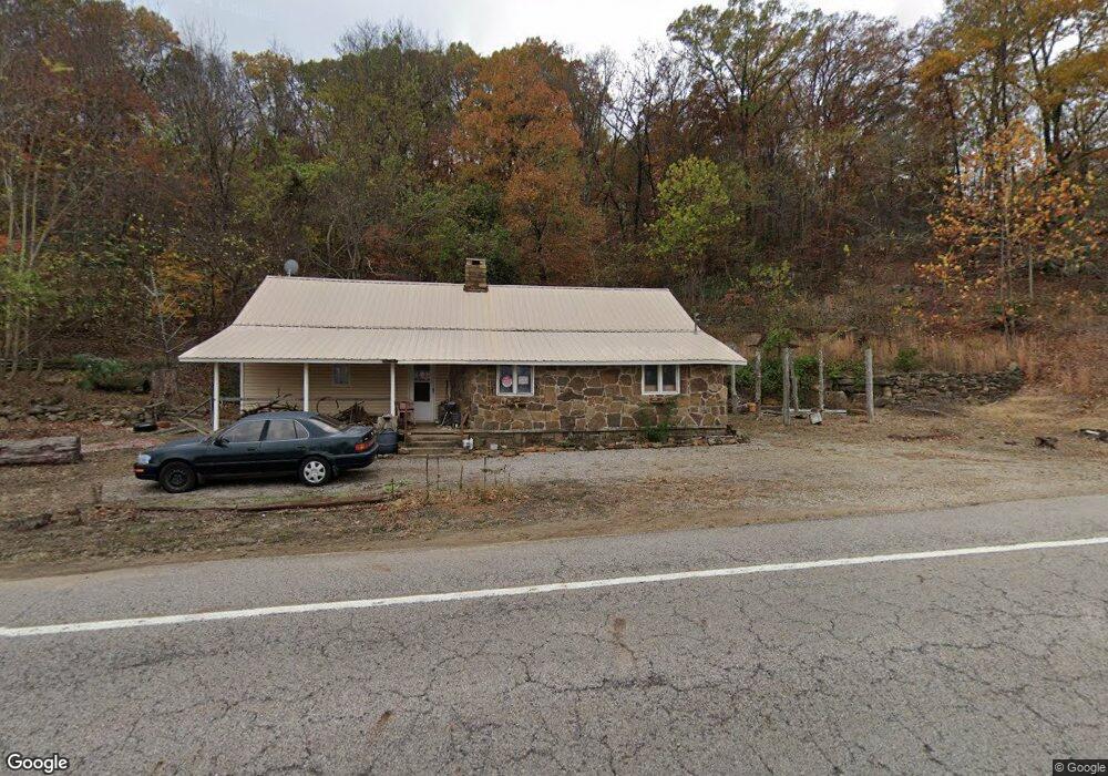
19505 N Highway 71 Mountainburg, AR 72946
Estimated Value: $111,102 - $251,000
--
Bed
1
Bath
1,456
Sq Ft
$133/Sq Ft
Est. Value
About This Home
This home is located at 19505 N Highway 71, Mountainburg, AR 72946 and is currently estimated at $193,026, approximately $132 per square foot. 19505 N Highway 71 is a home located in Crawford County with nearby schools including Mountainburg Elementary School, Mountainburg Middle School, and Mountainburg High School.
Ownership History
Date
Name
Owned For
Owner Type
Purchase Details
Closed on
Apr 20, 2010
Sold by
Secretary Of Hud
Bought by
Looney Timothy Roy
Current Estimated Value
Purchase Details
Closed on
May 21, 2009
Sold by
Roberts Charles E and Roberts Dorothy E
Bought by
Wells Fargo Bank Na
Purchase Details
Closed on
Apr 21, 2009
Sold by
Wells Fargo Bank Na
Bought by
Secretary Of Hud
Purchase Details
Closed on
Jun 15, 2001
Bought by
Schmidt-John
Purchase Details
Closed on
May 2, 2000
Bought by
State-Schmidt
Create a Home Valuation Report for This Property
The Home Valuation Report is an in-depth analysis detailing your home's value as well as a comparison with similar homes in the area
Home Values in the Area
Average Home Value in this Area
Purchase History
| Date | Buyer | Sale Price | Title Company |
|---|---|---|---|
| Looney Timothy Roy | -- | -- | |
| Wells Fargo Bank Na | $77,203 | -- | |
| Secretary Of Hud | -- | -- | |
| Schmidt-John | $19,000 | -- | |
| State-Schmidt | -- | -- |
Source: Public Records
Tax History Compared to Growth
Tax History
| Year | Tax Paid | Tax Assessment Tax Assessment Total Assessment is a certain percentage of the fair market value that is determined by local assessors to be the total taxable value of land and additions on the property. | Land | Improvement |
|---|---|---|---|---|
| 2025 | $6 | $15,850 | $4,400 | $11,450 |
| 2024 | $6 | $15,850 | $4,400 | $11,450 |
| 2023 | $58 | $15,850 | $4,400 | $11,450 |
| 2022 | $85 | $8,970 | $2,550 | $6,420 |
| 2021 | $85 | $8,970 | $2,550 | $6,420 |
| 2020 | $27 | $8,970 | $2,550 | $6,420 |
| 2019 | $10 | $8,970 | $2,550 | $6,420 |
| 2018 | $17 | $8,970 | $2,550 | $6,420 |
| 2017 | $0 | $8,180 | $2,550 | $5,630 |
| 2016 | -- | $8,180 | $2,550 | $5,630 |
| 2015 | $72 | $8,100 | $2,550 | $5,550 |
| 2014 | $72 | $8,100 | $2,550 | $5,550 |
Source: Public Records
Map
Nearby Homes
- 11939 Canova Trail
- 11901 Canova Trail
- 19108 Canova Trail
- 21701 Mount Gaylor Point
- 17221 N Highway 71
- 15800 Sand Point Terrace
- 22764 Carter Lane Rd
- 47 Acres Wc 4275
- 411 E Front Ave
- 15802 Sand Point Terrace
- 15801 Sand Point Terrace
- 21588 S Highway 71
- TBD Old Locke Rd
- TBD N Hwy 71
- 20845 U S 71
- 20805 Pine Dr
- 933 Serviceberry Rd
- 1100 Highway 71 NE
- 12774 Bunyard Wc 41
- 21710 Wc 274
- 19587 N Highway 71
- 19420 N Highway 71
- 0 Cartwright Mountain Rd Unit 655236
- 0 Cartwright Mountain Rd Unit 568785
- 0 Cartwright Mountain Rd Unit 590068
- 0 Cartwright Mountain Rd Unit 609839
- 0 Cartwright Mountain Rd Unit 641409
- TBD Cartwright Mountain Rd
- 19233 Cartwright Mountain Rd
- 19530 Cartwright Mountain Rd
- 19641 Cartwright Mountain Rd
- 19700 N Highway 71
- 19694 N Highway 71
- 19706 N Highway 71
- 19808 N Highway 71
- 19826 N Highway 71
- 19027 N Highway 71
- 19848 N Highway 71
- 19158 Cartwright Mountain Rd
- 19028 N Highway 71