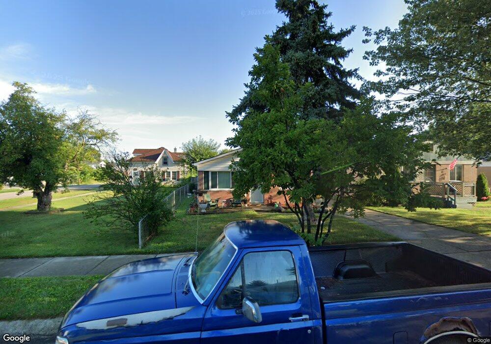
19509 Opal St Clinton Township, MI 48035
Estimated Value: $172,768 - $209,000
--
Bed
--
Bath
1,170
Sq Ft
$162/Sq Ft
Est. Value
About This Home
This home is located at 19509 Opal St, Clinton Township, MI 48035 and is currently estimated at $189,192, approximately $161 per square foot. 19509 Opal St is a home located in Macomb County with nearby schools including Clintondale High School and St. Thecla Catholic School.
Ownership History
Date
Name
Owned For
Owner Type
Purchase Details
Closed on
May 5, 2010
Sold by
Dunson Elizabeth
Bought by
Dunson Kevin and Dunson Elizabeth
Current Estimated Value
Home Financials for this Owner
Home Financials are based on the most recent Mortgage that was taken out on this home.
Original Mortgage
$68,000
Outstanding Balance
$22,783
Interest Rate
5.3%
Mortgage Type
New Conventional
Estimated Equity
$166,409
Purchase Details
Closed on
Jul 21, 1998
Sold by
Ricci Michele A
Bought by
Dedes Elizabeth A
Create a Home Valuation Report for This Property
The Home Valuation Report is an in-depth analysis detailing your home's value as well as a comparison with similar homes in the area
Home Values in the Area
Average Home Value in this Area
Purchase History
| Date | Buyer | Sale Price | Title Company |
|---|---|---|---|
| Dunson Kevin | -- | None Available | |
| Dedes Elizabeth A | $70,000 | -- |
Source: Public Records
Mortgage History
| Date | Status | Borrower | Loan Amount |
|---|---|---|---|
| Open | Dunson Kevin | $68,000 |
Source: Public Records
Tax History Compared to Growth
Tax History
| Year | Tax Paid | Tax Assessment Tax Assessment Total Assessment is a certain percentage of the fair market value that is determined by local assessors to be the total taxable value of land and additions on the property. | Land | Improvement |
|---|---|---|---|---|
| 2025 | $2,145 | $93,100 | $0 | $0 |
| 2024 | $1,283 | $91,600 | $0 | $0 |
| 2023 | $1,217 | $82,500 | $0 | $0 |
| 2022 | $1,927 | $66,100 | $0 | $0 |
| 2021 | $1,873 | $68,500 | $0 | $0 |
| 2020 | $1,063 | $61,700 | $0 | $0 |
| 2019 | $1,672 | $52,700 | $0 | $0 |
| 2018 | $1,621 | $47,600 | $0 | $0 |
| 2017 | $1,604 | $41,600 | $15,200 | $26,400 |
| 2016 | $1,596 | $41,600 | $0 | $0 |
| 2015 | -- | $36,900 | $0 | $0 |
| 2014 | -- | $32,800 | $0 | $0 |
| 2011 | -- | $52,700 | $21,800 | $30,900 |
Source: Public Records
Map
Nearby Homes
- 19573 Heckman St
- 19646 Gaynon Dr
- 19541 Colman St
- 34161 Beaconsfield St
- 19630 Webster St
- 19793 Electra St
- 34559 Chope Place
- 20219 Finley St
- 20201 Colman St
- 34606 Beaconsfield St
- 19633 E 14 Mile Rd
- 20118 Nicke St
- 20011 Abrahm St
- 15 Mile
- 20410 Woodward St
- 18754 E 14 Mile Rd Unit 2
- 20446 Williamson St
- 20440 Nicke St
- 0000 Garfield
- 20309 Abrahm St
- 19525 Opal St
- 19517 Opal St
- 19533 Opal St
- 19541 Opal St
- 19518 Gaynon Dr
- 19534 Gaynon Dr
- 19510 Gaynon Dr
- 19436 Gaynon Dr
- 19542 Gaynon Dr
- 19551 Opal St
- 19439 Opal St
- 33933 Chope Place
- 19550 Gaynon Dr Unit Bldg-Unit
- 19550 Gaynon Dr
- 33949 Chope Place Unit Bldg-Unit
- 33949 Chope Place
- 19559 Opal St
- 19431 Opal St
- 19428 Gaynon Dr
- 19558 Gaynon Dr