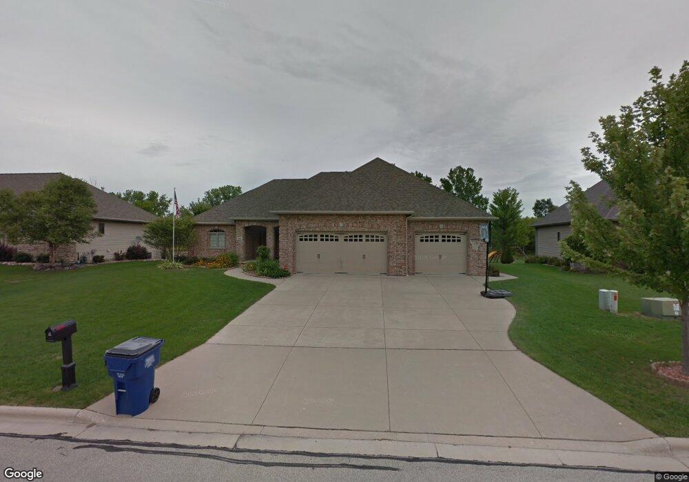
1951 Pheasant Run Trail de Pere, WI 54115
3
Beds
4
Baths
3,127
Sq Ft
0.45
Acres
About This Home
This home is located at 1951 Pheasant Run Trail, de Pere, WI 54115. 1951 Pheasant Run Trail is a home located in Brown County with nearby schools including Susie C. Altmayer Elementary School, De Pere Middle School, and Foxview Intermediate School.
Create a Home Valuation Report for This Property
The Home Valuation Report is an in-depth analysis detailing your home's value as well as a comparison with similar homes in the area
Home Values in the Area
Average Home Value in this Area
Tax History Compared to Growth
Tax History
| Year | Tax Paid | Tax Assessment Tax Assessment Total Assessment is a certain percentage of the fair market value that is determined by local assessors to be the total taxable value of land and additions on the property. | Land | Improvement |
|---|---|---|---|---|
| 2022 | $5,411 | $439,700 | $65,200 | $374,500 |
| 2021 | $5,282 | $439,700 | $65,200 | $374,500 |
| 2020 | $5,512 | $439,700 | $65,200 | $374,500 |
| 2019 | $5,804 | $360,700 | $52,200 | $308,500 |
| 2018 | $6,131 | $360,700 | $52,200 | $308,500 |
| 2017 | $5,877 | $360,700 | $52,200 | $308,500 |
| 2016 | $6,054 | $360,700 | $52,200 | $308,500 |
| 2015 | $6,032 | $360,700 | $52,200 | $308,500 |
| 2014 | -- | $360,700 | $52,200 | $308,500 |
| 2013 | -- | $360,700 | $52,200 | $308,500 |
Source: Public Records
Map
Nearby Homes
- 3273 Bower Creek Rd
- 0 County Road Gv
- 3728 Rustic Ledge Way
- 1790 Dallas Ln
- 1759 Dallas Ln
- 1541 Red Hawk Landing Trail
- 2133 Palmer Ct
- 1553 Red Hawk Landing Trail
- 1582 Red Hawk Landing Trail
- 1585 Red Hawk Landing Trail
- 1769 Dollar Rd
- 3200 Monroe Rd
- 3984 Dollar Ln
- 4166 Half Crown Run
- 4094 Half Crown Run
- 4134 Half Crown Run
- 1535 Brayden Ln
- 1650 Sweetbriar Way
- 1568 Brayden Ln
- 3924 Hawk Ledge Cir
- 1951 Pheasant Run Trail Unit TR
- 1955 Pheasant Run Trail
- 1947 Pheasant Run Trail
- 1959 Pheasant Run Trail
- 1943 Pheasant Run Trail
- 1948 Pheasant Run Trail
- 1944 Pheasant Run Trail
- 1956 Pheasant Run Trail
- 1956 Pheasant Run Trail Unit TR
- 1940 Pheasant Run Trail
- 1963 Pheasant Run Trail
- 1939 Pheasant Run Trail
- 1962 Pheasant Run Trail
- 1962 Pheasant Run Trail Unit TR
- 1955 Copper Top Way
- 1936 Pheasant Run Trail
- 1953 Copper Top Way
- 1936 1936 Pheasant Run Trail
- 1967 Pheasant Run Trail
- 1959 Copper Top Way