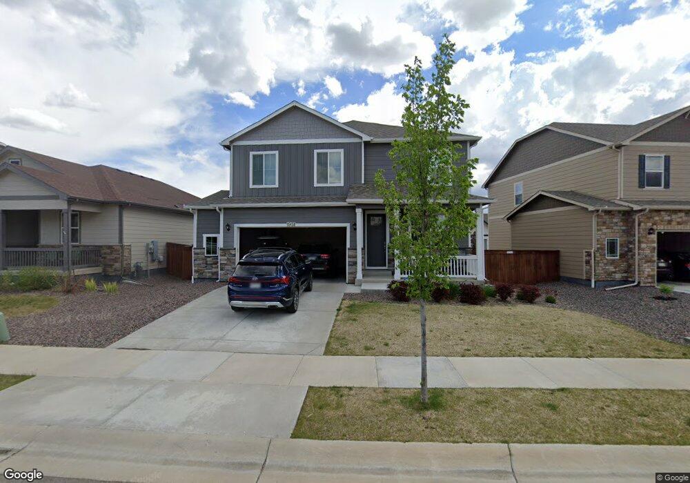
1951 Raindrop Dr Windsor, CO 80550
RainDance NeighborhoodEstimated Value: $562,000 - $606,000
3
Beds
3
Baths
2,288
Sq Ft
$256/Sq Ft
Est. Value
About This Home
This home is located at 1951 Raindrop Dr, Windsor, CO 80550 and is currently estimated at $584,905, approximately $255 per square foot. 1951 Raindrop Dr is a home with nearby schools including Windsor Middle School, Windsor High School, and Resurrection Christian School.
Ownership History
Date
Name
Owned For
Owner Type
Purchase Details
Closed on
Jun 25, 2025
Sold by
Sullivan Jessica R and Sullivan Caleb L
Bought by
Sullivan Jessica R
Current Estimated Value
Home Financials for this Owner
Home Financials are based on the most recent Mortgage that was taken out on this home.
Original Mortgage
$414,153
Outstanding Balance
$408,663
Interest Rate
6.81%
Mortgage Type
FHA
Estimated Equity
$176,242
Purchase Details
Closed on
Jul 9, 2021
Sold by
Melody Homes Inc
Bought by
Sullivan Jessica R and Sullivan Caleb L
Home Financials for this Owner
Home Financials are based on the most recent Mortgage that was taken out on this home.
Original Mortgage
$414,153
Interest Rate
2.96%
Mortgage Type
FHA
Create a Home Valuation Report for This Property
The Home Valuation Report is an in-depth analysis detailing your home's value as well as a comparison with similar homes in the area
Home Values in the Area
Average Home Value in this Area
Purchase History
We collect this data history from publicly available records. To have your information removed, we recommend requesting removal directly through your county’s website.
| Date | Buyer | Sale Price | Title Company |
|---|---|---|---|
| Sullivan Jessica R | -- | None Listed On Document | |
| Sullivan Jessica R | $448,230 | Dhi Title Agency |
Source: Public Records
Mortgage History
We collect this data history from publicly available records. To have your information removed, we recommend requesting removal directly through your county’s website.
| Date | Status | Borrower | Loan Amount |
|---|---|---|---|
| Open | Sullivan Jessica R | $414,153 | |
| Previous Owner | Sullivan Jessica R | $414,153 |
Source: Public Records
Tax History
| Year | Tax Paid | Tax Assessment Tax Assessment Total Assessment is a certain percentage of the fair market value that is determined by local assessors to be the total taxable value of land and additions on the property. | Land | Improvement |
|---|---|---|---|---|
| 2026 | $5,111 | $34,470 | $6,120 | $28,350 |
| 2025 | $5,268 | $35,200 | $6,250 | $28,950 |
| 2024 | $5,268 | $35,200 | $6,250 | $28,950 |
| 2023 | $5,097 | $41,330 | $7,100 | $34,230 |
| 2022 | $4,150 | $29,270 | $6,260 | $23,010 |
| 2021 | $2,732 | $20,900 | $20,900 | $0 |
| 2020 | $727 | $5,600 | $5,600 | $0 |
| 2019 | $235 | $1,820 | $1,820 | $0 |
| 2018 | $1 | $10 | $10 | $0 |
Source: Public Records
Map
Nearby Homes
- 1937 Raindrop Dr
- 1935 Rolling Wind Dr
- 1944 Thundercloud Dr
- 1929 Covered Bridge Pkwy
- 1661 Winter Glow Dr
- 1657 Winter Glow Dr
- 1653 Winter Glow Dr
- 1956 Blossom Grove Dr
- 1690 Winter Glow Dr
- 1691 Sundown Run Dr
- 1881 Blossom Grove Dr
- 2012 Day Spring Dr
- 1648 Sundown Run Dr
- 1644 Sundown Run Dr
- 1825 Crisp Air Dr
- 1685 Crystalline Dr
- 2009 Orchard Bloom Dr
- 1826 Frost Dr
- 1501 Flowering Tree Ct
- 1813 Crisp Air Dr
- 1933 Raindrop Dr
- 1941 Raindrop Dr
- 1929 Raindrop Dr
- 1945 Raindrop Dr
- 1930 Rolling Wind Dr
- 1938 Raindrop Dr
- 1926 Rolling Wind Dr
- 1925 Raindrop Dr
- 1942 Raindrop Dr
- 1934 Raindrop Dr
- 1930 Raindrop Dr
- 1946 Raindrop Dr
- 1921 Raindrop Dr
- 1922 Rolling Wind Dr
- 1953 Raindrop Dr
- 1926 Raindrop Dr
- 1950 Raindrop Dr
- 1924 Raindrop Dr
- 1946 Rolling Wind Dr
- 1917 Raindrop Dr
Your Personal Tour Guide
Ask me questions while you tour the home.