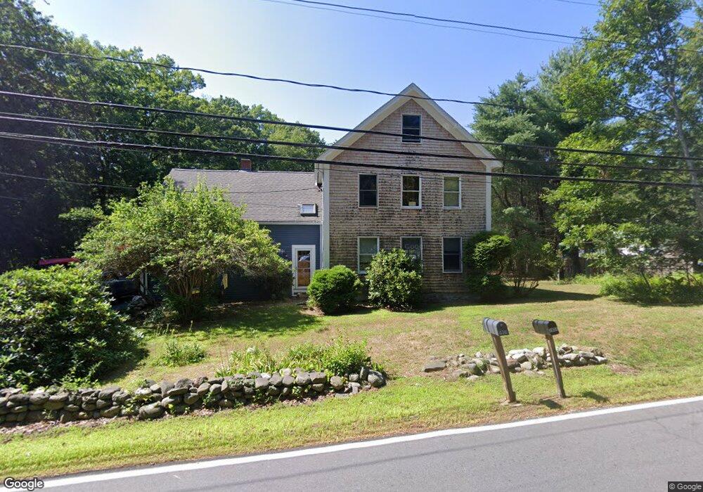
1951 State Rd Eliot, ME 03903
East Eliot NeighborhoodEstimated Value: $441,955 - $647,000
3
Beds
2
Baths
1,779
Sq Ft
$312/Sq Ft
Est. Value
About This Home
This home is located at 1951 State Rd, Eliot, ME 03903 and is currently estimated at $554,239, approximately $311 per square foot. 1951 State Rd is a home located in York County with nearby schools including Marshwood High School and Seacoast Waldorf School.
Create a Home Valuation Report for This Property
The Home Valuation Report is an in-depth analysis detailing your home's value as well as a comparison with similar homes in the area
Home Values in the Area
Average Home Value in this Area
Tax History Compared to Growth
Tax History
| Year | Tax Paid | Tax Assessment Tax Assessment Total Assessment is a certain percentage of the fair market value that is determined by local assessors to be the total taxable value of land and additions on the property. | Land | Improvement |
|---|---|---|---|---|
| 2024 | $3,447 | $290,900 | $129,300 | $161,600 |
| 2023 | $3,315 | $270,600 | $122,900 | $147,700 |
| 2022 | $3,190 | $263,600 | $122,900 | $140,700 |
| 2021 | $3,339 | $247,300 | $112,300 | $135,000 |
| 2020 | $3,424 | $232,900 | $106,900 | $126,000 |
| 2019 | $3,424 | $232,900 | $106,900 | $126,000 |
| 2018 | $3,424 | $232,900 | $106,900 | $126,000 |
| 2017 | $3,330 | $232,900 | $106,900 | $126,000 |
| 2016 | $3,272 | $232,900 | $106,900 | $126,000 |
| 2015 | $3,261 | $232,900 | $106,900 | $126,000 |
| 2014 | $3,214 | $232,900 | $106,900 | $126,000 |
| 2013 | $3,067 | $232,900 | $106,900 | $126,000 |
Source: Public Records
Map
Nearby Homes
- Lot 2 Cedar Tbd
- Lot 1 Cedar Tbd
- TBD Cedar Rd
- 34 Imperial Dr
- 16 Imperial Dr
- 25 Heritage Dr
- 19 Heritage Dr
- 35 Marshwood Dr
- 82 Stacy Ln
- 10 Broadfields Rd
- 1708 State Rd
- 708 River Rd Unit 3
- 708 River Rd Unit 2
- 18 Governor Hill Rd
- 25 Fosters Dr
- 25 Shore Ln
- 4 Shore Ln
- 0 Goodwin Rd Unit 1626810
- 126 Dover Point Rd
- 19 Schooner Dr