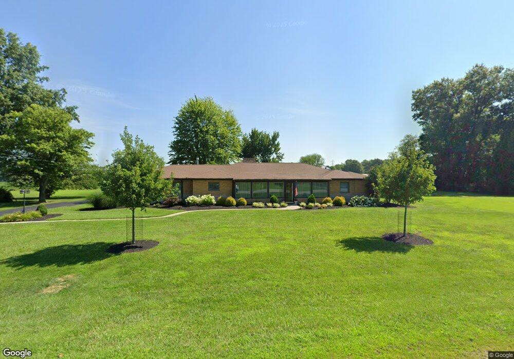
1951 State Route 125 Hamersville, OH 45130
Estimated Value: $59,000 - $148,000
2
Beds
1
Bath
817
Sq Ft
$116/Sq Ft
Est. Value
About This Home
This home is located at 1951 State Route 125, Hamersville, OH 45130 and is currently estimated at $94,864, approximately $116 per square foot. 1951 State Route 125 is a home located in Brown County with nearby schools including Western Brown High School.
Ownership History
Date
Name
Owned For
Owner Type
Purchase Details
Closed on
Oct 28, 2016
Bought by
Mckinney Rentals Llc
Current Estimated Value
Home Financials for this Owner
Home Financials are based on the most recent Mortgage that was taken out on this home.
Interest Rate
3.47%
Purchase Details
Closed on
Jun 5, 1995
Sold by
Mckinney Charles R
Bought by
Mckinney Steven R and Mckinney Peggy A
Purchase Details
Closed on
Nov 24, 1993
Sold by
Mckinney Steve R and Mckinney Peggy
Bought by
Mckinney Charles R and Mckinney Jun
Create a Home Valuation Report for This Property
The Home Valuation Report is an in-depth analysis detailing your home's value as well as a comparison with similar homes in the area
Home Values in the Area
Average Home Value in this Area
Purchase History
| Date | Buyer | Sale Price | Title Company |
|---|---|---|---|
| Mckinney Rentals Llc | -- | -- | |
| Mckinney Steven R | $30,000 | -- | |
| Mckinney Charles R | $27,000 | -- |
Source: Public Records
Mortgage History
| Date | Status | Borrower | Loan Amount |
|---|---|---|---|
| Closed | Mckinney Rentals Llc | -- | |
| Previous Owner | Mckinney Steve R | $75,000 |
Source: Public Records
Tax History Compared to Growth
Tax History
| Year | Tax Paid | Tax Assessment Tax Assessment Total Assessment is a certain percentage of the fair market value that is determined by local assessors to be the total taxable value of land and additions on the property. | Land | Improvement |
|---|---|---|---|---|
| 2024 | $494 | $15,830 | $960 | $14,870 |
| 2023 | $494 | $13,110 | $880 | $12,230 |
| 2022 | $447 | $13,110 | $880 | $12,230 |
| 2021 | $443 | $13,110 | $880 | $12,230 |
| 2020 | $418 | $11,390 | $760 | $10,630 |
| 2019 | $444 | $11,390 | $760 | $10,630 |
| 2018 | $396 | $11,390 | $760 | $10,630 |
| 2017 | $350 | $10,130 | $840 | $9,290 |
| 2016 | $350 | $10,130 | $840 | $9,290 |
| 2015 | $361 | $10,130 | $840 | $9,290 |
| 2014 | $361 | $10,050 | $760 | $9,290 |
| 2013 | $360 | $10,050 | $760 | $9,290 |
Source: Public Records
Map
Nearby Homes
- 1873 Ohio 125
- ac Ohio 774
- 3363 Ohio 774
- 1740 Yankeetown Rd
- 0 St Rt 774 Unit 1841964
- 49-acres Yankeetown Rd
- 23-acres Yankeetown Rd
- acres Yankeetown Rd
- 0 Fite Ave
- 0 Ohio 774
- 2953 N Feesburg Rd
- 0 Main St Unit 1850509
- 9488 Daugherty Marks Rd
- 0 Colthar Rd Unit 1822757
- 9291 Daugherty Marks Rd
- 3275 White Oak Valley Rd
- 11475 Colthar Rd
- 0 Old 47 Club Rd
- 2012 Bethel Maple Rd
- 2018 Bethel Maple Rd
- 1951 State Route 125
- 1951 State Route 125
- 1951 State Route 125
- 1951 State Route 125
- 1951 State Route 125
- 1951 State Route 125
- 1951 State Route 125
- 1951 State Route 125
- 1951 State Route 125
- 1951 State Route 125
- 1951 State Route 125
- 1941 St Rt 125
- 286 W Main St
- 453 Ohio 125
- 281 W Main St
- 268 W Main St
- 1919 Ohio 125
- 1919 State Route 125
- 1919 State Route 125
- 271 W Main St