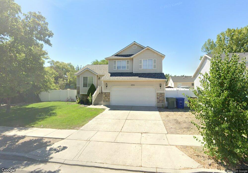
1951 W Red Angus Dr Salt Lake City, UT 84116
Westpointe NeighborhoodEstimated Value: $480,000 - $569,000
3
Beds
2
Baths
1,796
Sq Ft
$284/Sq Ft
Est. Value
About This Home
This home is located at 1951 W Red Angus Dr, Salt Lake City, UT 84116 and is currently estimated at $509,433, approximately $283 per square foot. 1951 W Red Angus Dr is a home located in Salt Lake County with nearby schools including North Star Elementary School, Northwest Middle School, and West High.
Ownership History
Date
Name
Owned For
Owner Type
Purchase Details
Closed on
Jun 16, 2020
Sold by
Lopez Pablo
Bought by
Lopez Pablo and Zarate Maria Margarita
Current Estimated Value
Home Financials for this Owner
Home Financials are based on the most recent Mortgage that was taken out on this home.
Original Mortgage
$252,800
Outstanding Balance
$223,525
Interest Rate
3.3%
Mortgage Type
New Conventional
Estimated Equity
$285,908
Purchase Details
Closed on
Apr 21, 2020
Sold by
Lopez Pablo and Zarate Maria Margarita
Bought by
Lopez Pablo
Home Financials for this Owner
Home Financials are based on the most recent Mortgage that was taken out on this home.
Original Mortgage
$252,800
Outstanding Balance
$223,525
Interest Rate
3.3%
Mortgage Type
New Conventional
Estimated Equity
$285,908
Purchase Details
Closed on
Sep 28, 2016
Sold by
Pak Sungho
Bought by
Lopez Pablo and Zarate Maria Margarita Figueroa
Home Financials for this Owner
Home Financials are based on the most recent Mortgage that was taken out on this home.
Original Mortgage
$8,738
Interest Rate
3.46%
Mortgage Type
Stand Alone Second
Purchase Details
Closed on
May 28, 2009
Sold by
Pak Sungho
Bought by
Pak Sungho
Purchase Details
Closed on
Jun 12, 2003
Sold by
Pak Sungho and Pak Minyong
Bought by
Pak Sungho
Home Financials for this Owner
Home Financials are based on the most recent Mortgage that was taken out on this home.
Original Mortgage
$142,500
Interest Rate
5.61%
Mortgage Type
Purchase Money Mortgage
Purchase Details
Closed on
Oct 26, 2001
Sold by
Ivory Homes Ltd
Bought by
Pak Sungho and Pak Minyong
Home Financials for this Owner
Home Financials are based on the most recent Mortgage that was taken out on this home.
Original Mortgage
$124,720
Interest Rate
6.87%
Create a Home Valuation Report for This Property
The Home Valuation Report is an in-depth analysis detailing your home's value as well as a comparison with similar homes in the area
Home Values in the Area
Average Home Value in this Area
Purchase History
| Date | Buyer | Sale Price | Title Company |
|---|---|---|---|
| Lopez Pablo | -- | Accommodation | |
| Lopez Pablo | -- | Monument Title Ins Co | |
| Lopez Pablo | -- | Title Guarantee S Jordan | |
| Pak Sungho | -- | None Available | |
| Pak Sungho | -- | Millcreek Land Title Ins | |
| Pak Sungho | -- | Cottonwood Title Ins Agency |
Source: Public Records
Mortgage History
| Date | Status | Borrower | Loan Amount |
|---|---|---|---|
| Open | Lopez Pablo | $252,800 | |
| Closed | Lopez Pablo | $8,738 | |
| Closed | Lopez Pablo | $218,469 | |
| Previous Owner | Pak Sungho | $142,500 | |
| Previous Owner | Pak Sungho | $124,720 | |
| Closed | Pak Sungho | $23,385 |
Source: Public Records
Tax History Compared to Growth
Tax History
| Year | Tax Paid | Tax Assessment Tax Assessment Total Assessment is a certain percentage of the fair market value that is determined by local assessors to be the total taxable value of land and additions on the property. | Land | Improvement |
|---|---|---|---|---|
| 2025 | $2,394 | $514,100 | $142,500 | $371,600 |
| 2024 | $2,394 | $456,800 | $134,800 | $322,000 |
| 2023 | $2,315 | $425,800 | $129,700 | $296,100 |
| 2022 | $2,413 | $416,300 | $127,100 | $289,200 |
| 2021 | $1,884 | $294,300 | $99,700 | $194,600 |
| 2020 | $1,804 | $268,300 | $89,000 | $179,300 |
| 2019 | $1,842 | $257,700 | $82,900 | $174,800 |
| 2018 | $1,671 | $230,100 | $82,900 | $147,200 |
| 2017 | $1,733 | $223,700 | $82,900 | $140,800 |
| 2016 | $1,653 | $202,700 | $69,700 | $133,000 |
| 2015 | $1,675 | $193,900 | $68,300 | $125,600 |
| 2014 | $1,602 | $184,000 | $66,900 | $117,100 |
Source: Public Records
Map
Nearby Homes
- 238 N 2200 W
- 1888 W New York Dr
- 1770 W Trafalga Way Unit B
- 1793 W Trafalga Way Unit F
- 1178 N Reveille Cir
- 1281 Carousel St
- 1301 N 1500 W
- 1366 Dupont Ave
- 1379 Dupont Ave
- 1989 Sir Timothy Ave
- 1320 W Sunset Dr
- 1004 N Sir Michael Dr
- 1827 Omni Ave
- 949 Libby Way
- 2075 W 2670 N
- 1305 N Valentine St
- 1245 W Siena Cir
- 1260 W 1100 N
- 1250 Buccaneer Dr
- 825 Star Crest Dr W
- 1961 W Red Angus Dr
- 1943 W Red Angus Dr
- 1952 W Gander Ln
- 1952 Gander Ln
- 1946 Gander Ln
- 1946 W Gander Ln
- 1960 Gander Ln
- 1960 W Gander Ln
- 1935 W Red Angus Dr
- 1967 W Red Angus Dr
- 1940 Gander Ln
- 1954 W Red Angus Dr
- 1948 W Red Angus Dr
- 1968 Gander Ln
- 1962 W Red Angus Dr
- 1932 Gander Ln
- 1975 W Red Angus Dr
- 1927 W Red Angus Dr
- 1970 W Red Angus Dr
- 1934 W Red Angus Dr