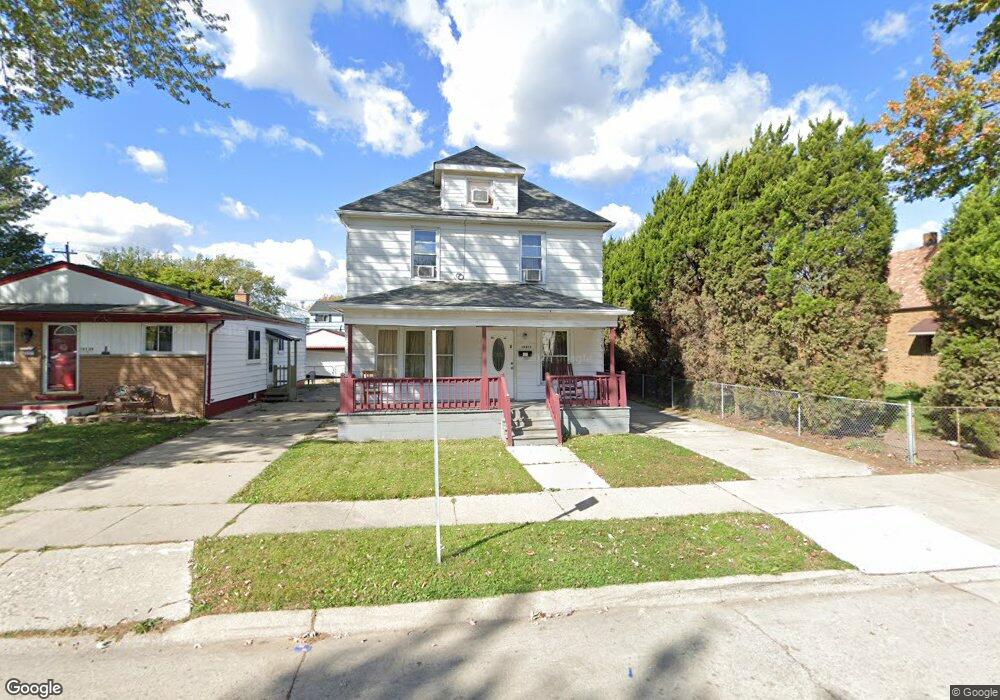
19517 Stanley St Unit Bldg-Unit Melvindale, MI 48122
Estimated Value: $139,000 - $158,000
--
Bed
2
Baths
1,354
Sq Ft
$111/Sq Ft
Est. Value
About This Home
This home is located at 19517 Stanley St Unit Bldg-Unit, Melvindale, MI 48122 and is currently estimated at $150,420, approximately $111 per square foot. 19517 Stanley St Unit Bldg-Unit is a home located in Wayne County with nearby schools including Rogers Early Elementary School, Allendale Elementary School, and Julian O. Strong Middle School.
Ownership History
Date
Name
Owned For
Owner Type
Purchase Details
Closed on
Aug 31, 2020
Sold by
Flores Eleidiana and Flores Ignacio
Bought by
Fernandez-Perdomo Mario
Current Estimated Value
Purchase Details
Closed on
Mar 15, 2017
Sold by
Acuna Ignacioi and Flores Eleidiana
Bought by
Hernandez Sandra Marlene Bobadilla
Purchase Details
Closed on
Apr 3, 2013
Sold by
Smith Mark Brian James and Smith Julissa
Bought by
Acuna Ignacio and Flores Eleidiana
Purchase Details
Closed on
May 4, 2011
Sold by
Sparks Nelson E and Sparks Naomi M
Bought by
The Bank Of New York Mellon and The Bank Of New York
Create a Home Valuation Report for This Property
The Home Valuation Report is an in-depth analysis detailing your home's value as well as a comparison with similar homes in the area
Home Values in the Area
Average Home Value in this Area
Purchase History
| Date | Buyer | Sale Price | Title Company |
|---|---|---|---|
| Fernandez-Perdomo Mario | $90,000 | None Listed On Document | |
| Hernandez Sandra Marlene Bobadilla | $3,500 | None Available | |
| Acuna Ignacio | -- | None Available | |
| The Bank Of New York Mellon | $110,492 | None Available |
Source: Public Records
Tax History Compared to Growth
Tax History
| Year | Tax Paid | Tax Assessment Tax Assessment Total Assessment is a certain percentage of the fair market value that is determined by local assessors to be the total taxable value of land and additions on the property. | Land | Improvement |
|---|---|---|---|---|
| 2025 | $1,733 | $70,800 | $0 | $0 |
| 2024 | $1,733 | $60,600 | $0 | $0 |
| 2023 | $1,652 | $53,800 | $0 | $0 |
| 2022 | $3,209 | $48,100 | $0 | $0 |
| 2021 | $3,110 | $43,200 | $0 | $0 |
| 2020 | $2,328 | $35,000 | $0 | $0 |
| 2019 | $2,157 | $31,400 | $0 | $0 |
| 2018 | $1,350 | $32,100 | $0 | $0 |
| 2017 | $1,474 | $32,000 | $0 | $0 |
| 2016 | $2,382 | $30,300 | $0 | $0 |
| 2015 | $2,733 | $27,600 | $0 | $0 |
| 2013 | $2,800 | $28,000 | $0 | $0 |
| 2012 | $1,686 | $27,200 | $2,400 | $24,800 |
Source: Public Records
Map
Nearby Homes
- 000 Harlow St
- 24558 Outer Dr
- 3603 Harlow Ave
- 18949 Wall St
- 4020 Wall Ave
- 15261 Demean Ave
- 14713 Morris Ave
- 2790 Blanche St
- 19167 Henry St
- 19163 Henry St
- 2190 Morris Ave
- 14633 College Ave
- 18906 Henry St
- 14545 College Ave
- 19120 Dix Rd
- 2064 Morris Ave
- 19059 Wood St
- 2809 Margaret St
- 2573 Grace St
- 19052 Harman St
- 19517 Stanley St
- 19529 Stanley St
- 19505 Stanley St
- 19545 Stanley St
- 19551 Stanley St
- 19263 Stanley St
- 19518 Stanley St
- 19512 Stanley St
- 19526 Stanley St
- 19500 Stanley St
- 19251 Stanley St
- 19251 Stanley St
- 19559 Stanley St
- 19544 Stanley St
- 19254 Stanley St
- 19247 Stanley St
- 19567 Stanley St
- 19550 Stanley St
- 19560 Stanley St
- 19575 Stanley St