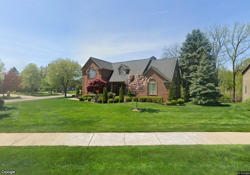
1952 Birch Bluff Dr Okemos, MI 48864
Estimated Value: $675,734 - $722,000
4
Beds
4
Baths
3,074
Sq Ft
$226/Sq Ft
Est. Value
About This Home
This home is located at 1952 Birch Bluff Dr, Okemos, MI 48864 and is currently estimated at $695,684, approximately $226 per square foot. 1952 Birch Bluff Dr is a home located in Ingham County with nearby schools including Hiawatha Elementary School, Kinawa School, and Chippewa Middle School.
Ownership History
Date
Name
Owned For
Owner Type
Purchase Details
Closed on
Jul 30, 2001
Sold by
Horlander Stephen T and Horlander Margaret E
Bought by
Schaefer B Patrick and Schaefer Gwen
Current Estimated Value
Home Financials for this Owner
Home Financials are based on the most recent Mortgage that was taken out on this home.
Original Mortgage
$351,200
Interest Rate
7.15%
Purchase Details
Closed on
Aug 1, 1993
Bought by
Horlander
Purchase Details
Closed on
Sep 1, 1990
Sold by
Briarwood Developmn
Bought by
Gupta
Create a Home Valuation Report for This Property
The Home Valuation Report is an in-depth analysis detailing your home's value as well as a comparison with similar homes in the area
Home Values in the Area
Average Home Value in this Area
Purchase History
| Date | Buyer | Sale Price | Title Company |
|---|---|---|---|
| Schaefer B Patrick | $439,000 | Chicago Title | |
| Horlander | $58,500 | -- | |
| Gupta | $49,500 | -- |
Source: Public Records
Mortgage History
| Date | Status | Borrower | Loan Amount |
|---|---|---|---|
| Closed | Schaefer B Patrick | $351,200 |
Source: Public Records
Tax History Compared to Growth
Tax History
| Year | Tax Paid | Tax Assessment Tax Assessment Total Assessment is a certain percentage of the fair market value that is determined by local assessors to be the total taxable value of land and additions on the property. | Land | Improvement |
|---|---|---|---|---|
| 2025 | $13,890 | $320,400 | $75,000 | $245,400 |
| 2024 | $13,066 | $296,900 | $73,100 | $223,800 |
| 2023 | $13,066 | $280,400 | $82,900 | $197,500 |
| 2022 | $12,429 | $266,600 | $79,100 | $187,500 |
| 2021 | $12,188 | $258,900 | $79,100 | $179,800 |
| 2020 | $12,028 | $250,700 | $79,100 | $171,600 |
| 2019 | $11,618 | $251,500 | $74,600 | $176,900 |
| 2018 | $11,014 | $237,900 | $61,000 | $176,900 |
| 2017 | $10,565 | $233,900 | $60,300 | $173,600 |
| 2016 | $4,648 | $222,000 | $58,000 | $164,000 |
| 2015 | $4,648 | $222,000 | $112,992 | $109,008 |
| 2014 | $4,648 | $211,700 | $104,190 | $107,510 |
Source: Public Records
Map
Nearby Homes
- 3660 Powderhorn Dr
- 1995 Belwood Dr
- 3588 Autumnwood Ln
- 2073 Birch Bluff Dr
- 3675 E Meadows Ct Unit 58
- 2024 Belwood Dr
- 3730 Cavalier Dr Unit 4
- 3740 Cavalier Dr Unit 2
- 3633 E Meadows Ct
- 3555 Breezy Point Dr
- 2083 Fox Hollow Dr
- 2020 Tamarack Dr
- 3614 Breezy Point Dr
- 3826 Pine Knoll Dr
- 2302 Fieldstone Dr
- 2150 Heritage Ave
- 3624 W Arbutus Dr
- 1591 Wenonah Dr
- 3921 Dobie Rd
- 2184 Belding Ct
- 3615 Powderhorn Dr
- 1966 Birch Bluff Dr
- 1944 Birch Bluff Dr
- 1949 Birch Bluff Dr
- 1955 Birch Bluff Dr
- 1978 Birch Bluff Dr
- 3625 Powderhorn Dr
- 1967 Birch Bluff Dr
- 1945 Birch Bluff Dr
- 3620 Powderhorn Dr
- 1990 Birch Bluff Dr
- 1936 Birch Bluff Dr
- 1939 Birch Bluff Dr
- 3635 Powderhorn Dr
- 3082 Summergate Ln
- 3630 Powderhorn Dr
- 1933 Birch Bluff Dr
- 1926 Birch Bluff Dr
- 1979 Birch Bluff Dr
- 3074 Summergate Ln