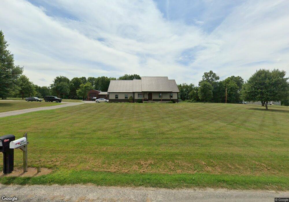
1952 Coal Dock Rd Waverly, OH 45690
Estimated Value: $279,000 - $344,000
3
Beds
1
Bath
1,200
Sq Ft
$269/Sq Ft
Est. Value
About This Home
This home is located at 1952 Coal Dock Rd, Waverly, OH 45690 and is currently estimated at $322,525, approximately $268 per square foot. 1952 Coal Dock Rd is a home located in Pike County.
Ownership History
Date
Name
Owned For
Owner Type
Purchase Details
Closed on
Dec 30, 2025
Sold by
Tribby Timothy R and Tribby Jenny L
Bought by
Anders Tyler and Anders Caitlin
Current Estimated Value
Home Financials for this Owner
Home Financials are based on the most recent Mortgage that was taken out on this home.
Original Mortgage
$270,717
Outstanding Balance
$270,414
Interest Rate
5.38%
Mortgage Type
New Conventional
Estimated Equity
$52,111
Purchase Details
Closed on
Feb 21, 2008
Sold by
Tribby Timothy and Tribby Jenny L
Bought by
Tribby Timothy R and Tribby Jenny L
Create a Home Valuation Report for This Property
The Home Valuation Report is an in-depth analysis detailing your home's value as well as a comparison with similar homes in the area
Purchase History
| Date | Buyer | Sale Price | Title Company |
|---|---|---|---|
| Anders Tyler | $340,000 | None Listed On Document | |
| Tribby Timothy R | -- | None Available |
Source: Public Records
Mortgage History
| Date | Status | Borrower | Loan Amount |
|---|---|---|---|
| Open | Anders Tyler | $270,717 |
Source: Public Records
Tax History
| Year | Tax Paid | Tax Assessment Tax Assessment Total Assessment is a certain percentage of the fair market value that is determined by local assessors to be the total taxable value of land and additions on the property. | Land | Improvement |
|---|---|---|---|---|
| 2024 | $1,982 | $62,910 | $13,070 | $49,840 |
| 2023 | $1,990 | $62,910 | $13,070 | $49,840 |
| 2022 | $1,782 | $54,090 | $10,330 | $43,760 |
| 2021 | $1,734 | $54,090 | $10,330 | $43,760 |
| 2020 | $1,747 | $54,090 | $10,330 | $43,760 |
| 2019 | $1,597 | $49,000 | $9,390 | $39,610 |
| 2018 | $1,711 | $49,000 | $9,390 | $39,610 |
| 2017 | $1,695 | $49,000 | $9,390 | $39,610 |
| 2016 | $1,833 | $55,360 | $3,540 | $51,820 |
| 2015 | $1,834 | $55,360 | $3,540 | $51,820 |
| 2014 | $1,867 | $55,360 | $3,540 | $51,820 |
| 2013 | $1,987 | $55,360 | $3,540 | $51,820 |
| 2012 | $2,062 | $55,360 | $3,540 | $51,820 |
Source: Public Records
Map
Nearby Homes
- 2662 Adams Rd
- 151 Meadow Run Rd
- 0 Buck Hollow Rd
- 001 Ervin Hill Rd
- 0 E Side State Route 335
- 01 Ervin Hill Rd
- 308 Bliss Rd
- 0 Straight Creek Rd
- 7679 Ohio 335
- 9459 State Route 335
- 0 Carrs Run Rd
- 3725 Beaver Creek Rd
- 6269 Beaver Pike
- 4604 Straight Creek Rd
- 352 Holbrook Rd
- 459 Holbrook Rd
- 0 Dutch Hollow Rd
- 12893 Ohio 220
- 338 Anderson Ln
- 258 Umblebee Rd
- 1949 Coal Dock Rd
- 0 Coal Dock Rd
- 2038 Coal Dock Rd
- 2025 Coal Dock Rd
- 1859 Coal Dock Rd
- 1976 Coal Dock Rd
- 2075 Coal Dock Rd
- 2088 Coal Dock Rd Unit 215142
- 1974 Coal Dock Rd
- 2123 Coal Dock Rd
- 1740 Coal Dock Rd
- 2120 Coal Dock Rd
- 2147 Coal Dock Rd
- 1757 Coal Dock Rd
- 1643 Coal Dock Rd
- 2247 Coal Dock Rd
- 1588 Coal Dock Rd
- 6199 Red Hollow Rd
- 2272 Coal Dock Rd
- 6235 Red Hollow Rd
Your Personal Tour Guide
Ask me questions while you tour the home.