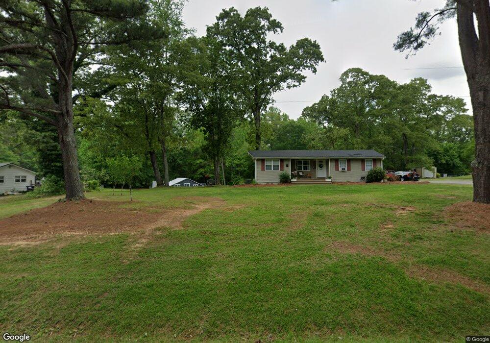
1952 E Highway 5 Whitesburg, GA 30185
Estimated Value: $158,000 - $207,000
3
Beds
1
Bath
940
Sq Ft
$192/Sq Ft
Est. Value
About This Home
This home is located at 1952 E Highway 5, Whitesburg, GA 30185 and is currently estimated at $180,722, approximately $192 per square foot. 1952 E Highway 5 is a home located in Carroll County with nearby schools including Whitesburg Elementary School, Central Middle School, and Central High School.
Ownership History
Date
Name
Owned For
Owner Type
Purchase Details
Closed on
Jul 17, 2020
Sold by
Lanham Teressa Darlene
Bought by
White Larry Chad
Current Estimated Value
Home Financials for this Owner
Home Financials are based on the most recent Mortgage that was taken out on this home.
Original Mortgage
$83,000
Outstanding Balance
$57,408
Interest Rate
3.1%
Mortgage Type
New Conventional
Estimated Equity
$123,314
Purchase Details
Closed on
Jul 25, 2003
Sold by
Lanham Teressa D
Bought by
Lanham Teressa D
Purchase Details
Closed on
Jan 13, 2003
Sold by
Lanhamdonald E
Bought by
Lanham Teressa D
Purchase Details
Closed on
Mar 22, 1982
Bought by
Lanhamdonald E
Create a Home Valuation Report for This Property
The Home Valuation Report is an in-depth analysis detailing your home's value as well as a comparison with similar homes in the area
Home Values in the Area
Average Home Value in this Area
Purchase History
| Date | Buyer | Sale Price | Title Company |
|---|---|---|---|
| White Larry Chad | $113,000 | -- | |
| Lanham Teressa D | -- | -- | |
| Lanham Teressa D | -- | -- | |
| Lanhamdonald E | -- | -- |
Source: Public Records
Mortgage History
| Date | Status | Borrower | Loan Amount |
|---|---|---|---|
| Open | White Larry Chad | $83,000 |
Source: Public Records
Tax History Compared to Growth
Tax History
| Year | Tax Paid | Tax Assessment Tax Assessment Total Assessment is a certain percentage of the fair market value that is determined by local assessors to be the total taxable value of land and additions on the property. | Land | Improvement |
|---|---|---|---|---|
| 2025 | $984 | $43,983 | $7,698 | $36,285 |
| 2024 | $995 | $43,983 | $7,698 | $36,285 |
| 2023 | $995 | $39,192 | $6,158 | $33,034 |
| 2022 | $768 | $30,621 | $4,106 | $26,515 |
| 2021 | $669 | $26,087 | $3,284 | $22,803 |
| 2020 | $465 | $23,364 | $2,986 | $20,378 |
| 2019 | $434 | $21,433 | $2,986 | $18,447 |
| 2018 | $399 | $19,208 | $2,790 | $16,418 |
| 2017 | $401 | $19,208 | $2,790 | $16,418 |
| 2016 | $348 | $18,745 | $2,327 | $16,418 |
| 2015 | $276 | $13,848 | $3,593 | $10,256 |
| 2014 | $277 | $13,849 | $3,593 | $10,256 |
Source: Public Records
Map
Nearby Homes
- 10 Wigwam Cir
- 46 Helen Ct
- 2116 Jones Mill Rd
- 0 Hamilton Rd Unit LOT 1 10554357
- 0 Hamilton Rd Unit 10480307
- 0 Hamilton Rd Unit 10480360
- 89 Copeland Rd
- 42 Church Ln
- 2184 Jones Mill Rd
- 109 Landon Dr
- 8322 Loch Lomand Ln
- 8342 Loch Lomand Ln
- 8345 Loch Lomand Ln
- 8351 Dublin Dr
- 659 Hood Rd
- 8325 Loch Lomand Ln
- 8910 Callaway Dr
- 8981 Callaway Dr
- 8870 Callaway Dr
- 8970 Callaway Dr
- 1938 Georgia 5
- 1938 E Highway 5
- 1962 Georgia 5
- 1962 E Highway 5
- 1930 E Highway 5
- 1930 Georgia 5
- 1988 E Highway 5
- 1988 E Highway 5
- 1916 E Highway 5
- 15 Roberts Rd
- 63 Castleman Rd
- 63 Castleman Rd
- 1900 Georgia 5
- 1900 E Highway 5
- 86 Roberts Rd
- 1918 E Highway 5
- 3927 Hutcheson Ferry Rd
- 3955 Hutcheson Ferry Rd
- 1895 E Highway 5
- 63 Roberts Rd