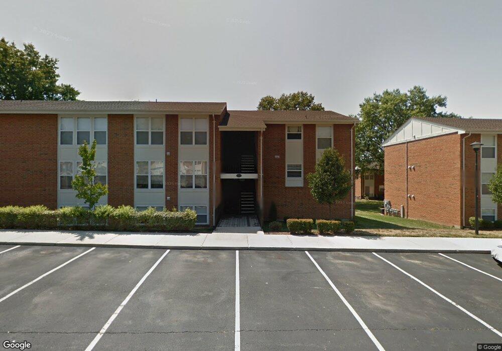
1952 Greenpoint Dr Unit 204 Saint Louis, MO 63122
Estimated Value: $144,269 - $171,000
2
Beds
1
Bath
929
Sq Ft
$169/Sq Ft
Est. Value
About This Home
This home is located at 1952 Greenpoint Dr Unit 204, Saint Louis, MO 63122 and is currently estimated at $157,067, approximately $169 per square foot. 1952 Greenpoint Dr Unit 204 is a home located in St. Louis County with nearby schools including George R. Robinson Elementary School, Nipher Middle School, and Kirkwood Senior High School.
Ownership History
Date
Name
Owned For
Owner Type
Purchase Details
Closed on
Mar 19, 2009
Sold by
Greenbriar Development Llc
Bought by
Crain Vickie S
Current Estimated Value
Home Financials for this Owner
Home Financials are based on the most recent Mortgage that was taken out on this home.
Original Mortgage
$101,600
Outstanding Balance
$64,877
Interest Rate
5.21%
Mortgage Type
FHA
Estimated Equity
$92,190
Create a Home Valuation Report for This Property
The Home Valuation Report is an in-depth analysis detailing your home's value as well as a comparison with similar homes in the area
Home Values in the Area
Average Home Value in this Area
Purchase History
| Date | Buyer | Sale Price | Title Company |
|---|---|---|---|
| Crain Vickie S | $124,900 | Multiple |
Source: Public Records
Mortgage History
| Date | Status | Borrower | Loan Amount |
|---|---|---|---|
| Open | Crain Vickie S | $101,600 |
Source: Public Records
Tax History Compared to Growth
Tax History
| Year | Tax Paid | Tax Assessment Tax Assessment Total Assessment is a certain percentage of the fair market value that is determined by local assessors to be the total taxable value of land and additions on the property. | Land | Improvement |
|---|---|---|---|---|
| 2025 | $1,503 | $27,420 | $12,350 | $15,070 |
| 2024 | $1,503 | $23,700 | $7,070 | $16,630 |
| 2023 | $1,480 | $23,700 | $7,070 | $16,630 |
| 2022 | $1,382 | $20,630 | $7,770 | $12,860 |
| 2021 | $1,365 | $20,630 | $7,770 | $12,860 |
| 2020 | $1,341 | $19,480 | $6,350 | $13,130 |
| 2019 | $1,345 | $19,480 | $6,350 | $13,130 |
| 2018 | $1,276 | $16,310 | $4,850 | $11,460 |
| 2017 | $1,275 | $16,310 | $4,850 | $11,460 |
| 2016 | $1,185 | $15,260 | $2,830 | $12,430 |
| 2015 | $1,180 | $15,260 | $2,830 | $12,430 |
| 2014 | $1,189 | $15,050 | $6,820 | $8,230 |
Source: Public Records
Map
Nearby Homes
- 1932 Green Glen Dr Unit 304
- 1924 Greenglen Dr Unit 101
- 1925 W Woodbine Ave
- 1968 Greenglen Dr Unit 102
- 1931 Greenglen Dr Unit 301
- 1926 Hunting Lake Ct Unit 304
- 1951 Greenpoint Dr Unit 103
- 1920 Hunting Lake Ct Unit 202
- 2025 Lily Ave
- 1912 Windy Hill Rd
- 2029 Lily Ave
- 2033 Lily Ave
- 410 Bach Ave
- 416 S Ballas Rd
- 602 S Ballas Rd
- 726 S Ballas Rd
- 150 W Glenwood Ln
- 12243 Old Big Bend Rd
- 514 Coulter Ave
- 128 Sweetbriar Ln
- 1946 Greenpoint Dr Unit 101
- 1952 Greenpoint Dr Unit 304
- 1952 Greenpoint Dr Unit 103
- 1952 Greenpoint Dr Unit 203
- 1946 Greenpoint Dr Unit 301
- 1946 Greenpoint Dr Unit 102
- 1946 Greenpoint Dr Unit 202
- 1952 Greenpoint Dr Unit 303
- 1946 Greenpoint Dr Unit 201
- 1946 Greenpoint Dr Unit 302
- 1946 Greenpoint Dr Unit 102
- 1946 Greenpoint Dr
- 1952 Greenpoint Dr
- 1952 Greenpoint Dr
- 1952 Greenpoint Dr Unit 5
- 1946 Greenpoint Dr Unit 5
- 1946 Greenpoint Dr
- 1952 Greenpoint Dr Unit 5
- 1946 Greenpoint Dr Unit 5
- 1952 Greenpoint Dr