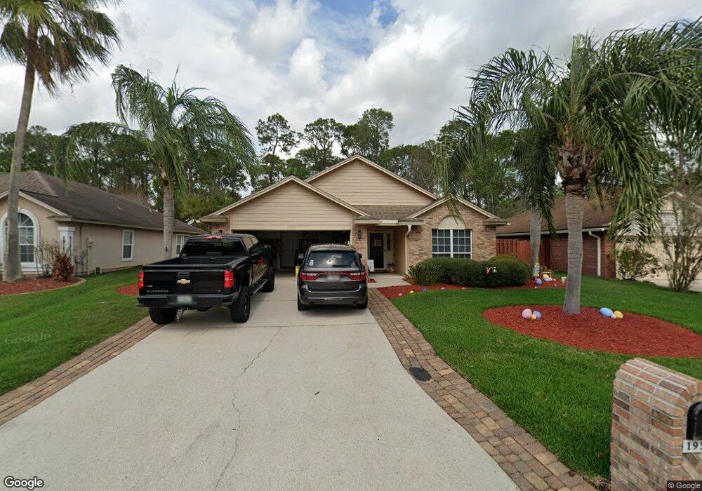
1952 Harbor Island Dr Fleming Island, FL 32003
Estimated Value: $337,018 - $359,000
4
Beds
2
Baths
1,731
Sq Ft
$202/Sq Ft
Est. Value
About This Home
This home is located at 1952 Harbor Island Dr, Fleming Island, FL 32003 and is currently estimated at $350,255, approximately $202 per square foot. 1952 Harbor Island Dr is a home located in Clay County with nearby schools including Robert M. Paterson Elementary School, Fleming Island High School, and Green Cove Springs Junior High School.
Ownership History
Date
Name
Owned For
Owner Type
Purchase Details
Closed on
May 11, 2009
Sold by
Sanders Terry F and Sanders Linda S
Bought by
Sanders David C and Sanders Tonya M
Current Estimated Value
Home Financials for this Owner
Home Financials are based on the most recent Mortgage that was taken out on this home.
Original Mortgage
$92,000
Outstanding Balance
$57,657
Interest Rate
4.86%
Mortgage Type
Purchase Money Mortgage
Estimated Equity
$292,598
Purchase Details
Closed on
May 31, 2000
Sold by
Plummer Leon G
Bought by
Sanders Terry F and Sanders Linda S
Home Financials for this Owner
Home Financials are based on the most recent Mortgage that was taken out on this home.
Original Mortgage
$91,700
Interest Rate
8.14%
Mortgage Type
Purchase Money Mortgage
Create a Home Valuation Report for This Property
The Home Valuation Report is an in-depth analysis detailing your home's value as well as a comparison with similar homes in the area
Home Values in the Area
Average Home Value in this Area
Purchase History
| Date | Buyer | Sale Price | Title Company |
|---|---|---|---|
| Sanders David C | $115,000 | Security Title Agency Inc | |
| Sanders Terry F | $131,000 | Realty Title Services Of Nor |
Source: Public Records
Mortgage History
| Date | Status | Borrower | Loan Amount |
|---|---|---|---|
| Open | Sanders David C | $92,000 | |
| Previous Owner | Sanders Terry F | $91,700 |
Source: Public Records
Tax History Compared to Growth
Tax History
| Year | Tax Paid | Tax Assessment Tax Assessment Total Assessment is a certain percentage of the fair market value that is determined by local assessors to be the total taxable value of land and additions on the property. | Land | Improvement |
|---|---|---|---|---|
| 2025 | $1,864 | $168,512 | -- | -- |
| 2024 | $2,139 | $163,763 | -- | -- |
| 2023 | $2,139 | $158,994 | $0 | $0 |
| 2022 | $1,959 | $154,364 | $0 | $0 |
| 2021 | $1,950 | $149,868 | $0 | $0 |
| 2020 | $1,887 | $147,799 | $0 | $0 |
| 2019 | $1,857 | $144,477 | $0 | $0 |
| 2018 | $1,700 | $141,783 | $0 | $0 |
| 2017 | $1,688 | $138,867 | $0 | $0 |
| 2016 | $1,683 | $136,011 | $0 | $0 |
| 2015 | $1,731 | $135,066 | $0 | $0 |
| 2014 | $1,687 | $133,994 | $0 | $0 |
Source: Public Records
Map
Nearby Homes
- 1028 Creighton Rd
- ST. GEORGE Plan at Creighton Pointe
- GRAYTON II Plan at Creighton Pointe
- MARSHALL Plan at Creighton Pointe
- JENSEN Plan at Creighton Pointe
- JAMESON Plan at Creighton Pointe
- SEASIDE Plan at Creighton Pointe
- EGRET Plan at Creighton Pointe
- ROSEMARY Plan at Creighton Pointe
- 1024 Creighton Rd
- 1044 Creighton Rd
- 1634 Dockside Dr
- 1040 Creighton Rd
- 1052 Creighton Rd
- 1279 Pirates Cove Ln
- 774 Creighton Rd
- 2025 Castle Point Ct
- 1203 Stern Way
- 2216 Salt Myrtle Ln
- 1947 Rose Mallow Ln
- 1956 Harbor Island Dr
- 1948 Harbor Island Dr
- 1944 Harbor Island Dr
- 1945 Harbor Island Dr
- 1964 Harbor Island Dr
- 1951 Harbor Island Dr
- 1957 Harbor Island Dr
- 1941 Harbor Island Dr
- 1968 Harbor Island Dr
- 1936 Harbor Island Dr
- 1963 Harbor Island Dr
- 0 Creighton Rd Unit 1158908
- 0 Creighton Rd Unit 808774
- 0 Creighton Rd
- 1935 Harbor Island Dr
- 947 Creighton Rd
- 1972 Harbor Island Dr
- 1934 Harbor Island Dr
- 1967 Harbor Island Dr
- 1931 Harbor Island Dr