

1952 Mount Pisgah Rd Cabool, MO 65689
Estimated payment $3,017/month
Highlights
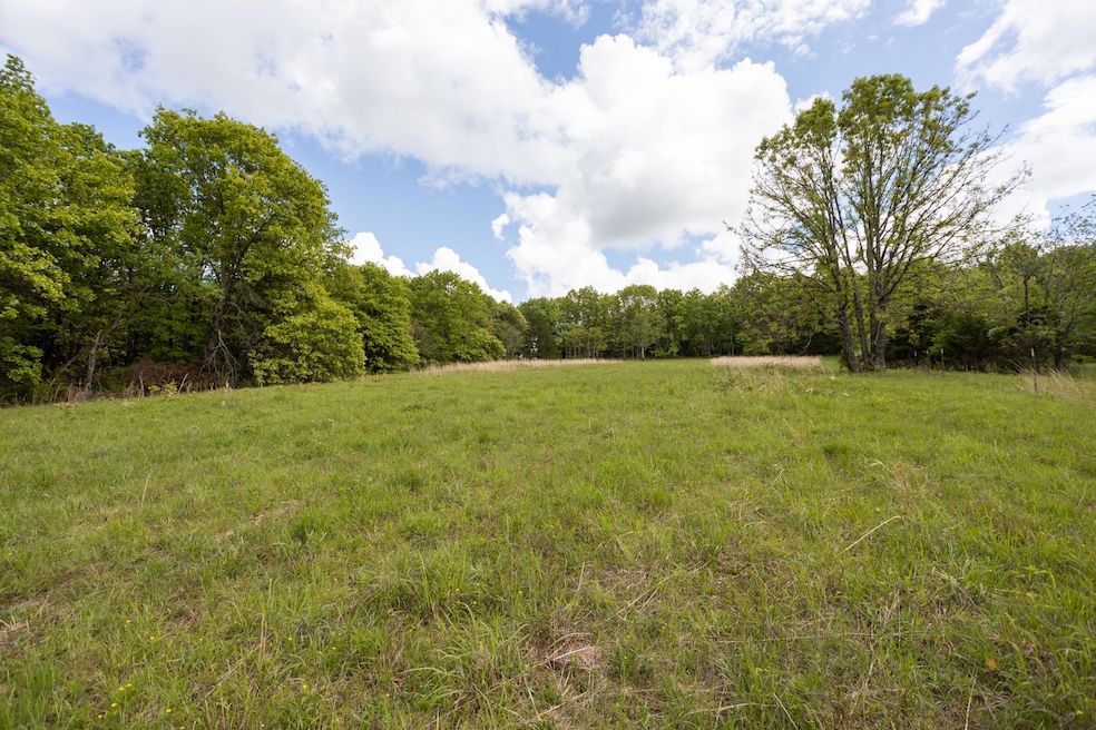
- 91 Acre Lot
- Pond
- Farmhouse Style Home
- Mature Trees
- Wood Flooring
- No HOA
About This Home
Discover this well designed 2,700 sqft, 2-bedroom, 2-bath ICF home nestled on approximately 91 acres of stunning, natural beauty. Designed with comfort and outdoor living in mind, this multi-level residence features inviting front and back decks, perfect for relaxing or entertaining while taking in the serene surroundings. The home is connected to a private well.
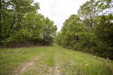
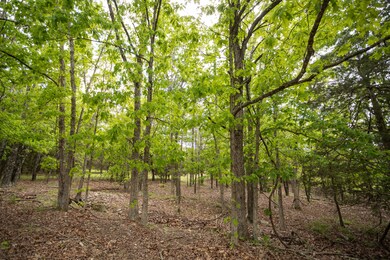
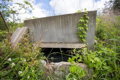
equipped with mature timber, the property offers a beautiful retreat with two well developed ponds and a natural spring providing great water sources. The cleared fields are ideal for establishing food plots to attract deer and turkey, making it an ideal spot for hunters and wildlife enthusiasts. Enjoy exploring the property with UTV trails cut through the woods, offering easy access to your favorite outdoor spots. Secluded and private, the long driveway ensures complete privacy from the outside world. Whether you're looking for a peaceful getaway, a hunting retreat, or a place to enjoy outdoor activities, this property combines natural beauty, privacy, and opportunity to enjoy the outdoors.

Home Details
Home Type
- Single Family
Est. Annual Taxes
- $688
Year Built
- Built in 1995
Lot Details
- 91 Acre Lot
- Property fronts a county road
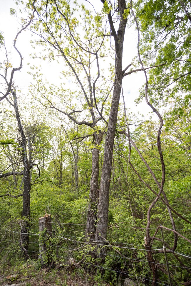
- Partially Fenced Property
- Barbed Wire
- Cleared Lot
- Mature Trees
- Wooded Lot
- Few Trees
Home Design
- Farmhouse Style Home
- Concrete Siding
- Vinyl Siding
Interior Spaces
- 2,700 Sq Ft Home
- 3-Story Property
- Ceiling Fan
- Wood Burning Fireplace
- Blinds
- Wood Flooring
Bedrooms and Bathrooms
- 2 Bedrooms
- 2 Full Bathrooms
Outdoor Features
- Property is near a pond
- Pond
- Covered Patio or Porch
- Outbuilding
Schools
- Cabool Elementary School
- Cabool High School
Utilities
- Window Unit Cooling System
- Heating System Uses Propane
- Private Company Owned Well
- Septic Tank
Additional Features
- Accessible Approach with Ramp
- Pasture
Community Details
- No Home Owners Association
Listing and Financial Details
- Tax Lot 11
- Assessor Parcel Number 31-0.1-11-000-000-014
Map
Tax History
| Year | Tax Paid | Tax Assessment Tax Assessment Total Assessment is a certain percentage of the fair market value that is determined by local assessors to be the total taxable value of land and additions on the property. | Land | Improvement |
|---|---|---|---|---|
| 2025 | $755 | $19,110 | $0 | $0 |
| 2024 | $755 | $19,110 | $0 | $0 |
| 2023 | $776 | $19,110 | $0 | $0 |
| 2022 | $714 | $17,700 | $0 | $0 |
| 2021 | $639 | $17,700 | $0 | $0 |
| 2020 | $639 | $16,410 | $0 | $0 |
| 2019 | $639 | $16,410 | $0 | $0 |
| 2018 | $591 | $15,120 | $0 | $0 |
| 2017 | $612 | $15,740 | $0 | $0 |
| 2016 | $613 | $15,740 | $0 | $0 |
| 2015 | -- | $3,680 | $0 | $0 |
| 2014 | -- | $3,680 | $0 | $0 |
| 2013 | -- | $3,590 | $0 | $0 |
Property History
| Date | Event | Price | List to Sale | Price per Sq Ft |
|---|---|---|---|---|
| 03/16/2026 03/16/26 | Price Changed | $554,000 | -5.3% | $205 / Sq Ft |
| 03/02/2026 03/02/26 | For Sale | $584,700 | 0.0% | $217 / Sq Ft |
| 01/11/2026 01/11/26 | Off Market | -- | -- | -- |
| 07/23/2025 07/23/25 | Price Changed | $584,700 | -3.7% | $217 / Sq Ft |
| 05/13/2025 05/13/25 | For Sale | $607,400 | -- | $225 / Sq Ft |
Purchase History
| Date | Type | Sale Price | Title Company |
|---|---|---|---|
| Quit Claim Deed | -- | None Available | |
| Warranty Deed | -- | None Available |
Mortgage History
| Date | Status | Loan Amount | Loan Type |
|---|---|---|---|
| Open | $104,000 | Future Advance Clause Open End Mortgage |
Source: Southern Missouri Regional MLS
MLS Number: 60294385
APN: 31-0.1-11-000-000-014
Disclaimer: Certain information contained herein is derived from information provided by parties other than Homes.com. All information provided is deemed reliable, but is not guaranteed to be accurate and should be independently verified.
![]() Based on information submitted to the MLS GRID. All data is obtained from various sources and may not have been verified by broker or MLS GRID. Supplied Open House Information is subject to change without notice. All information should be independently reviewed and verified for accuracy. Properties may or may not be listed by the office/agent presenting the information. Some IDX listings have been excluded from this website. The data relating to real estate for sale on this web page comes in part from the Internet Data Exchange (IDX) of the Southern Missouri Regional MLS, LLC, Inc. Real estate listings held by Brokerage firms other than Homes.com, LLC are marked with the IDX logo and detailed information about them includes the name of the listing Brokers. The information being provided is for consumers’ personal, noncommercial use and may not be used for any purpose other than to identify prospective properties consumers may be interested in purchasing. The information being provided is not guaranteed, and all information should be verified by the consumer. Any representation that a web site contains all listings shall only mean that the website contains all listings available to the public through the IDX data feed. There may be other properties offered through a REALTOR® that have not been displayed on this site. © 2026 Southern Missouri Regional MLS, LLC. All rights reserved.
Based on information submitted to the MLS GRID. All data is obtained from various sources and may not have been verified by broker or MLS GRID. Supplied Open House Information is subject to change without notice. All information should be independently reviewed and verified for accuracy. Properties may or may not be listed by the office/agent presenting the information. Some IDX listings have been excluded from this website. The data relating to real estate for sale on this web page comes in part from the Internet Data Exchange (IDX) of the Southern Missouri Regional MLS, LLC, Inc. Real estate listings held by Brokerage firms other than Homes.com, LLC are marked with the IDX logo and detailed information about them includes the name of the listing Brokers. The information being provided is for consumers’ personal, noncommercial use and may not be used for any purpose other than to identify prospective properties consumers may be interested in purchasing. The information being provided is not guaranteed, and all information should be verified by the consumer. Any representation that a web site contains all listings shall only mean that the website contains all listings available to the public through the IDX data feed. There may be other properties offered through a REALTOR® that have not been displayed on this site. © 2026 Southern Missouri Regional MLS, LLC. All rights reserved.
SOMO MLS respects the intellectual property rights of others and expects you to do the same. Per the DMCA, SOMO MLS will respond expeditiously to claims of copyright infringement on the Site if submitted to SOMO MLS' s Copyright Agent as described below. Upon receipt of a notice alleging copyright infringement, SOMO MLS will take whatever action it deems appropriate within its sole discretion, including removal of the allegedly infringing materials. If you believe that your intellectual property rights have been violated by SOMO MLS or by a third party who has uploaded materials to the Site, please provide the following information to SOMO MLS' s designated Copyright Agent listed below:
a. A description of the copyrighted work or other intellectual property that you claim has been infringed;
b. A description of where the material that you claim is infringing is located on the Site;
c. An address, telephone number, and e-mail address where SOMO MLS can contact you and, if different, an e-mail address where the alleged infringing party, if not SOMO MLS, can contact you;
d. A statement that you have a good-faith belief that the use is not authorized by the copyright owner or other intellectual property rights owner, by its agent, or by law;
e. A statement by you under penalty of perjury that the information in your notice is accurate and that you are the copyright or intellectual property owner or are authorized to act on the owner's behalf;
f. Your electronic or physical signature. SOMO MLS may request additional information before removing any allegedly infringing material.
In the event SOMO MLS removes the allegedly infringing materials, SOMO MLS will immediately notify the person responsible for posting such materials that SOMO MLS removed or disabled access to the materials. SOMO MLS may also provide the responsible person with your e-mail address so that the person may respond to your allegations. SOMO MLS reserves the right to terminate, limit or suspend any user's access to the Site in the event of repeated infringing activity. If you believe that a user of this Site is a repeat infringer, please follow the above instructions to contact SOMO MLS's Copyright Agent. Please include sufficient information to assist SOMO MLS in determining that the user repeatedly engaged in infringing activity. SOMO MLS registered a designated agent with the Copyright Office pursuant to 17 U.S.C. 512(c). SOMO MLS's designated Copyright Agent is: Jeff Kester 1310 Primrose, Springfield, MO 65804, Phone: 417-883-1226, Email: jeff@gsbor.com
Based on information submitted to the MLS GRID
- Rd Unit 1952
- 15768 Sargent
- 000 Sargent Rd
- 0 Sargent Rd
- 000 Berry Rd
- 000 Highway U
- 207 Juniper Ave
- Lot D Malberg Rd
- 000 Malberg Rd Unit Lot B
- 000 Malberg Rd Unit Lot D
- Lot B Malberg Rd
- Lot C Malberg Rd
- 000 Malberg Rd Unit Lot C
- 150 Sunshine Ave
- 183 M- Sunshine Ave
- 185 Sunshine Ave
- 723 Roberts St
- 0 U S 63
- 000 Jackson Rd
- 420 Ozark St
Ask me questions while you tour the home.