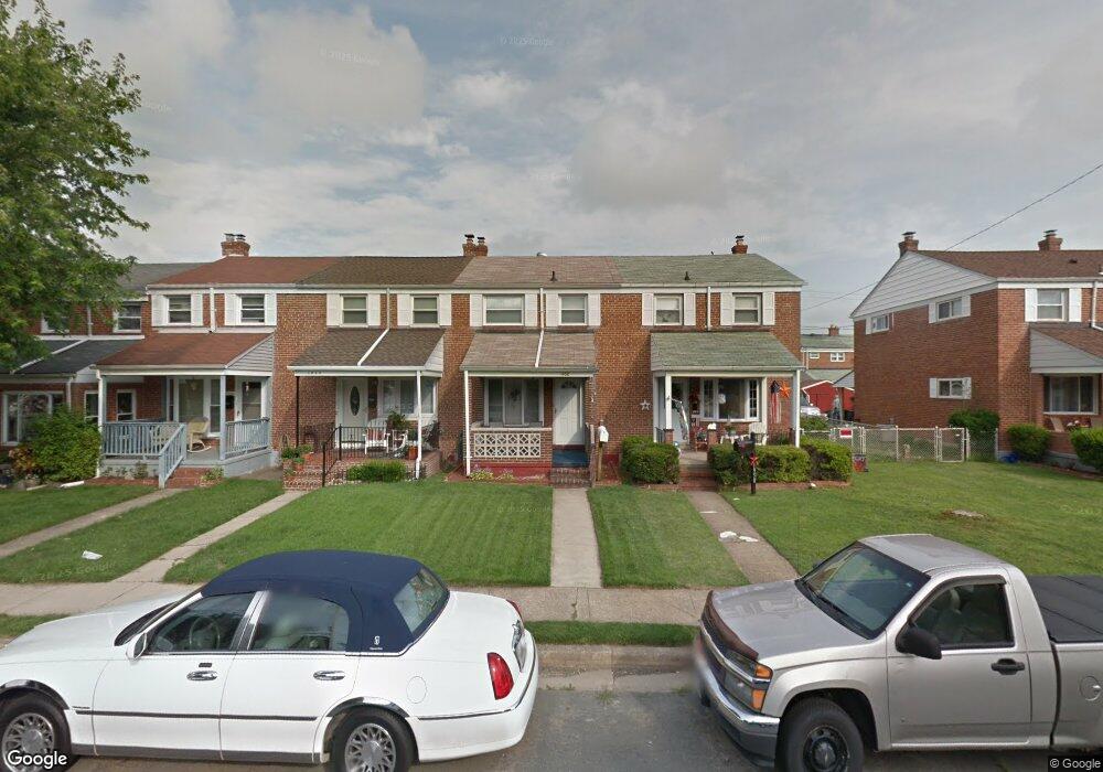
1952 Ormand Rd Dundalk, MD 21222
Estimated Value: $181,356 - $222,000
Studio
1
Bath
1,008
Sq Ft
$207/Sq Ft
Est. Value
About This Home
This home is located at 1952 Ormand Rd, Dundalk, MD 21222 and is currently estimated at $209,089, approximately $207 per square foot. 1952 Ormand Rd is a home located in Baltimore County with nearby schools including Grange Elementary School, General John Stricker Middle School, and Patapsco High & Center for Arts.
Ownership History
Date
Name
Owned For
Owner Type
Purchase Details
Closed on
Apr 19, 2006
Sold by
Ridings Melissa A
Bought by
Freeman Carson S and Freeman Loretta H
Current Estimated Value
Home Financials for this Owner
Home Financials are based on the most recent Mortgage that was taken out on this home.
Original Mortgage
$132,000
Outstanding Balance
$74,764
Interest Rate
6.4%
Mortgage Type
Purchase Money Mortgage
Estimated Equity
$134,325
Purchase Details
Closed on
Nov 8, 2005
Sold by
Kluczyk Melissa A
Bought by
Ridings Melissa A
Home Financials for this Owner
Home Financials are based on the most recent Mortgage that was taken out on this home.
Original Mortgage
$94,000
Interest Rate
5.79%
Mortgage Type
New Conventional
Purchase Details
Closed on
May 19, 1998
Sold by
Bertoni Gene C
Bought by
Kluczyk Melissa A
Create a Home Valuation Report for This Property
The Home Valuation Report is an in-depth analysis detailing your home's value as well as a comparison with similar homes in the area
Home Values in the Area
Average Home Value in this Area
Purchase History
| Date | Buyer | Sale Price | Title Company |
|---|---|---|---|
| Freeman Carson S | $165,000 | -- | |
| Ridings Melissa A | -- | -- | |
| Kluczyk Melissa A | $77,500 | -- |
Source: Public Records
Mortgage History
| Date | Status | Borrower | Loan Amount |
|---|---|---|---|
| Open | Freeman Carson S | $132,000 | |
| Previous Owner | Ridings Melissa A | $94,000 |
Source: Public Records
Tax History
| Year | Tax Paid | Tax Assessment Tax Assessment Total Assessment is a certain percentage of the fair market value that is determined by local assessors to be the total taxable value of land and additions on the property. | Land | Improvement |
|---|---|---|---|---|
| 2025 | $2,165 | $147,367 | -- | -- |
| 2024 | $2,165 | $137,233 | $0 | $0 |
| 2023 | $1,018 | $127,100 | $36,000 | $91,100 |
| 2022 | $1,982 | $125,467 | $0 | $0 |
| 2021 | $1,945 | $123,833 | $0 | $0 |
| 2020 | $1,945 | $122,200 | $36,000 | $86,200 |
| 2019 | $1,890 | $119,233 | $0 | $0 |
| 2018 | $1,813 | $116,267 | $0 | $0 |
| 2017 | $1,712 | $113,300 | $0 | $0 |
| 2016 | $1,927 | $113,300 | $0 | $0 |
| 2015 | $1,927 | $113,300 | $0 | $0 |
| 2014 | $1,927 | $131,500 | $0 | $0 |
Source: Public Records
Map
Nearby Homes
- 1935 Stanhope Rd
- 1954 Stanhope Rd
- 2012 Wareham Rd
- 1930 Stanhope Rd
- 2811 Moorgate Rd
- 2782 Moorgate Rd
- 1911 Sunberry Rd
- 7252 Meadow Ln
- 7807 Rockbourne Rd
- 1940H Robinwood Rd
- 7111 Sollers Point Rd
- 7832 Rockbourne Rd
- 9 Vista Mobile Dr
- 2924 Sollers Point Rd
- 2953 Yorkway
- 3145 Baybriar Rd
- 7849 Harold Rd
- 8201 Seaworthy Way
- 7512 School Ave
- 100 Shipway
- 1954 Ormand Rd
- 1950 Ormand Rd
- 1956 Ormand Rd
- 1958 Ormand Rd
- 1948 Ormand Rd
- 1960 Ormand Rd
- 1946 Ormand Rd
- 1962 Ormand Rd
- 1944 Ormand Rd
- 1942 Ormand Rd
- 1955 Wareham Rd
- 1951 Wareham Rd
- 1957 Wareham Rd
- 1959 Wareham Rd
- 1949 Wareham Rd
- 1940 Ormand Rd
- 1961 Wareham Rd
- 1947 Wareham Rd
- 1938 Ormand Rd
- 1963 Wareham Rd
Your Personal Tour Guide
Ask me questions while you tour the home.