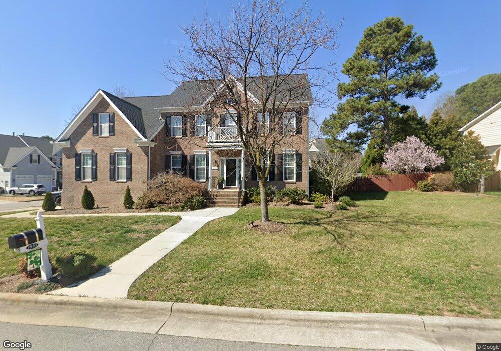
1952 Post Rail Ln Apex, NC 27502
Friendship NeighborhoodEstimated Value: $718,000 - $880,000
4
Beds
3
Baths
3,725
Sq Ft
$219/Sq Ft
Est. Value
About This Home
This home is located at 1952 Post Rail Ln, Apex, NC 27502 and is currently estimated at $814,718, approximately $218 per square foot. 1952 Post Rail Ln is a home located in Wake County with nearby schools including Scotts Ridge Elementary School, Apex Friendship Middle School, and Apex Friendship High School.
Ownership History
Date
Name
Owned For
Owner Type
Purchase Details
Closed on
Aug 22, 2008
Sold by
Comstock Holland Road Llc
Bought by
Delitizia Darren J and Delitizia Leah M
Current Estimated Value
Home Financials for this Owner
Home Financials are based on the most recent Mortgage that was taken out on this home.
Original Mortgage
$304,750
Outstanding Balance
$199,917
Interest Rate
6.32%
Mortgage Type
Purchase Money Mortgage
Estimated Equity
$614,801
Create a Home Valuation Report for This Property
The Home Valuation Report is an in-depth analysis detailing your home's value as well as a comparison with similar homes in the area
Home Values in the Area
Average Home Value in this Area
Purchase History
| Date | Buyer | Sale Price | Title Company |
|---|---|---|---|
| Delitizia Darren J | $381,000 | None Available |
Source: Public Records
Mortgage History
| Date | Status | Borrower | Loan Amount |
|---|---|---|---|
| Open | Delitizia Darren J | $304,750 |
Source: Public Records
Tax History
| Year | Tax Paid | Tax Assessment Tax Assessment Total Assessment is a certain percentage of the fair market value that is determined by local assessors to be the total taxable value of land and additions on the property. | Land | Improvement |
|---|---|---|---|---|
| 2025 | $6,578 | $751,135 | $170,000 | $581,135 |
| 2024 | $6,431 | $751,135 | $170,000 | $581,135 |
Source: Public Records
Map
Nearby Homes
- 2516 Maroni Dr
- 7104 Camp Branch Ln
- 2805 Evans Rd
- 2801 Evans Rd
- 1124 Woodlands Creek Way
- 2170 Vittorio Ln
- 1956 Lazio Ln
- 2030 Lazio Ln
- 2908 Evans Rd
- 2414 Vetrina Way
- 2428 Vetrina Way
- 3020 Holland Rd
- 2061 Tordelo Place
- 2466 Vetrina Way
- 2429 Vetrina Way
- 2437 Vetrina Way
- 2495 Vetrina Way
- 2499 Vetrina Way
- 2505 Vetrina Way
- 2511 Vetrina Way
- 1946 Post Rail Ln
- 1955 Combine Cir
- 1953 Post Rail Ln
- 1964 Combine Cir
- 1949 Post Rail Ln
- 1947 Combine Cir
- 1960 Combine Cir
- 1940 Post Rail Ln
- 1968 Combine Cir
- 1943 Post Rail Ln
- 1956 Combine Cir
- 1939 Combine Cir
- 1972 Combine Cir
- 1990 Steeple Chase Bend
- 1937 Post Rail Ln
- 1934 Post Rail Ln
- 1986 Steeple Chase Bend
- 1948 Combine Cir
- 1987 Old Byre Way
- 1991 Old Byre Way
Your Personal Tour Guide
Ask me questions while you tour the home.