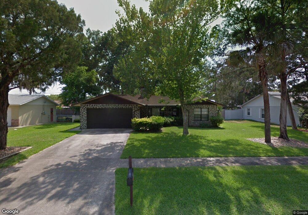
1952 Red Cedar Cir South Daytona, FL 32119
Estimated Value: $258,901 - $315,000
3
Beds
2
Baths
1,277
Sq Ft
$217/Sq Ft
Est. Value
About This Home
This home is located at 1952 Red Cedar Cir, South Daytona, FL 32119 and is currently estimated at $277,225, approximately $217 per square foot. 1952 Red Cedar Cir is a home located in Volusia County with nearby schools including South Daytona Elementary School, Atlantic High School, and Campbell Middle School.
Ownership History
Date
Name
Owned For
Owner Type
Purchase Details
Closed on
Jul 26, 2004
Sold by
Raborne Marshall L and Raborne Karen
Bought by
England Donald L and England Ann R
Current Estimated Value
Home Financials for this Owner
Home Financials are based on the most recent Mortgage that was taken out on this home.
Original Mortgage
$60,000
Interest Rate
5.92%
Mortgage Type
Purchase Money Mortgage
Purchase Details
Closed on
Jun 15, 1983
Bought by
England Donald L and England Ann R
Purchase Details
Closed on
May 15, 1983
Bought by
England Donald L and England Ann R
Create a Home Valuation Report for This Property
The Home Valuation Report is an in-depth analysis detailing your home's value as well as a comparison with similar homes in the area
Home Values in the Area
Average Home Value in this Area
Purchase History
| Date | Buyer | Sale Price | Title Company |
|---|---|---|---|
| England Donald L | $150,000 | Premier Title & Abstract Inc | |
| England Donald L | $54,000 | -- | |
| England Donald L | $36,400 | -- |
Source: Public Records
Mortgage History
| Date | Status | Borrower | Loan Amount |
|---|---|---|---|
| Previous Owner | England Donald L | $60,000 |
Source: Public Records
Tax History Compared to Growth
Tax History
| Year | Tax Paid | Tax Assessment Tax Assessment Total Assessment is a certain percentage of the fair market value that is determined by local assessors to be the total taxable value of land and additions on the property. | Land | Improvement |
|---|---|---|---|---|
| 2025 | $476 | $98,301 | -- | -- |
| 2024 | $476 | $95,531 | -- | -- |
| 2023 | $476 | $92,749 | $0 | $0 |
| 2022 | $510 | $90,048 | $0 | $0 |
| 2021 | $496 | $87,425 | $0 | $0 |
| 2020 | $486 | $86,218 | $0 | $0 |
| 2019 | $454 | $84,280 | $0 | $0 |
| 2018 | $443 | $82,709 | $0 | $0 |
| 2017 | $856 | $81,008 | $0 | $0 |
| 2016 | $836 | $79,342 | $0 | $0 |
| 2015 | $855 | $78,790 | $0 | $0 |
| 2014 | $849 | $78,165 | $0 | $0 |
Source: Public Records
Map
Nearby Homes
- 1951 Red Cedar Cir
- 1970 Red Cedar Cir
- 1975 Red Cedar Cir
- 781 Aspen Dr
- 1982 Menger Cir
- 784 Little Pine Dr
- 786 Little Pine Dr
- 1810 Western Rd
- 1703 Magnolia Ave Unit 11
- 705 Largo Way
- 1749 Jacobs Rd
- 1724 Western Rd
- 1743 Jacobs Rd
- 840 Teague St
- 638 Aurora St
- 2009 Brian Ave
- 618 Aurora St
- 1642 Caldwell Rd
- 713 Beville Rd
- 518 Katherine St
- 1950 Red Cedar Cir
- 1954 Red Cedar Cir
- 1977 Menger Cir
- 1979 Menger Cir
- 1975 Menger Cir
- 1956 Red Cedar Cir
- 1948 Red Cedar Cir
- 1949 Red Cedar Cir
- 1953 Red Cedar Cir
- 1981 Menger Cir
- 1973 Menger Cir
- 1947 Red Cedar Cir
- 1955 Red Cedar Cir
- 1958 Red Cedar Cir
- 1946 Red Cedar Cir
- 1976 Menger Cir
- 1971 Menger Cir
- 1976 Red Cedar Cir
- 1983 Menger Cir
- 1974 Menger Cir