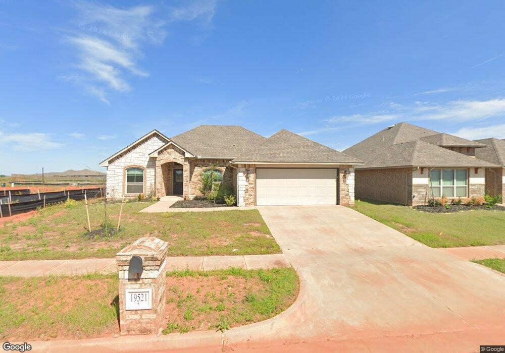
19521 Birchfield Dr Edmond, OK 73012
Deer Creek NeighborhoodEstimated Value: $326,098 - $356,000
3
Beds
2
Baths
1,876
Sq Ft
$183/Sq Ft
Est. Value
About This Home
This home is located at 19521 Birchfield Dr, Edmond, OK 73012 and is currently estimated at $344,025, approximately $183 per square foot. 19521 Birchfield Dr is a home located in Oklahoma County with nearby schools including Grove Valley Elementary School, Deer Creek Middle School, and Deer Creek Intermediate School.
Ownership History
Date
Name
Owned For
Owner Type
Purchase Details
Closed on
May 26, 2022
Sold by
Dotson Mechell D
Bought by
Nexpoint Sfr Spe 1 Llc
Current Estimated Value
Purchase Details
Closed on
May 16, 2022
Sold by
Dotson Mechell D
Bought by
Nexpoint Sfr Spe 1 Llc
Purchase Details
Closed on
Oct 21, 2019
Sold by
Castleberry Properties Llc
Bought by
Dotson Mechell D
Home Financials for this Owner
Home Financials are based on the most recent Mortgage that was taken out on this home.
Original Mortgage
$245,709
Interest Rate
3.5%
Mortgage Type
VA
Create a Home Valuation Report for This Property
The Home Valuation Report is an in-depth analysis detailing your home's value as well as a comparison with similar homes in the area
Home Values in the Area
Average Home Value in this Area
Purchase History
| Date | Buyer | Sale Price | Title Company |
|---|---|---|---|
| Nexpoint Sfr Spe 1 Llc | $335,000 | American Eagle | |
| Nexpoint Sfr Spe 1 Llc | $335,000 | American Eagle | |
| Dotson Mechell D | $241,000 | Stewart Title Of Ok Inc |
Source: Public Records
Mortgage History
| Date | Status | Borrower | Loan Amount |
|---|---|---|---|
| Previous Owner | Dotson Mechell D | $245,709 |
Source: Public Records
Tax History Compared to Growth
Tax History
| Year | Tax Paid | Tax Assessment Tax Assessment Total Assessment is a certain percentage of the fair market value that is determined by local assessors to be the total taxable value of land and additions on the property. | Land | Improvement |
|---|---|---|---|---|
| 2024 | $4,660 | $35,750 | $5,045 | $30,705 |
| 2023 | $4,660 | $35,420 | $5,045 | $30,375 |
| 2022 | $3,837 | $29,452 | $4,808 | $24,644 |
| 2021 | $3,580 | $28,050 | $5,045 | $23,005 |
| 2020 | $3,578 | $27,005 | $5,299 | $21,706 |
| 2019 | $221 | $1,645 | $1,645 | $0 |
| 2018 | $220 | $1,645 | $0 | $0 |
Source: Public Records
Map
Nearby Homes
- 19524 Denison Ave
- 19520 Denison Ave
- 19604 Denison Ave
- 19505 Birchfield Dr
- 19509 Birchfield Dr
- 19513 Birchfield Dr
- 19517 Birchfield Dr
- 19601 Denison Ave
- 19605 Denison Ave
- 2513 NW 196th St
- 2517 NW 196th St
- 2509 NW 196th St
- 2521 NW 196th St
- 19616 Bolton Rd
- 2525 NW 196th St
- 2520 NW 196th St
- 2524 NW 196th St
- 2525 NW 194th St
- 2529 NW 196th St
- 19704 Forsythe Dr
- 19521 Birchfield Dr
- 19525 Birchfield Dr
- 19612 Denison Ave
- 19529 Birchfield Dr
- 19616 Denison Ave
- 19524 Birchfield Dr
- 19528 Birchfield Dr
- 19524 Birchfield Dr
- 19529 Birchfield Dr
- 19525 Birchfield Dr
- 19528 Birchfield Dr
- 19613 Denison Ave
- 19620 Denison Ave
- 19609 Denison Ave
- 19616 Castleberry Dr
- 19515 Castleberry Dr
- 2529 NW 195th St
- 2525 NW 195th St
- 2701 NW 195th St
- 19629 Castleberry Dr