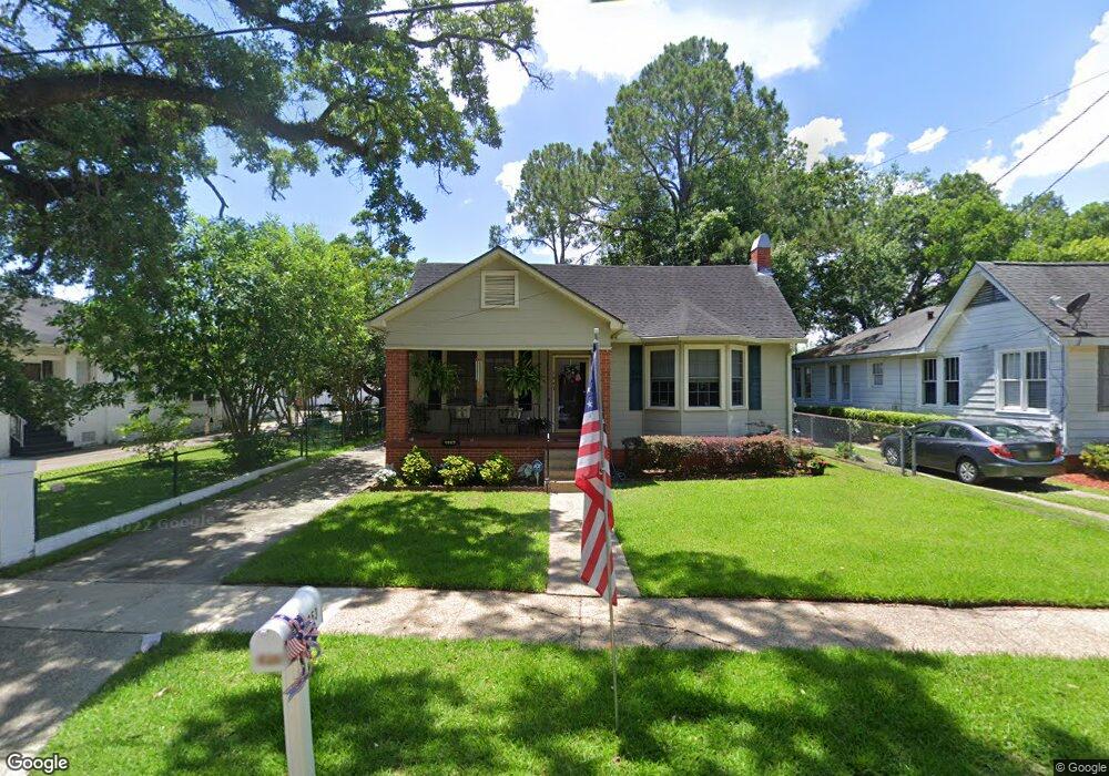
1953 Myrtle Ave Mobile, AL 36606
Midtown Mobile NeighborhoodEstimated Value: $168,000 - $247,000
2
Beds
2
Baths
1,393
Sq Ft
$153/Sq Ft
Est. Value
About This Home
This home is located at 1953 Myrtle Ave, Mobile, AL 36606 and is currently estimated at $213,535, approximately $153 per square foot. 1953 Myrtle Ave is a home located in Mobile County with nearby schools including Leinkauf Elementary School, Booker T. Washington Middle School, and Murphy High School.
Ownership History
Date
Name
Owned For
Owner Type
Purchase Details
Closed on
Jan 7, 2022
Sold by
Meneill Richard
Bought by
Tinnea Cathy C and Tinnea Cathy
Current Estimated Value
Home Financials for this Owner
Home Financials are based on the most recent Mortgage that was taken out on this home.
Original Mortgage
$160,000
Outstanding Balance
$147,479
Interest Rate
3.12%
Mortgage Type
New Conventional
Estimated Equity
$66,056
Purchase Details
Closed on
Apr 19, 2013
Sold by
Wilhelm Audrey V
Bought by
Grandquest Lindsay
Purchase Details
Closed on
Oct 12, 2004
Sold by
Bedford David Clayton and Bedford Stephanie C
Bought by
Mcneill Richard
Home Financials for this Owner
Home Financials are based on the most recent Mortgage that was taken out on this home.
Original Mortgage
$99,116
Interest Rate
5.71%
Mortgage Type
FHA
Create a Home Valuation Report for This Property
The Home Valuation Report is an in-depth analysis detailing your home's value as well as a comparison with similar homes in the area
Home Values in the Area
Average Home Value in this Area
Purchase History
| Date | Buyer | Sale Price | Title Company |
|---|---|---|---|
| Tinnea Cathy C | $160,000 | Surety Land Title | |
| Grandquest Lindsay | $93,000 | None Available | |
| Mcneill Richard | $99,900 | -- |
Source: Public Records
Mortgage History
| Date | Status | Borrower | Loan Amount |
|---|---|---|---|
| Open | Tinnea Cathy C | $160,000 | |
| Previous Owner | Mcneill Richard | $99,116 |
Source: Public Records
Tax History
| Year | Tax Paid | Tax Assessment Tax Assessment Total Assessment is a certain percentage of the fair market value that is determined by local assessors to be the total taxable value of land and additions on the property. | Land | Improvement |
|---|---|---|---|---|
| 2025 | $936 | $16,950 | $3,600 | $13,350 |
| 2024 | $936 | $16,420 | $3,600 | $12,820 |
| 2023 | $906 | $16,090 | $3,000 | $13,090 |
| 2022 | $665 | $11,510 | $3,000 | $8,510 |
| 2021 | $665 | $11,510 | $3,000 | $8,510 |
| 2020 | $659 | $11,420 | $3,000 | $8,420 |
| 2019 | $539 | $9,540 | $0 | $0 |
| 2018 | $539 | $9,540 | $0 | $0 |
| 2017 | $539 | $9,540 | $0 | $0 |
| 2016 | $568 | $10,000 | $0 | $0 |
| 2013 | $792 | $12,960 | $0 | $0 |
Source: Public Records
Map
Nearby Homes
- 1956 Myrtle Ave
- 1958 Myrtle Ave
- 1954 Old Government St
- 1900 Old Government St
- 2054 Old Government St
- 253 Cherokee St
- 1858 Old Government St
- 266 Rickarby St
- 312 Glenwood St
- 165 S Fulton St
- 266 Mohawk St
- 203 Mohawk St
- 2155 Old Government St
- 1824 Woodcock Place
- 1961 Duncan St
- 1821 Woodcock Place
- 1817 Woodcock Place
- 1813 Woodcock Place
- 168 Mohawk St
- 120 Demouy Ave
- 1955 Myrtle Ave
- 1951 Myrtle Ave
- 2008 Airport Blvd
- 1959 Myrtle Ave
- 1917 Myrtle Ave
- 1917 Myrtle Ave Unit B
- 2006 Airport Blvd
- 2004 Airport Blvd
- 2010 Airport Blvd
- 1954 Myrtle Ave
- 1952 Myrtle Ave
- 1950 Myrtle Ave
- 1915 Myrtle Ave
- 2000 Airport Blvd
- 1920 Myrtle Ave
- 1911 Myrtle Ave
- 1918 Myrtle Ave
- 1960 Myrtle Ave
- 1916 Myrtle Ave
- 1907 Myrtle Ave
Your Personal Tour Guide
Ask me questions while you tour the home.