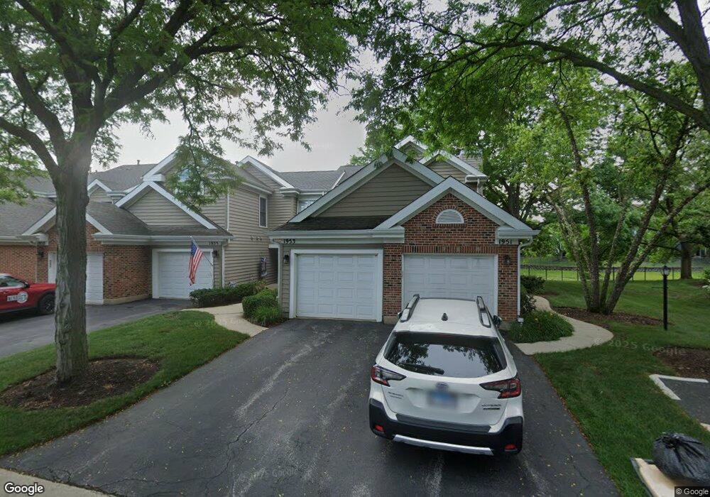
1953 N Coldspring Rd Unit 68 Arlington Heights, IL 60004
Estimated Value: $268,821 - $325,000
2
Beds
--
Bath
9,533
Sq Ft
$32/Sq Ft
Est. Value
About This Home
This home is located at 1953 N Coldspring Rd Unit 68, Arlington Heights, IL 60004 and is currently estimated at $303,205, approximately $31 per square foot. 1953 N Coldspring Rd Unit 68 is a home located in Cook County with nearby schools including Dwight D Eisenhower Elementary School, Anne Sullivan Elementary School, and Betsy Ross Elementary School.
Ownership History
Date
Name
Owned For
Owner Type
Purchase Details
Closed on
May 12, 2022
Sold by
Richard D Fulk Trust and Fulk Richard V
Bought by
Fulk Properties Llc
Current Estimated Value
Purchase Details
Closed on
May 9, 2022
Sold by
Richard D Fulk Trust
Bought by
Fulk Properties Llc
Purchase Details
Closed on
Jun 22, 2016
Sold by
Fulk Richard D
Bought by
Fulk Richard D and Richard D Fulk Trust
Create a Home Valuation Report for This Property
The Home Valuation Report is an in-depth analysis detailing your home's value as well as a comparison with similar homes in the area
Home Values in the Area
Average Home Value in this Area
Purchase History
| Date | Buyer | Sale Price | Title Company |
|---|---|---|---|
| Fulk Properties Llc | -- | -- | |
| Fulk Properties Llc | -- | -- | |
| Fulk Properties Llc | -- | None Listed On Document | |
| Fulk Richard D | -- | Attorneys Title Guaranty Fun |
Source: Public Records
Tax History Compared to Growth
Tax History
| Year | Tax Paid | Tax Assessment Tax Assessment Total Assessment is a certain percentage of the fair market value that is determined by local assessors to be the total taxable value of land and additions on the property. | Land | Improvement |
|---|---|---|---|---|
| 2024 | $5,434 | $19,882 | $4,236 | $15,646 |
| 2023 | $5,189 | $19,882 | $4,236 | $15,646 |
| 2022 | $5,189 | $19,882 | $4,236 | $15,646 |
| 2021 | $4,937 | $16,242 | $441 | $15,801 |
| 2020 | $4,806 | $16,242 | $441 | $15,801 |
| 2019 | $4,804 | $18,165 | $441 | $17,724 |
| 2018 | $4,074 | $13,990 | $352 | $13,638 |
| 2017 | $4,031 | $13,990 | $352 | $13,638 |
| 2016 | $3,755 | $13,990 | $352 | $13,638 |
| 2015 | $4,327 | $14,558 | $2,205 | $12,353 |
| 2014 | $4,281 | $14,558 | $2,205 | $12,353 |
| 2013 | $4,185 | $14,558 | $2,205 | $12,353 |
Source: Public Records
Map
Nearby Homes
- 1912 N Coldspring Rd Unit 96
- 1949 N Charter Point Dr Unit 1949
- 2026 N Stillwater Rd Unit 24
- 1956 N Silver Lake Rd
- 307 Anne Ct
- 105 W Ridge Ave
- 2611 E Radford Ct
- 11 W Palatine Rd
- 802 Andover Ct
- 13 W Kenilworth Ave
- 1044 Creekside Ct Unit 2B
- 1500 Harbour Dr Unit 2K
- 1500 Harbour Dr Unit 1D
- 2143 E Peachtree Ln
- 412 Cherry Creek Ln
- 21 E Stonegate Dr
- 1519 E Arbor Ln
- 9 Kenneth Ave
- 1424 E Jonquil Cir
- 1014 N Elmhurst Rd
- 1951 N Coldspring Rd Unit 67
- 1955 N Coldspring Rd Unit 66
- 1957 N Coldspring Rd Unit 65
- 1957 N Coldspring Rd Unit 1957
- 1959 N Coldspring Rd Unit 64
- 1947 N Coldspring Rd Unit 81
- 1963 N Coldspring Rd Unit 62
- 1945 N Coldspring Rd Unit 82
- 1943 N Coldspring Rd Unit 83
- 1941 N Coldspring Rd Unit 84
- 1939 N Coldspring Rd Unit 85
- 1962 N Coldspring Rd Unit 51
- 1956 N Coldspring Rd Unit 77
- 1971 N Coldspring Rd Unit 47
- 1954 N Coldspring Rd Unit 78
- 1964 N Coldspring Rd Unit 52
- 1928 N Silver Lake Rd Unit 66
- 1935 N Coldspring Rd Unit 88
- 1973 N Coldspring Rd Unit 48
- 1952 N Coldspring Rd Unit 76