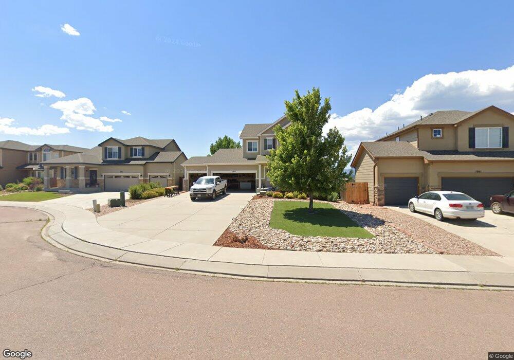
1953 Wagon Gap Trail Monument, CO 80132
Estimated Value: $665,000
5
Beds
2
Baths
2,176
Sq Ft
$306/Sq Ft
Est. Value
About This Home
This home is located at 1953 Wagon Gap Trail, Monument, CO 80132 and is currently priced at $665,000, approximately $305 per square foot. 1953 Wagon Gap Trail is a home located in El Paso County with nearby schools including Bear Creek Elementary School, Lewis-Palmer Middle School, and Lewis-Palmer High School.
Ownership History
Date
Name
Owned For
Owner Type
Purchase Details
Closed on
Apr 1, 2021
Sold by
Logrande Anthony B
Bought by
Eden Joseph W and Pariente Christina F
Current Estimated Value
Home Financials for this Owner
Home Financials are based on the most recent Mortgage that was taken out on this home.
Original Mortgage
$440,000
Outstanding Balance
$395,978
Interest Rate
2.8%
Mortgage Type
New Conventional
Purchase Details
Closed on
Aug 27, 2018
Sold by
Wheelock Jeff and Wheelock Dana
Bought by
Logrande Anthony B
Home Financials for this Owner
Home Financials are based on the most recent Mortgage that was taken out on this home.
Original Mortgage
$434,035
Interest Rate
4.5%
Mortgage Type
VA
Purchase Details
Closed on
Nov 30, 2009
Sold by
Richmond American Homes Of Colorado Inc
Bought by
Emelander Steven K and Emelander Stephanie L
Home Financials for this Owner
Home Financials are based on the most recent Mortgage that was taken out on this home.
Original Mortgage
$291,636
Interest Rate
5.06%
Mortgage Type
FHA
Create a Home Valuation Report for This Property
The Home Valuation Report is an in-depth analysis detailing your home's value as well as a comparison with similar homes in the area
Home Values in the Area
Average Home Value in this Area
Purchase History
| Date | Buyer | Sale Price | Title Company |
|---|---|---|---|
| Eden Joseph W | $550,000 | Land Title Guarantee Company | |
| Logrande Anthony B | $424,900 | Heritage Title Co | |
| Emelander Steven K | $297,000 | American Home Title & Escrow |
Source: Public Records
Mortgage History
| Date | Status | Borrower | Loan Amount |
|---|---|---|---|
| Open | Eden Joseph W | $440,000 | |
| Previous Owner | Logrande Anthony B | $434,035 | |
| Previous Owner | Emelander Steven K | $291,636 |
Source: Public Records
Tax History Compared to Growth
Tax History
| Year | Tax Paid | Tax Assessment Tax Assessment Total Assessment is a certain percentage of the fair market value that is determined by local assessors to be the total taxable value of land and additions on the property. | Land | Improvement |
|---|---|---|---|---|
| 2022 | $2,513 | $34,240 | $5,600 | $28,640 |
| 2021 | $2,600 | $35,230 | $5,760 | $29,470 |
| 2020 | $2,306 | $29,910 | $5,150 | $24,760 |
| 2019 | $1,995 | $26,000 | $5,150 | $20,850 |
| 2018 | $1,824 | $22,570 | $4,610 | $17,960 |
| 2017 | $1,997 | $22,570 | $4,610 | $17,960 |
| 2016 | $1,734 | $22,800 | $4,600 | $18,200 |
| 2015 | $1,732 | $22,800 | $4,600 | $18,200 |
| 2014 | $1,628 | $20,540 | $4,600 | $15,940 |
Source: Public Records
Map
Nearby Homes
- 16420 Hay Barn Heights
- 16845 Buffalo Valley Path
- 16613 Elk Valley Trail
- 16850 Buffalo Valley Path
- 16389 Alpine Sorrel Dr
- 16781 Elk Valley Trail
- 2130 Indian Balsam Dr
- 17215 Buffalo Valley Path
- 2149 Indian Balsam Dr
- 16015 Mountain Flax Dr
- 16478 Mountain Flax Dr
- 2266 Prairie Smoke Dr
- 16972 Park Trail Dr
- 16423 Mountain Flax Dr
- 16135 Mountain Flax Dr
- 2325 Coyote Mint Dr
- 16270 Mountain Flax Dr
- 16860 New Autumn Dr
- 977 Sunny Shore Dr
- 16556 Hallmark Trail
- 1961 Wagon Gap Trail
- 1945 Wagon Gap Trail
- 1937 Wagon Gap Trail
- 1969 Wagon Gap Trail
- 1929 Wagon Gap Trail
- 1977 Wagon Gap Trail
- 1962 Wagon Gap Trail
- 1985 Wagon Gap Trail
- 1970 Wagon Gap Trail
- 1993 Wagon Gap Trail
- 16760 Buffalo Valley Path
- 1978 Wagon Gap Trail
- 1986 Wagon Gap Trail
- 16754 Buffalo Valley Path
- 2001 Wagon Gap Trail
- 1994 Wagon Gap Trail
- 16778 Buffalo Valley Path
- 16772 Buffalo Valley Path
- 2009 Wagon Gap Trail
- 2002 Wagon Gap Trail