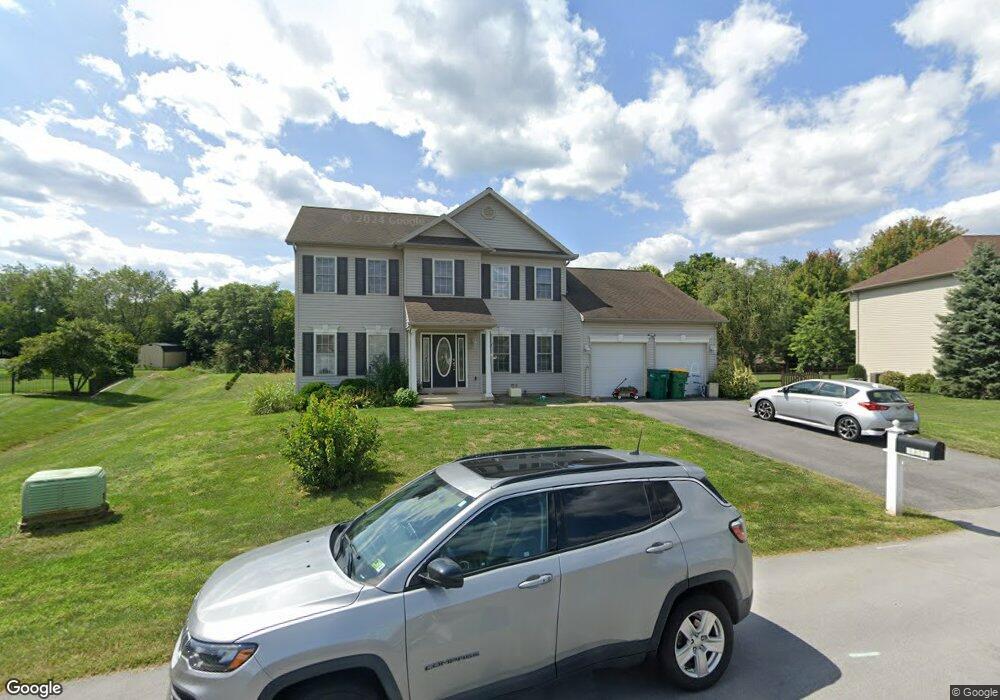
19537 Portsmouth Dr Hagerstown, MD 21742
Estimated Value: $434,000 - $541,000
--
Bed
4
Baths
2,462
Sq Ft
$206/Sq Ft
Est. Value
About This Home
This home is located at 19537 Portsmouth Dr, Hagerstown, MD 21742 and is currently estimated at $507,870, approximately $206 per square foot. 19537 Portsmouth Dr is a home located in Washington County with nearby schools including Paramount Elementary School, Otsego West Campus High School, and Northern Middle School.
Ownership History
Date
Name
Owned For
Owner Type
Purchase Details
Closed on
Oct 24, 2005
Sold by
Adkins Ryan G
Bought by
Tilton Khyam A
Current Estimated Value
Home Financials for this Owner
Home Financials are based on the most recent Mortgage that was taken out on this home.
Original Mortgage
$300,000
Outstanding Balance
$161,483
Interest Rate
5.85%
Mortgage Type
New Conventional
Estimated Equity
$346,387
Purchase Details
Closed on
Mar 17, 2005
Sold by
Adkins Gregory J
Bought by
Adkins Ryan A
Create a Home Valuation Report for This Property
The Home Valuation Report is an in-depth analysis detailing your home's value as well as a comparison with similar homes in the area
Home Values in the Area
Average Home Value in this Area
Purchase History
| Date | Buyer | Sale Price | Title Company |
|---|---|---|---|
| Tilton Khyam A | $431,200 | -- | |
| Adkins Ryan A | $44,000 | -- |
Source: Public Records
Mortgage History
| Date | Status | Borrower | Loan Amount |
|---|---|---|---|
| Open | Tilton Khyam A | $300,000 |
Source: Public Records
Tax History Compared to Growth
Tax History
| Year | Tax Paid | Tax Assessment Tax Assessment Total Assessment is a certain percentage of the fair market value that is determined by local assessors to be the total taxable value of land and additions on the property. | Land | Improvement |
|---|---|---|---|---|
| 2025 | $3,923 | $417,000 | $0 | $0 |
| 2024 | $3,923 | $378,900 | $77,700 | $301,200 |
| 2023 | $3,720 | $359,300 | $0 | $0 |
| 2022 | $3,517 | $339,700 | $0 | $0 |
| 2021 | $3,312 | $320,100 | $77,700 | $242,400 |
| 2020 | $3,312 | $313,833 | $0 | $0 |
| 2019 | $3,260 | $307,567 | $0 | $0 |
| 2018 | $3,194 | $301,300 | $77,700 | $223,600 |
| 2017 | $3,133 | $295,567 | $0 | $0 |
| 2016 | -- | $289,833 | $0 | $0 |
| 2015 | $3,530 | $284,100 | $0 | $0 |
| 2014 | $3,530 | $284,100 | $0 | $0 |
Source: Public Records
Map
Nearby Homes
- 13511 Cherry Tree Cir
- 19703 Portsmouth Dr
- 19702 Portsmouth Dr
- 13335 Keener Rd
- 13343 Keener Rd
- 13336 Keener Rd
- 13347 Keener Rd
- 13336 Marquise Dr
- 13366 Marquise Dr
- 19310 Smallwood Terrace
- 20111 Regent Cir
- 20122 Regent Cir
- 13407 Cherry Tree Cir
- 19446 Sapphire Dr
- 13116 Blue Ridge Rd
- TBD Turquoise Dr Unit V221
- 19554 Turquoise Dr Unit V219
- 19330 Longmeadow Rd
- 13110 Woodburn Dr
- 0 Diamond Pointe Dr Unit V120
- 19533 Portsmouth Dr
- 19541 Portsmouth Dr
- 19536 Portsmouth Dr
- 13303 Newport Ct
- 13302 Newport Ct
- 19531 Portsmouth Dr
- 19532 Portsmouth Dr
- 19527 Portsmouth Dr
- 0 Newport Ct Unit WA2161595
- 19605 Portsmouth Dr
- 13306 Newport Ct
- 19602 Portsmouth Dr
- 19528 Portsmouth Dr
- 13301 Keener Rd
- 19529 Portsmouth Dr
- 19523 Portsmouth Dr
- 19609 Portsmouth Dr
- 13305 Keener Rd
- 13310 Newport Ct
- 19608 Portsmouth Dr