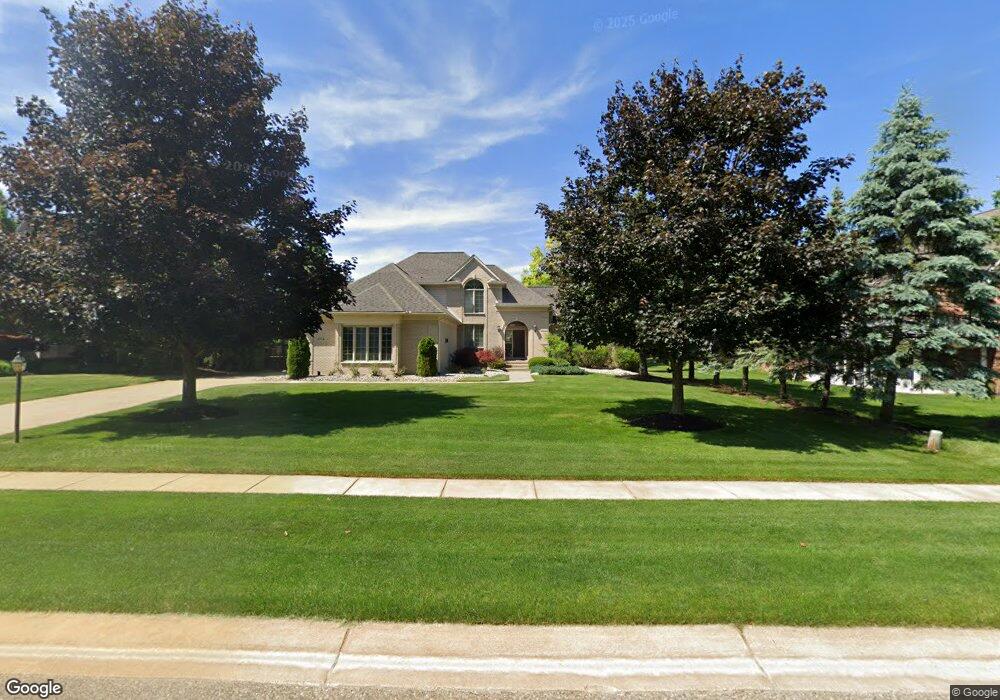
1954 Deer Path Trail Commerce Township, MI 48390
Estimated Value: $565,000 - $777,000
4
Beds
3
Baths
2,785
Sq Ft
$228/Sq Ft
Est. Value
About This Home
This home is located at 1954 Deer Path Trail, Commerce Township, MI 48390 and is currently estimated at $635,807, approximately $228 per square foot. 1954 Deer Path Trail is a home located in Oakland County with nearby schools including Loon Lake Elementary School, Sarah G. Banks Middle School, and Walled Lake Central High School.
Ownership History
Date
Name
Owned For
Owner Type
Purchase Details
Closed on
May 22, 2024
Sold by
Amcheslavsky Alan L
Bought by
Amcheslavsky Alan I and Alan And Anna Amcheslavsky Living Trust
Current Estimated Value
Purchase Details
Closed on
Oct 26, 2001
Sold by
A A Sons Const Co Inc
Bought by
Amcheslavsky Alan
Home Financials for this Owner
Home Financials are based on the most recent Mortgage that was taken out on this home.
Original Mortgage
$259,200
Interest Rate
6.72%
Purchase Details
Closed on
Apr 12, 2000
Sold by
Hidden Paradise
Bought by
A A Sons Const Co Inc
Create a Home Valuation Report for This Property
The Home Valuation Report is an in-depth analysis detailing your home's value as well as a comparison with similar homes in the area
Home Values in the Area
Average Home Value in this Area
Purchase History
| Date | Buyer | Sale Price | Title Company |
|---|---|---|---|
| Amcheslavsky Alan I | -- | None Listed On Document | |
| Amcheslavsky Alan | $78,850 | -- | |
| A A Sons Const Co Inc | $78,850 | -- |
Source: Public Records
Mortgage History
| Date | Status | Borrower | Loan Amount |
|---|---|---|---|
| Previous Owner | Amcheslavsky Alan | $259,200 |
Source: Public Records
Tax History Compared to Growth
Tax History
| Year | Tax Paid | Tax Assessment Tax Assessment Total Assessment is a certain percentage of the fair market value that is determined by local assessors to be the total taxable value of land and additions on the property. | Land | Improvement |
|---|---|---|---|---|
| 2024 | $3,702 | $253,130 | $0 | $0 |
| 2023 | $3,490 | $242,350 | $0 | $0 |
| 2022 | $5,315 | $220,160 | $0 | $0 |
| 2021 | $5,218 | $194,720 | $0 | $0 |
| 2020 | $3,449 | $193,970 | $0 | $0 |
| 2019 | $4,976 | $186,400 | $0 | $0 |
| 2018 | $4,948 | $183,220 | $0 | $0 |
| 2017 | $4,876 | $183,220 | $0 | $0 |
| 2016 | $4,814 | $176,020 | $0 | $0 |
| 2015 | -- | $165,860 | $0 | $0 |
| 2014 | -- | $153,130 | $0 | $0 |
| 2011 | -- | $148,140 | $0 | $0 |
Source: Public Records
Map
Nearby Homes
- 1987 Carsons Cove
- 2240 W Nalone
- 1561 Waters Edge Ct
- 2349 Fairbury
- 2000 Twin Sun Cir
- 1860 Twin Sun Cir
- 1431 Lee Wood Ridge Rd
- 1736 Pine Forest Dr
- 1599 Chanticlair Cir
- 1625 Mc Coy St
- 1500 Rustic Ln
- 1338 Andover Cir
- 1128 Andover Cir Unit 88
- 1104 Andover Cir Unit 92
- 1179 Andover Cir Unit 48
- 2751 Lakeridge
- 2785 Hillcrest
- 2015 Lamella
- 2370 Roselawn St
- 2436 Woodlawn St
- 1974 Deer Path Trail
- 1937 Carsons Cove
- 1967 Carsons Cove
- 1984 Deer Path Trail Unit 70
- 1994 Deer Path Trail Unit 69
- 1959 Tranquil Ct
- 1963 Deer Path Trail
- 1943 Deer Path Trail
- 1969 Tranquil Ct
- 1926 Carsons Cove Unit 46
- 1993 Deer Path Trail Unit 55
- 2006 Deer Path Trail
- 1979 Tranquil Ct
- 2109 Deer Path Trail
- 1986 Carsons Cove Unit 39
- 1989 Tranquil Ct
- 1906 Carsons Cove Unit 47
- 2016 Deer Path Trail
- 0 Tranquil Ct
- 00 Tranquil Ct
