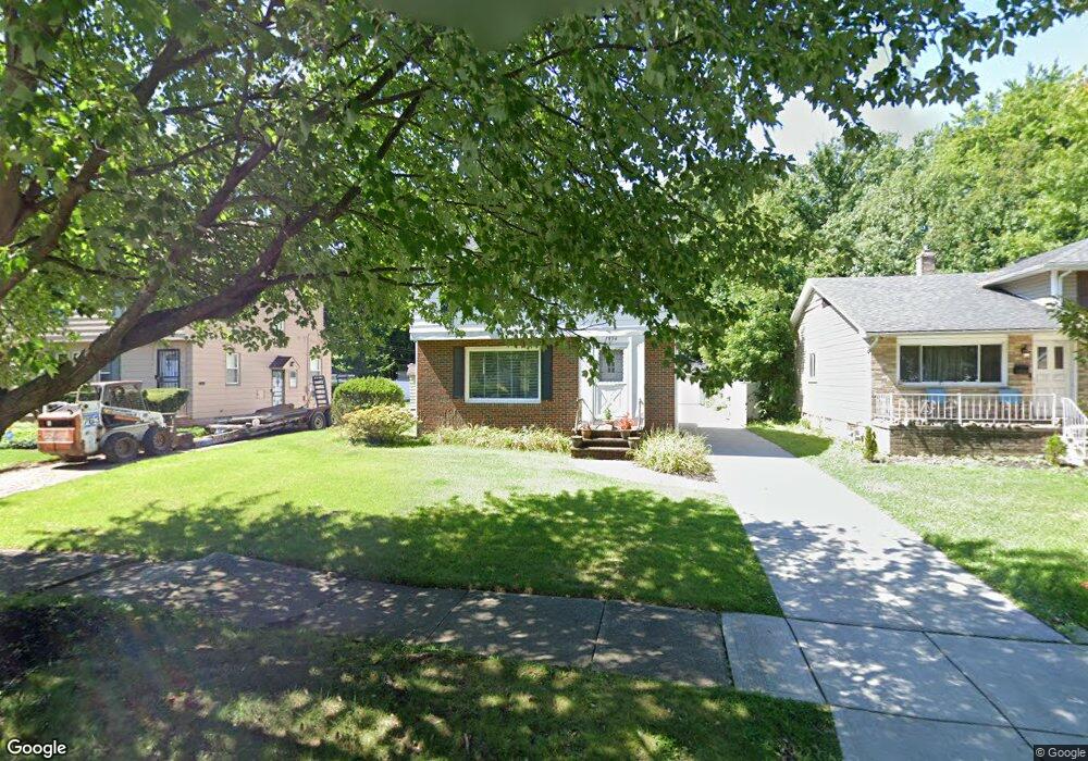
1954 Wyandotte Rd Euclid, OH 44117
Estimated Value: $161,000 - $174,000
3
Beds
1
Bath
1,278
Sq Ft
$131/Sq Ft
Est. Value
About This Home
This home is located at 1954 Wyandotte Rd, Euclid, OH 44117 and is currently estimated at $167,268, approximately $130 per square foot. 1954 Wyandotte Rd is a home located in Cuyahoga County with nearby schools including Bluestone Elementary School, Euclid Middle School, and Euclid High School.
Ownership History
Date
Name
Owned For
Owner Type
Purchase Details
Closed on
Jun 8, 1994
Sold by
Mancini Deborah M
Bought by
Johnson Lamont L and Johnson Latina R
Current Estimated Value
Home Financials for this Owner
Home Financials are based on the most recent Mortgage that was taken out on this home.
Original Mortgage
$86,700
Interest Rate
8.45%
Mortgage Type
VA
Purchase Details
Closed on
Jun 17, 1992
Sold by
Fuller Debroah M
Bought by
Fuller Deborah M
Purchase Details
Closed on
Jun 5, 1992
Sold by
Mathias Mathias F F and Mathias Cleo P
Bought by
Fuller Debroah M
Purchase Details
Closed on
Jan 1, 1975
Bought by
Mathias Mathias F and Mathias Cleo P
Create a Home Valuation Report for This Property
The Home Valuation Report is an in-depth analysis detailing your home's value as well as a comparison with similar homes in the area
Home Values in the Area
Average Home Value in this Area
Purchase History
| Date | Buyer | Sale Price | Title Company |
|---|---|---|---|
| Johnson Lamont L | $85,500 | -- | |
| Fuller Deborah M | -- | -- | |
| Fuller Debroah M | $74,500 | -- | |
| Mathias Mathias F | -- | -- |
Source: Public Records
Mortgage History
| Date | Status | Borrower | Loan Amount |
|---|---|---|---|
| Previous Owner | Johnson Lamont L | $86,700 |
Source: Public Records
Tax History Compared to Growth
Tax History
| Year | Tax Paid | Tax Assessment Tax Assessment Total Assessment is a certain percentage of the fair market value that is determined by local assessors to be the total taxable value of land and additions on the property. | Land | Improvement |
|---|---|---|---|---|
| 2024 | $3,115 | $45,045 | $9,450 | $35,595 |
| 2023 | $3,288 | $38,230 | $8,230 | $30,000 |
| 2022 | $3,213 | $38,220 | $8,230 | $30,000 |
| 2021 | $3,581 | $38,220 | $8,230 | $30,000 |
| 2020 | $3,397 | $32,970 | $7,110 | $25,870 |
| 2019 | $3,056 | $94,200 | $20,300 | $73,900 |
| 2018 | $3,085 | $32,970 | $7,110 | $25,870 |
| 2017 | $3,230 | $28,840 | $5,180 | $23,660 |
| 2016 | $3,144 | $27,970 | $5,180 | $22,790 |
| 2015 | $2,860 | $27,970 | $5,180 | $22,790 |
| 2014 | $2,860 | $27,970 | $5,180 | $22,790 |
Source: Public Records
Map
Nearby Homes
- 1780 Sagamore Dr
- 19151 Genesee Rd
- 1809 Pontiac Dr
- 18132 Weston Rd
- 1721 Grand Blvd
- 2110 Miami Rd
- 20130 Green Oak Dr
- 1860 Glenridge Rd
- 1477 E 195th St
- 24 Washington Square
- 1767 Avalon Rd
- 1707 Catalpa Rd
- 1724 Cliffview Rd
- 237 Greenbriar Ct Unit F237
- 1897 Torbenson Dr
- 1617 Catalpa Rd
- 1563 Clermont Rd
- 2545 Greenvale Rd
- 1738 Burgess Rd
- 2536 Greenvale Rd
- 1950 Wyandotte Rd
- 1960 Wyandotte Rd
- 1924 Wyandotte Rd
- 1964 Wyandotte Rd
- 1920 Wyandotte Rd
- 1970 Wyandotte Rd
- 19501 Delaware Dr
- 19551 Seminole Rd
- 19601 Seminole Rd
- 19571 Seminole Rd
- 19571 Delaware Dr
- 19631 Delaware Dr
- 19731 Seminole Rd
- 1955 Wyandotte Rd
- 1961 Wyandotte Rd
- 1951 Wyandotte Rd
- 1910 Wyandotte Rd
- 1974 Wyandotte Rd
- 1965 Wyandotte Rd
- 1925 Wyandotte Rd