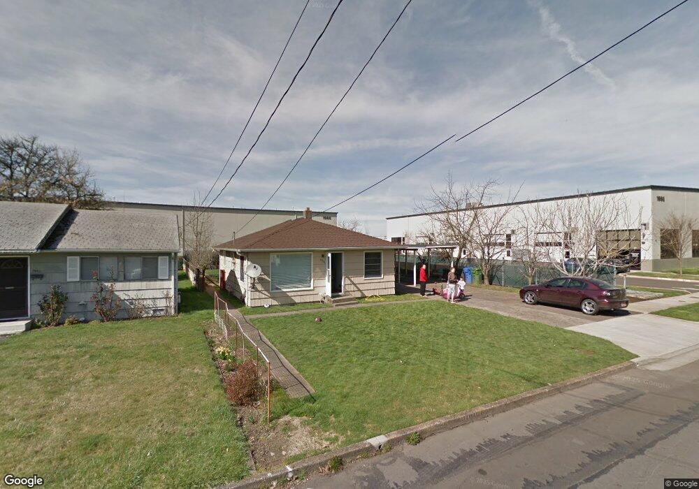
1955 16th St NE Salem, OR 97301
Northeast Neighbors NeighborhoodEstimated Value: $313,639 - $336,000
3
Beds
1
Bath
900
Sq Ft
$362/Sq Ft
Est. Value
About This Home
This home is located at 1955 16th St NE, Salem, OR 97301 and is currently estimated at $325,910, approximately $362 per square foot. 1955 16th St NE is a home located in Marion County with nearby schools including Englewood Elementary School, Parrish Middle School, and North Salem High School.
Ownership History
Date
Name
Owned For
Owner Type
Purchase Details
Closed on
Aug 7, 2008
Sold by
Keystone Industrial Park Llc
Bought by
Hancock Terry L and Hancock Teresa M
Current Estimated Value
Purchase Details
Closed on
Apr 27, 2004
Sold by
Hancock Terry L
Bought by
Hancock Terry L and Hancock Teresa M
Home Financials for this Owner
Home Financials are based on the most recent Mortgage that was taken out on this home.
Original Mortgage
$70,000
Interest Rate
5.35%
Mortgage Type
Stand Alone Refi Refinance Of Original Loan
Purchase Details
Closed on
Jun 12, 2003
Sold by
Hancock Terry L
Bought by
Hancock Terry L and Hancock Larry D
Create a Home Valuation Report for This Property
The Home Valuation Report is an in-depth analysis detailing your home's value as well as a comparison with similar homes in the area
Home Values in the Area
Average Home Value in this Area
Purchase History
| Date | Buyer | Sale Price | Title Company |
|---|---|---|---|
| Hancock Terry L | $138,000 | Amerititle | |
| Hancock Terry L | -- | Amerititle | |
| Hancock Terry L | -- | -- |
Source: Public Records
Mortgage History
| Date | Status | Borrower | Loan Amount |
|---|---|---|---|
| Previous Owner | Hancock Terry L | $70,000 |
Source: Public Records
Tax History Compared to Growth
Tax History
| Year | Tax Paid | Tax Assessment Tax Assessment Total Assessment is a certain percentage of the fair market value that is determined by local assessors to be the total taxable value of land and additions on the property. | Land | Improvement |
|---|---|---|---|---|
| 2024 | $2,494 | $127,020 | -- | -- |
| 2023 | $2,421 | $123,330 | $0 | $0 |
| 2022 | $2,282 | $119,740 | $0 | $0 |
| 2021 | $2,217 | $116,260 | $0 | $0 |
| 2020 | $2,219 | $112,880 | $0 | $0 |
| 2019 | $2,141 | $109,600 | $0 | $0 |
| 2018 | $2,114 | $0 | $0 | $0 |
| 2017 | $1,908 | $0 | $0 | $0 |
| 2016 | $1,818 | $0 | $0 | $0 |
| 2015 | $1,831 | $0 | $0 | $0 |
| 2014 | $1,772 | $0 | $0 | $0 |
Source: Public Records
Map
Nearby Homes
- 1665 Grant St NE
- 2090 17th St NE
- 1895 18th St NE
- 2050 18th St NE
- 1515 Norway St NE
- 1885 19th St NE
- 1555 Pearl St NE
- 1760 Norway St NE
- 1425 17th St NE
- 1760 Mccoy Ave NE
- 1925 24th St NE
- 1645 Mccoy Ave NE
- 1090 Norway St NE
- 1275 18th St NE
- 1145 Hood St NE
- 1329 Baker St NE
- 1180 16th St NE
- 925 Shipping St NE
- 1175 19th St NE
- 2040 Laurel Ave NE
- 1945 16th St NE
- 1615 Grant St NE
- 1985 16th St NE
- 1925 16th St NE
- 1625 Grant St NE
- 1610 Grant St NE
- 1630 Grant St NE
- 2040 16th St NE
- 1645 Grant St NE
- 1585 Roosevelt St NE
- 1595 Roosevelt St NE
- 1575 Roosevelt St NE
- 1565 Roosevelt St NE
- 2070 16th St NE
- 1640 Grant St NE
- 1615 Roosevelt St NE
- 1965 Taft St NE
- 1555 Roosevelt St NE
- 2080 16th St NE
- 1635 Roosevelt St NE