Estimated Value: $278,000 - $304,000
3
Beds
2
Baths
1,288
Sq Ft
$227/Sq Ft
Est. Value
About This Home
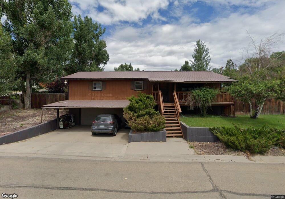
This home is located at 1955 A St, Craig, CO 81625 and is currently estimated at $292,984, approximately $227 per square foot. 1955 A St is a home located in Moffat County with nearby schools including Sunset Elementary School, Moffat County High School, and Calvary Baptist School.
Ownership History
Date
Name
Owned For
Owner Type
Purchase Details
Closed on
Mar 30, 2023
Sold by
Morgan Christopher F
Bought by
Bingham Jacob Cole
Current Estimated Value
Home Financials for this Owner
Home Financials are based on the most recent Mortgage that was taken out on this home.
Original Mortgage
$245,471
Outstanding Balance
$238,292
Interest Rate
6.32%
Mortgage Type
FHA
Estimated Equity
$54,692
Purchase Details
Closed on
Feb 25, 2021
Sold by
Morgan Dale F and Morgan Pauline A
Bought by
Morgan Christopher A and Morgan Blair Lori
Create a Home Valuation Report for This Property
The Home Valuation Report is an in-depth analysis detailing your home's value as well as a comparison with similar homes in the area
Home Values in the Area
Average Home Value in this Area
Purchase History
| Date | Buyer | Sale Price | Title Company |
|---|---|---|---|
| Bingham Jacob Cole | $250,000 | -- | |
| Morgan Christopher A | -- | None Available |
Source: Public Records
Mortgage History
| Date | Status | Borrower | Loan Amount |
|---|---|---|---|
| Open | Bingham Jacob Cole | $245,471 | |
| Closed | Bingham Jacob Cole | $9,818 |
Source: Public Records
Tax History Compared to Growth
Tax History
| Year | Tax Paid | Tax Assessment Tax Assessment Total Assessment is a certain percentage of the fair market value that is determined by local assessors to be the total taxable value of land and additions on the property. | Land | Improvement |
|---|---|---|---|---|
| 2024 | $946 | $10,900 | $0 | $0 |
| 2023 | $946 | $10,900 | $1,340 | $9,560 |
| 2022 | $990 | $11,750 | $1,860 | $9,890 |
| 2021 | $1,000 | $12,080 | $1,910 | $10,170 |
| 2020 | $467 | $11,420 | $1,910 | $9,510 |
| 2019 | $463 | $11,420 | $1,910 | $9,510 |
| 2018 | $441 | $10,830 | $1,920 | $8,910 |
| 2017 | $455 | $10,830 | $1,920 | $8,910 |
| 2016 | $475 | $11,710 | $2,130 | $9,580 |
| 2015 | $482 | $11,710 | $2,130 | $9,580 |
| 2013 | $482 | $11,710 | $2,130 | $9,580 |
Source: Public Records
Map
Nearby Homes
- 535 3rd Ave W
- TBD Villa W
- TBD Finley Ln
- Tbd Sunset Cir
- 2110 Alder Place
- 925 W 1st St
- TBD S Highway 13 1 32 Acres
- 908 Ridge Rd
- 2773 W 1st St
- TBD W Victory Way 6 66 Acres
- 1060 Alta Vista Dr
- 198 Cedar Ct
- 1290 Alta Vista Dr
- 951 Alta Vista Dr
- 870 Green St
- 1123 Sequoia Ave
- 676 Overlook Dr
- TBD Crescent Dr & Riford Rd
- 1164 Aspen Ave
- 1155 Taylor St
- 525 6th Ave W
- 1903 Frontier Dr
- 2015 A St
- 590 6th Ave W Unit West
- 530 5th Ave W
- 2017 W Victory Way
- 2005 W Victory Way Unit 2023
- 2005 W Victory Way
- 551 6th Ave W
- 1937 W Victory Way
- 544 6th Ave W
- 544 6th Ave W Unit West
- 572 5th Ave W
- 1960 B St
- 590 5th Ave W Unit W
- 2040 B St
- 2075 A St
- 1875 W Victory Way
- 545 7th Ave W
- 545 7th Ave W Unit 1 & 2