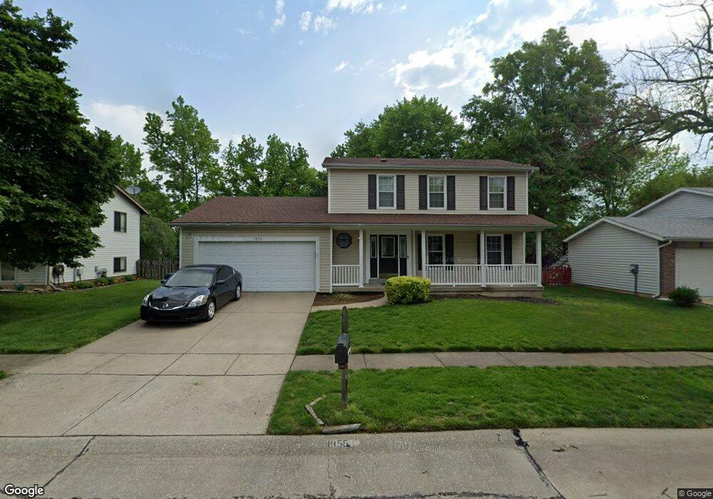
1955 Acorn Trail Dr Florissant, MO 63031
Estimated Value: $253,000 - $346,000
3
Beds
4
Baths
1,822
Sq Ft
$163/Sq Ft
Est. Value
About This Home
This home is located at 1955 Acorn Trail Dr, Florissant, MO 63031 and is currently estimated at $296,475, approximately $162 per square foot. 1955 Acorn Trail Dr is a home located in St. Louis County with nearby schools including Russell Elementary School, West Middle School, and Hazelwood West High School.
Ownership History
Date
Name
Owned For
Owner Type
Purchase Details
Closed on
Jun 19, 2021
Sold by
Brison Ella E and Pitts Ella E
Bought by
Pitts Ella E
Current Estimated Value
Home Financials for this Owner
Home Financials are based on the most recent Mortgage that was taken out on this home.
Original Mortgage
$150,000
Outstanding Balance
$124,962
Interest Rate
2.9%
Mortgage Type
New Conventional
Estimated Equity
$171,513
Purchase Details
Closed on
May 31, 2012
Sold by
Rice Gaylord D and Rice Janet F
Bought by
Brison Ella E
Home Financials for this Owner
Home Financials are based on the most recent Mortgage that was taken out on this home.
Original Mortgage
$4,639
Interest Rate
3.86%
Mortgage Type
Stand Alone Second
Create a Home Valuation Report for This Property
The Home Valuation Report is an in-depth analysis detailing your home's value as well as a comparison with similar homes in the area
Home Values in the Area
Average Home Value in this Area
Purchase History
| Date | Buyer | Sale Price | Title Company |
|---|---|---|---|
| Pitts Ella E | -- | Servicelink East Escrow | |
| Brison Ella E | $157,500 | Investors Title Co Clayton |
Source: Public Records
Mortgage History
| Date | Status | Borrower | Loan Amount |
|---|---|---|---|
| Open | Pitts Ella E | $150,000 | |
| Closed | Brison Ella E | $4,639 | |
| Closed | Brison Ella E | $154,646 |
Source: Public Records
Tax History Compared to Growth
Tax History
| Year | Tax Paid | Tax Assessment Tax Assessment Total Assessment is a certain percentage of the fair market value that is determined by local assessors to be the total taxable value of land and additions on the property. | Land | Improvement |
|---|---|---|---|---|
| 2025 | $3,980 | $52,840 | $8,170 | $44,670 |
| 2024 | $3,980 | $48,930 | $3,270 | $45,660 |
| 2023 | $4,028 | $48,930 | $3,270 | $45,660 |
| 2022 | $3,463 | $37,560 | $5,720 | $31,840 |
| 2021 | $3,405 | $37,560 | $5,720 | $31,840 |
| 2020 | $3,192 | $32,940 | $4,900 | $28,040 |
| 2019 | $3,118 | $32,940 | $4,900 | $28,040 |
| 2018 | $2,877 | $28,160 | $4,900 | $23,260 |
| 2017 | $2,864 | $28,160 | $4,900 | $23,260 |
| 2016 | $2,846 | $27,730 | $4,260 | $23,470 |
| 2015 | $2,780 | $27,730 | $4,260 | $23,470 |
| 2014 | $2,513 | $24,950 | $5,020 | $19,930 |
Source: Public Records
Map
Nearby Homes
- 1978 Acorn Trail Dr
- 1815 Flordawn Dr
- 1085 Campion Ln
- 1565 Yaqui Dr
- 1495 Yaqui Dr
- 1160 Kostka Ln
- 1060 Florland Dr
- 10 Garnier Ct
- 1790 Tahoe Dr
- 1065 Keeven Ln
- 912 Shamrock Dr
- 1035 Rosary Tree Ct
- 425 Gerald Ave
- 1090 Howdershell Rd
- 7565 English Coach Ln
- 154 Riverwood Park Dr
- 541 White Birch Way
- 7525 English Coach Ln
- 1625 Charbonier Rd
- 400 Raymond Dr
- 1949 Acorn Trail Dr
- 1961 Acorn Trail Dr
- 1964 Tealwood Cove Dr
- 1954 Tealwood Cove Dr
- 1948 Tealwood Cove Dr
- 1954 Acorn Trail Dr
- 1960 Acorn Trail Dr
- 1948 Acorn Trail Dr
- 1944 Tealwood Cove Dr
- 1937 Acorn Trail Dr
- 1966 Acorn Trail Dr
- 1942 Acorn Trail Dr
- 1973 Acorn Trail Dr
- 1973 Tealwood Cove Dr
- 1942 Tealwood Cove Dr
- 1969 Tealwood Cove Dr
- 1972 Acorn Trail Dr
- 1961 Tealwood Cove Dr
- 1931 Acorn Trail Dr
- 1936 Acorn Trail Dr