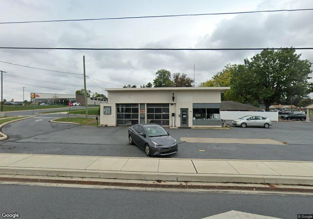
1955 Columbia Ave Lancaster, PA 17603
Wheatland NeighborhoodEstimated Value: $582,836
--
Bed
--
Bath
1,232
Sq Ft
$473/Sq Ft
Est. Value
About This Home
This home is located at 1955 Columbia Ave, Lancaster, PA 17603 and is currently estimated at $582,836, approximately $473 per square foot. 1955 Columbia Ave is a home located in Lancaster County with nearby schools including Rohrerstown Elementary School, Centerville Middle School, and Hempfield Senior High School.
Ownership History
Date
Name
Owned For
Owner Type
Purchase Details
Closed on
Sep 9, 2019
Sold by
Lidl Us Operations Llc
Bought by
Commonwealth Of Pa Dept Of Trans
Current Estimated Value
Purchase Details
Closed on
May 28, 2019
Sold by
Ashley Charmayne M and Charmayne M Ashley Trust
Bought by
Lidl Us Operations Llc
Purchase Details
Closed on
Apr 30, 2015
Sold by
Charmayne M Ashley Trust
Bought by
Steves Automotive Technology Llc
Home Financials for this Owner
Home Financials are based on the most recent Mortgage that was taken out on this home.
Original Mortgage
$388,000
Interest Rate
5.55%
Mortgage Type
New Conventional
Purchase Details
Closed on
Nov 29, 2007
Sold by
Ashley Charmayne M
Bought by
Ashley Charmayne M and Herr Rosetta K
Create a Home Valuation Report for This Property
The Home Valuation Report is an in-depth analysis detailing your home's value as well as a comparison with similar homes in the area
Home Values in the Area
Average Home Value in this Area
Purchase History
| Date | Buyer | Sale Price | Title Company |
|---|---|---|---|
| Commonwealth Of Pa Dept Of Trans | -- | None Available | |
| Lidl Us Operations Llc | -- | None Available | |
| Steves Automotive Technology Llc | $485,000 | -- | |
| Ashley Charmayne M | -- | None Available | |
| Ashley Charmayne M | -- | None Available | |
| Ashley Charmayne M | -- | None Available |
Source: Public Records
Mortgage History
| Date | Status | Borrower | Loan Amount |
|---|---|---|---|
| Previous Owner | Steves Automotive Technology Llc | $388,000 |
Source: Public Records
Tax History Compared to Growth
Tax History
| Year | Tax Paid | Tax Assessment Tax Assessment Total Assessment is a certain percentage of the fair market value that is determined by local assessors to be the total taxable value of land and additions on the property. | Land | Improvement |
|---|---|---|---|---|
| 2025 | $4,990 | $230,900 | $167,400 | $63,500 |
| 2024 | $4,990 | $230,900 | $167,400 | $63,500 |
| 2023 | $4,890 | $230,900 | $167,400 | $63,500 |
| 2022 | $4,755 | $230,900 | $167,400 | $63,500 |
| 2021 | $4,680 | $230,900 | $167,400 | $63,500 |
| 2020 | $4,680 | $230,900 | $167,400 | $63,500 |
| 2019 | $4,601 | $230,900 | $167,400 | $63,500 |
| 2018 | $905 | $230,900 | $167,400 | $63,500 |
| 2017 | $4,024 | $159,800 | $104,900 | $54,900 |
| 2016 | $4,024 | $159,800 | $104,900 | $54,900 |
| 2015 | $808 | $159,800 | $104,900 | $54,900 |
| 2014 | $3,110 | $159,800 | $104,900 | $54,900 |
Source: Public Records
Map
Nearby Homes
- 1922 Columbia Ave
- 115 Redwood Dr
- 2008 Manor Ridge Dr
- 1930 Manor Ridge Dr
- 1959 Hemlock Rd
- 1841 Wheatland Ave
- 151 Tulane Terrace
- 1761 Wilson Ave
- 2249 Manor Ridge Dr
- 322 Banyan Circle Dr
- 112 Harvard Ave
- 105 Silverwind Ct S
- 108 Wildbriar Ct S
- 204 Greenbriar Cir
- 494 Northlawn Dr
- 109 Falcon Ct
- 103 Jemfield Ct
- 110 Clearfield Ct E
- 215 Fawn Meadow Crossing
- 123 Westbrook Dr
- 1960 Columbia Ave
- 10 Eisenhower Blvd
- 1942 Columbia Ave
- 2001 Columbia Ave
- 2015 Columbia Ave
- 2015-2017 Columbia Ave
- 1955 Ursinus Ave
- 1963 Ursinus Ave
- 1927 Columbia Ave
- 2000 Columbia Ave
- 2000 Columbia Ave Unit BUILDING 2
- 1947 Ursinus Ave
- 102 Eisenhower Blvd
- 104 Eisenhower Blvd
- 51 Redwood Dr
- 1948 Ursinus Ave
- 1917 Wilson Ave
- 1942 Ursinus Ave
- 106 Eisenhower Blvd
- 2008 Ursinus Ave