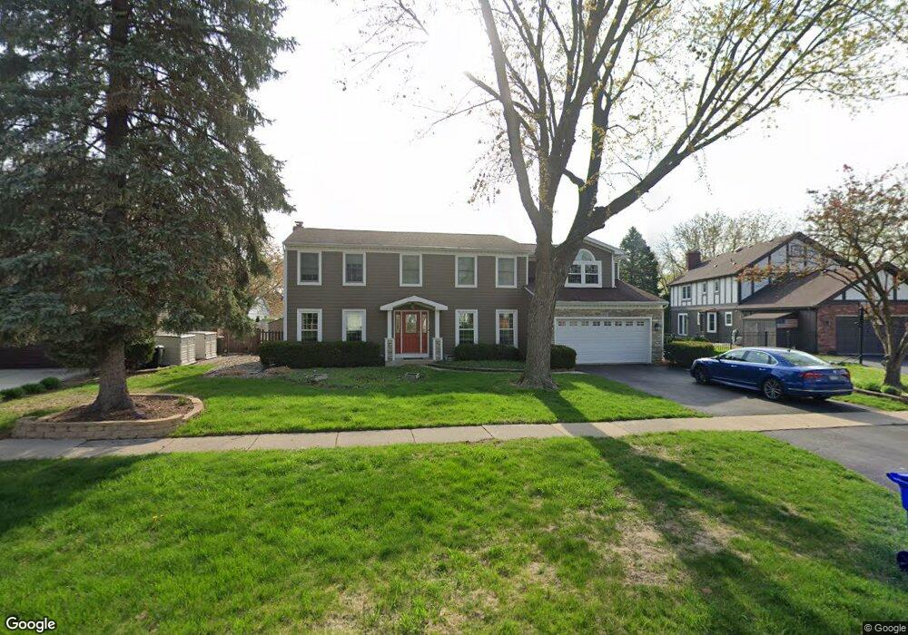
1955 Cromwell Dr Wheaton, IL 60189
Stonehedge NeighborhoodEstimated Value: $694,000 - $766,000
4
Beds
3
Baths
2,767
Sq Ft
$262/Sq Ft
Est. Value
About This Home
This home is located at 1955 Cromwell Dr, Wheaton, IL 60189 and is currently estimated at $725,660, approximately $262 per square foot. 1955 Cromwell Dr is a home located in DuPage County with nearby schools including Whittier Elementary School, Edison Middle School, and Wheaton Warrenville South High School.
Ownership History
Date
Name
Owned For
Owner Type
Purchase Details
Closed on
Mar 15, 2005
Sold by
Rowitz Jeffrey L and Rowitz Mary
Bought by
Weber Todd M and Weber Kelly A
Current Estimated Value
Home Financials for this Owner
Home Financials are based on the most recent Mortgage that was taken out on this home.
Original Mortgage
$265,000
Outstanding Balance
$134,882
Interest Rate
5.67%
Mortgage Type
Purchase Money Mortgage
Estimated Equity
$590,778
Create a Home Valuation Report for This Property
The Home Valuation Report is an in-depth analysis detailing your home's value as well as a comparison with similar homes in the area
Home Values in the Area
Average Home Value in this Area
Purchase History
| Date | Buyer | Sale Price | Title Company |
|---|---|---|---|
| Weber Todd M | $461,000 | Ctic |
Source: Public Records
Mortgage History
| Date | Status | Borrower | Loan Amount |
|---|---|---|---|
| Open | Weber Todd M | $265,000 | |
| Closed | Weber Todd M | $116,000 |
Source: Public Records
Tax History Compared to Growth
Tax History
| Year | Tax Paid | Tax Assessment Tax Assessment Total Assessment is a certain percentage of the fair market value that is determined by local assessors to be the total taxable value of land and additions on the property. | Land | Improvement |
|---|---|---|---|---|
| 2024 | $12,416 | $200,647 | $51,778 | $148,869 |
| 2023 | $11,941 | $184,690 | $47,660 | $137,030 |
| 2022 | $11,673 | $174,550 | $45,040 | $129,510 |
| 2021 | $11,636 | $170,410 | $43,970 | $126,440 |
| 2020 | $11,601 | $168,820 | $43,560 | $125,260 |
| 2019 | $11,337 | $164,360 | $42,410 | $121,950 |
| 2018 | $12,088 | $172,900 | $39,960 | $132,940 |
| 2017 | $11,914 | $166,530 | $38,490 | $128,040 |
| 2016 | $11,762 | $159,880 | $36,950 | $122,930 |
| 2015 | $10,214 | $134,160 | $35,250 | $98,910 |
| 2014 | $9,621 | $124,660 | $34,740 | $89,920 |
| 2013 | $9,373 | $125,030 | $34,840 | $90,190 |
Source: Public Records
Map
Nearby Homes
- 141 Loretto Ct
- 44 Marywood Trail
- 28 Winners Cup Cir
- 212 Hamilton Ln
- 1771 Lucky Debonair Ct
- 25W451 Plamondon Rd
- 1602 Hunters Glen Ct
- 187 E Thompson Dr
- 1645 Burning Trail Ct
- 1S550 Hawthorne Ln
- 821 Plamondon Rd
- 1601 W Wiesbrook Rd
- 26W281 Menomini Dr
- 1028 Lodalia Ct
- 2412 W Lucent Ln
- 1219 Golf Ln
- 1547 Huntleigh Dr
- 1813 Knapp Ct
- 1344 S Main St
- 1473 Creekside Dr
- 1949 Cromwell Dr
- 2005 Somerset Ln
- 1950 Gladstone Dr
- 1943 Cromwell Dr
- 1944 Gladstone Dr
- 1956 Gladstone Dr
- 1956 Cromwell Dr
- 1938 Gladstone Dr
- 2003 Somerset Ln
- 1937 Cromwell Dr
- 1944 Cromwell Dr
- 2004 Gladstone Dr
- 1938 Cromwell Dr
- 1932 Gladstone Dr
- 1931 Cromwell Dr
- 1949 Gladstone Dr
- 2007 Cromwell Dr
- 1955 Gladstone Dr
- 1943 Gladstone Dr
- 1955 Buckingham Dr