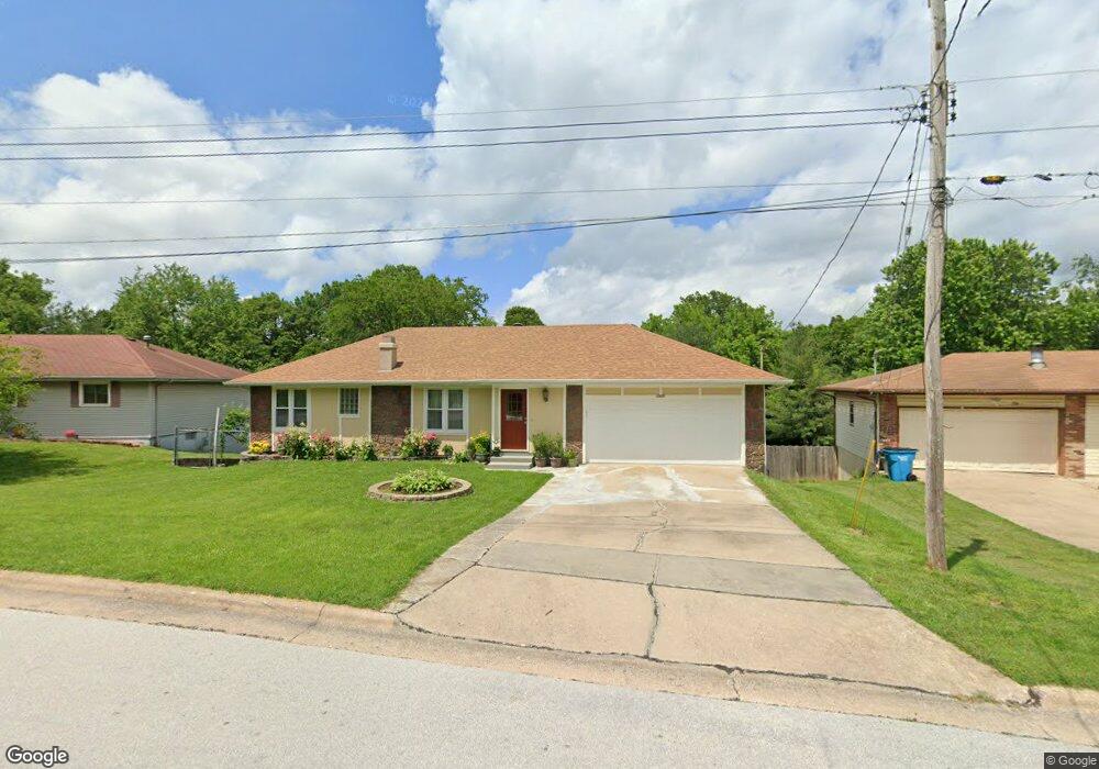
1955 E Snider St Springfield, MO 65803
Estimated Value: $228,000 - $302,000
5
Beds
3
Baths
2,508
Sq Ft
$107/Sq Ft
Est. Value
About This Home
This home is located at 1955 E Snider St, Springfield, MO 65803 and is currently estimated at $267,218, approximately $106 per square foot. 1955 E Snider St is a home located in Greene County with nearby schools including Fremont Elementary School, Pleasant View K-8 School, and Hillcrest High School.
Ownership History
Date
Name
Owned For
Owner Type
Purchase Details
Closed on
Dec 21, 2023
Sold by
Nemeti Sandor and Nemeti Susana
Bought by
Sandor And Susana Nemeti Map Trust and Nemeti
Current Estimated Value
Purchase Details
Closed on
May 29, 2007
Sold by
G & H Properties Of Springfield Inc and Hestand Joseph M
Bought by
Cdns1 Inc
Home Financials for this Owner
Home Financials are based on the most recent Mortgage that was taken out on this home.
Original Mortgage
$110,562
Interest Rate
8.75%
Mortgage Type
Construction
Create a Home Valuation Report for This Property
The Home Valuation Report is an in-depth analysis detailing your home's value as well as a comparison with similar homes in the area
Purchase History
| Date | Buyer | Sale Price | Title Company |
|---|---|---|---|
| Sandor And Susana Nemeti Map Trust | -- | None Listed On Document | |
| Cdns1 Inc | -- | None Available |
Source: Public Records
Mortgage History
| Date | Status | Borrower | Loan Amount |
|---|---|---|---|
| Previous Owner | Cdns1 Inc | $110,562 |
Source: Public Records
Tax History
| Year | Tax Paid | Tax Assessment Tax Assessment Total Assessment is a certain percentage of the fair market value that is determined by local assessors to be the total taxable value of land and additions on the property. | Land | Improvement |
|---|---|---|---|---|
| 2025 | $1,474 | $31,990 | $8,320 | $23,670 |
| 2024 | $1,474 | $27,470 | $4,180 | $23,290 |
| 2023 | $1,465 | $27,470 | $4,180 | $23,290 |
| 2022 | $1,425 | $26,090 | $4,180 | $21,910 |
| 2021 | $1,425 | $26,090 | $4,180 | $21,910 |
| 2020 | $1,357 | $23,770 | $4,180 | $19,590 |
| 2019 | $1,319 | $23,770 | $4,180 | $19,590 |
| 2018 | $1,094 | $19,720 | $3,230 | $16,490 |
| 2017 | $1,083 | $19,720 | $3,230 | $16,490 |
| 2016 | $1,081 | $19,720 | $3,230 | $16,490 |
| 2015 | $1,071 | $19,720 | $3,230 | $16,490 |
| 2014 | $1,079 | $19,720 | $3,230 | $16,490 |
Source: Public Records
Map
Nearby Homes
- 1923 E Valley Water Mill Rd
- 3424 N Darwin Ave
- 4260 N State Highway H
- 3839 N Stewart Ave
- 1502 E McClernon St
- 1414 E Smith St
- 3975 N Stewart Ave
- 1339 E McClernon St
- 3749 N Pickwick Ave
- 3753 N Pickwick Ave
- 1255 E Bonaire Dr
- 2393 E Valley Water Mill Rd
- 1349 E Stoneridge St
- 3107 N Neergard Ave
- 3983 N Courtney Cir
- 1406 E Nora St
- 1113 E Smith St
- 1508 E Livingston St
- 1103 E Smith St
- 1107 E Smith St
- 1961 E Snider St
- 1945 E Snider St
- 1941 E Snider St
- 3355 N Wildan Ct
- 1950 E Snider St
- 1946 E Snider St
- 1958 E Snider St
- 3338 N Greenview Ave
- 3363 N Wildan Ct
- 1921 E Snider St
- 1968 E Snider St
- 3405 N Greenview Ave
- 3332 N Greenview Ave
- 3347 N Greenview Ave
- 3340 N Wildan Ave
- 3335 N Wildan Ave
- 1939 E Greenview St
- 1915 E Snider St
- 1945 E Greenview St
- 3356 N Wildan Ct
Your Personal Tour Guide
Ask me questions while you tour the home.