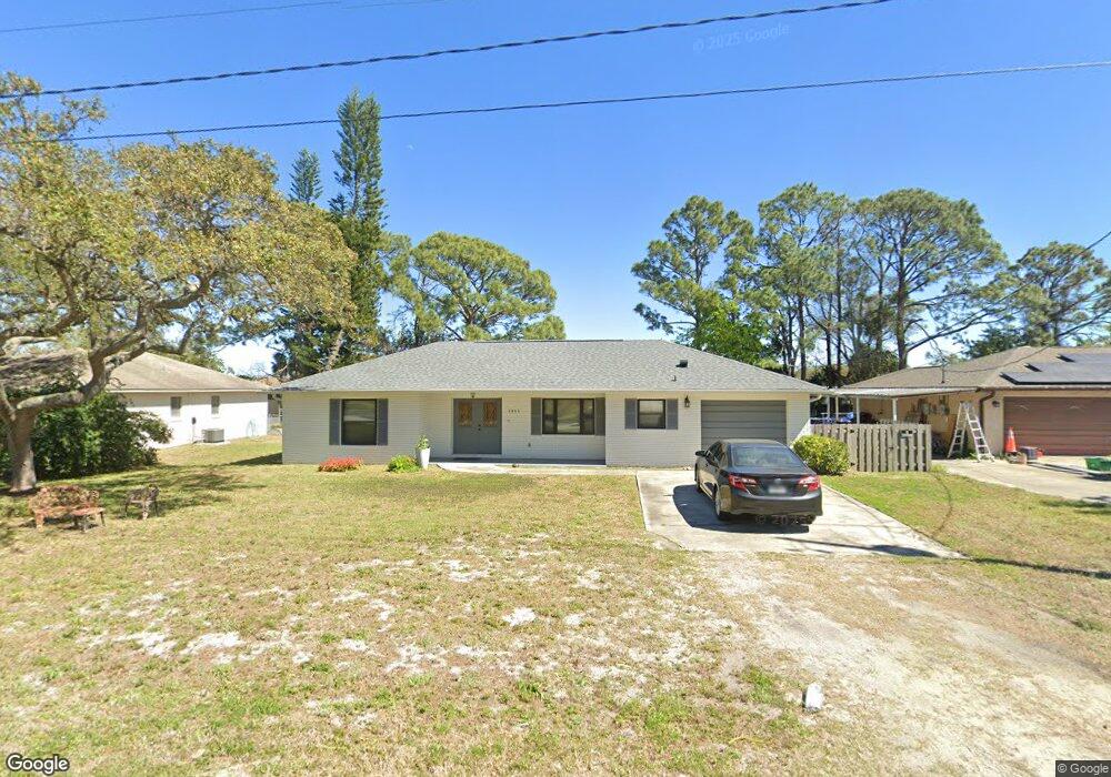
1955 Forest Ave Daytona Beach, FL 32119
Estimated Value: $267,000 - $319,000
3
Beds
2
Baths
1,312
Sq Ft
$222/Sq Ft
Est. Value
About This Home
This home is located at 1955 Forest Ave, Daytona Beach, FL 32119 and is currently estimated at $291,436, approximately $222 per square foot. 1955 Forest Ave is a home located in Volusia County with nearby schools including South Daytona Elementary School, Atlantic High School, and Campbell Middle School.
Ownership History
Date
Name
Owned For
Owner Type
Purchase Details
Closed on
Aug 31, 1999
Sold by
Labar William J and Labar William C
Bought by
Knight Diane L
Current Estimated Value
Home Financials for this Owner
Home Financials are based on the most recent Mortgage that was taken out on this home.
Original Mortgage
$55,500
Outstanding Balance
$16,340
Interest Rate
7.73%
Mortgage Type
Purchase Money Mortgage
Estimated Equity
$275,096
Purchase Details
Closed on
Apr 15, 1990
Bought by
Knight Diane L
Purchase Details
Closed on
Jun 15, 1988
Bought by
Knight Diane L
Purchase Details
Closed on
May 15, 1986
Bought by
Knight Diane L
Purchase Details
Closed on
Feb 15, 1986
Bought by
Knight Diane L
Create a Home Valuation Report for This Property
The Home Valuation Report is an in-depth analysis detailing your home's value as well as a comparison with similar homes in the area
Home Values in the Area
Average Home Value in this Area
Purchase History
| Date | Buyer | Sale Price | Title Company |
|---|---|---|---|
| Knight Diane L | -- | -- | |
| Knight Diane L | -- | -- | |
| Knight Diane L | $75,500 | -- | |
| Knight Diane L | $72,000 | -- | |
| Knight Diane L | $100 | -- | |
| Knight Diane L | $60,000 | -- | |
| Knight Diane L | $55,000 | -- |
Source: Public Records
Mortgage History
| Date | Status | Borrower | Loan Amount |
|---|---|---|---|
| Open | Knight Diane L | $55,500 | |
| Closed | Knight Diane L | $55,500 |
Source: Public Records
Tax History Compared to Growth
Tax History
| Year | Tax Paid | Tax Assessment Tax Assessment Total Assessment is a certain percentage of the fair market value that is determined by local assessors to be the total taxable value of land and additions on the property. | Land | Improvement |
|---|---|---|---|---|
| 2025 | $1,519 | $119,210 | -- | -- |
| 2024 | $1,519 | $115,851 | -- | -- |
| 2023 | $1,519 | $112,477 | $0 | $0 |
| 2022 | $1,543 | $109,201 | $0 | $0 |
| 2021 | $1,563 | $106,020 | $0 | $0 |
| 2020 | $1,530 | $104,556 | $0 | $0 |
| 2019 | $1,506 | $102,205 | $0 | $0 |
| 2018 | $1,472 | $100,299 | $0 | $0 |
| 2017 | $1,441 | $98,236 | $0 | $0 |
| 2016 | $1,420 | $96,215 | $0 | $0 |
| 2015 | $1,449 | $95,546 | $0 | $0 |
| 2014 | $1,425 | $94,788 | $0 | $0 |
Source: Public Records
Map
Nearby Homes
- 1957 Deloy Dr
- 1959 Forest Ave
- 1293 Williamsburg Place
- 1291 Mayflower Dr
- 1178 Lavonne Dr
- 1283 Jamestown Dr
- 1279 Mayflower Dr
- 1301 Bunker Hill Dr
- 1275 Jamestown Dr
- 1283 Monticello Dr
- 1282 Bunker Hill Dr
- 1275 Monticello Dr
- 1283 Constitution Dr
- 1255 Williamsburg Place
- 1667 E Shangri la Dr
- 1290 Constitution Dr
- 1268 Plantation Place
- 1278 Constitution Dr
- 1260 Valley Forge Dr
- 1274 Constitution Dr
- 1957 Forest Ave
- 1953 Forest Ave
- 1951 Forest Ave
- 1297 Williamsburg Place
- 1956 Forest Ave
- 1961 Forest Ave
- 1948 Forest Ave
- 1960 Forest Ave
- 1949 Forest Ave
- 1170 Lavonne Dr
- 1293 Jamestown Dr
- 1962 Forest Ave
- 1955 Deloy Dr
- 1172 Lavonne Dr
- 1293 Valley Forge Dr
- 1947 Forest Ave
- 1959 Deloy Dr
- 1289 Jamestown Dr
- 1964 Forest Ave
- 1299 Mayflower Dr