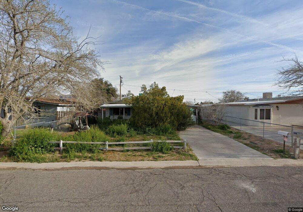
1955 Hope Ave Kingman, AZ 86401
Estimated Value: $141,623 - $209,000
--
Bed
2
Baths
1,005
Sq Ft
$172/Sq Ft
Est. Value
About This Home
This home is located at 1955 Hope Ave, Kingman, AZ 86401 and is currently estimated at $172,656, approximately $171 per square foot. 1955 Hope Ave is a home located in Mohave County with nearby schools including Manzanita Elementary School, Kingman Middle School, and Kingman High School.
Ownership History
Date
Name
Owned For
Owner Type
Purchase Details
Closed on
Sep 26, 2013
Sold by
Jacobi Jarrod S
Bought by
Jacobi Jarrod S and Jacobi Sylvia S
Current Estimated Value
Purchase Details
Closed on
Jun 27, 2002
Sold by
Cody Rodney F and Cody Deeanna P
Bought by
Jacobi Jarrod S
Home Financials for this Owner
Home Financials are based on the most recent Mortgage that was taken out on this home.
Original Mortgage
$52,000
Outstanding Balance
$22,028
Interest Rate
6.7%
Mortgage Type
Purchase Money Mortgage
Estimated Equity
$150,628
Create a Home Valuation Report for This Property
The Home Valuation Report is an in-depth analysis detailing your home's value as well as a comparison with similar homes in the area
Home Values in the Area
Average Home Value in this Area
Purchase History
| Date | Buyer | Sale Price | Title Company |
|---|---|---|---|
| Jacobi Jarrod S | -- | None Available | |
| Jacobi Jarrod S | $65,000 | First American Title |
Source: Public Records
Mortgage History
| Date | Status | Borrower | Loan Amount |
|---|---|---|---|
| Open | Jacobi Jarrod S | $52,000 |
Source: Public Records
Tax History Compared to Growth
Tax History
| Year | Tax Paid | Tax Assessment Tax Assessment Total Assessment is a certain percentage of the fair market value that is determined by local assessors to be the total taxable value of land and additions on the property. | Land | Improvement |
|---|---|---|---|---|
| 2026 | -- | -- | -- | -- |
| 2025 | $741 | $16,470 | $0 | $0 |
| 2024 | $741 | $20,890 | $0 | $0 |
| 2023 | $741 | $13,599 | $0 | $0 |
| 2022 | $688 | $11,890 | $0 | $0 |
| 2021 | $712 | $10,312 | $0 | $0 |
| 2019 | $650 | $8,000 | $0 | $0 |
| 2018 | $672 | $7,861 | $0 | $0 |
| 2017 | $618 | $9,198 | $0 | $0 |
| 2016 | $596 | $8,018 | $0 | $0 |
| 2015 | $608 | $7,654 | $0 | $0 |
Source: Public Records
Map
Nearby Homes
- 1951 Motor Ave
- 1926 Hope Ave
- 1916 Pacific Ave
- 1953 Club Ave
- 1939 Chicago Ave
- 1827 Davis Ave
- 2041 Chicago Ave
- 1820 Motor Ave
- 1816 Motor Ave
- 1946 Gates Ave
- 1834 Club Ave
- 2130 Club Ave
- 1737 Atlantic Ave
- 2209 Los Angeles St
- 1818 Golden Gate Ave
- 2221 Golden Gate Ave
- 1736 Golden Gate Ave
- 0000 Lucille Ave
- 1829 Florence Ave
- 1930 Lucille Ave
- 1951 Hope Ave
- 1961 Hope Ave
- 1965 Hope Ave
- 1947 Hope Ave
- 1958 Airfield Ave
- 1954 Airfield Ave
- 1964 Airfield Ave
- 1958 Hope Ave
- 1943 Hope Ave
- 1969 Hope Ave
- 1968 Airfield Ave
- 1950 Hope Ave
- 1966 Hope Ave
- 1946 Airfield Ave
- 1972 Airfield Ave
- 1946 Hope Ave
- 1939 Hope Ave
- 1973 Hope Ave
- 1970 Hope Ave
- 1942 Hope Ave