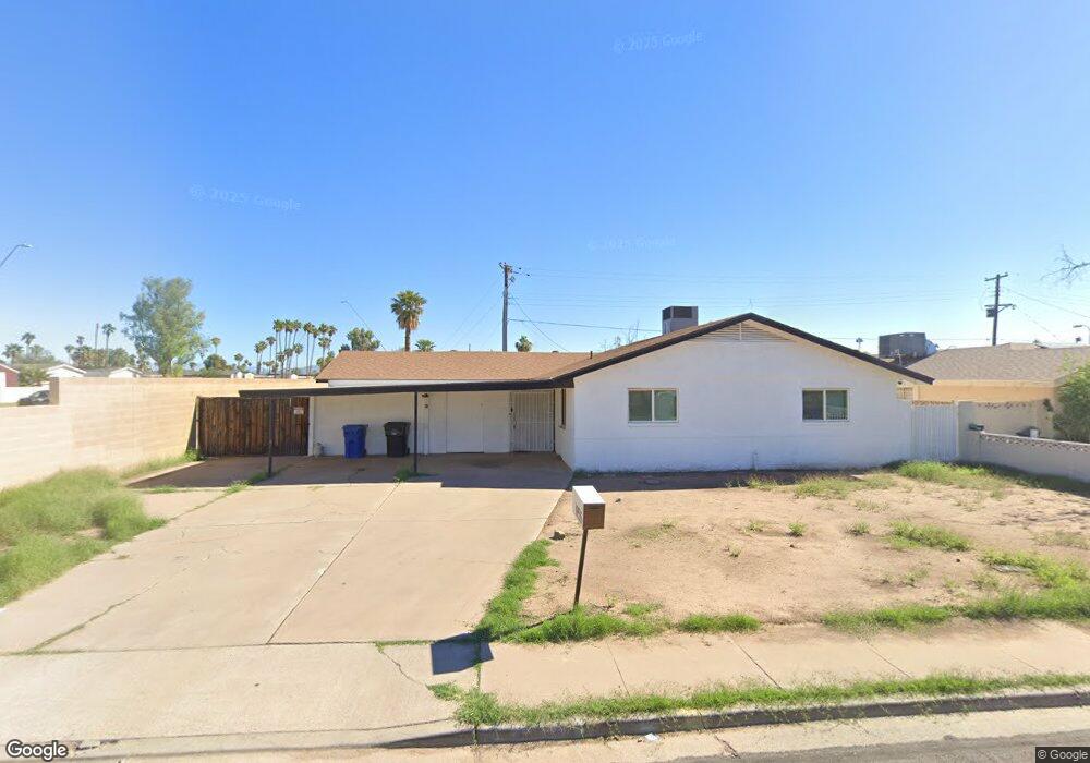
1955 N Robson Mesa, AZ 85201
Whitman Park NeighborhoodEstimated Value: $311,000 - $395,000
4
Beds
2
Baths
1,879
Sq Ft
$193/Sq Ft
Est. Value
About This Home
This home is located at 1955 N Robson, Mesa, AZ 85201 and is currently estimated at $362,162, approximately $192 per square foot. 1955 N Robson is a home located in Maricopa County with nearby schools including Whitman Elementary School, Franklin at Brimhall Elementary School, and Franklin West Elementary School.
Ownership History
Date
Name
Owned For
Owner Type
Purchase Details
Closed on
Jan 13, 2022
Sold by
Stoa 3 Llc
Bought by
Rs Rental Iii-A Llc
Current Estimated Value
Purchase Details
Closed on
Jan 11, 2022
Sold by
Stoa 3 Llc
Bought by
Rs Rental Iii A Llc
Purchase Details
Closed on
May 26, 2021
Sold by
Cherrypick Investments Llc
Bought by
Stoa 3 Llc
Purchase Details
Closed on
Mar 5, 2021
Sold by
Visger James B and Visger Judith A
Bought by
Cherry Pick Investments Llc
Home Financials for this Owner
Home Financials are based on the most recent Mortgage that was taken out on this home.
Original Mortgage
$251,160
Interest Rate
2.7%
Mortgage Type
Commercial
Create a Home Valuation Report for This Property
The Home Valuation Report is an in-depth analysis detailing your home's value as well as a comparison with similar homes in the area
Home Values in the Area
Average Home Value in this Area
Purchase History
| Date | Buyer | Sale Price | Title Company |
|---|---|---|---|
| Rs Rental Iii-A Llc | $735,180 | None Listed On Document | |
| Rs Rental Iii A Llc | $735,180 | Spruce | |
| Stoa 3 Llc | $315,000 | Title Alliance Of Az Agcy Ll | |
| Cherry Pick Investments Llc | $225,000 | Roc Title Agency Llc |
Source: Public Records
Mortgage History
| Date | Status | Borrower | Loan Amount |
|---|---|---|---|
| Previous Owner | Cherry Pick Investments Llc | $251,160 |
Source: Public Records
Tax History
| Year | Tax Paid | Tax Assessment Tax Assessment Total Assessment is a certain percentage of the fair market value that is determined by local assessors to be the total taxable value of land and additions on the property. | Land | Improvement |
|---|---|---|---|---|
| 2025 | $1,349 | $13,118 | -- | -- |
| 2024 | $1,353 | $12,494 | -- | -- |
| 2023 | $1,353 | $28,620 | $5,720 | $22,900 |
| 2022 | $1,325 | $21,470 | $4,290 | $17,180 |
| 2021 | $1,339 | $20,160 | $4,030 | $16,130 |
| 2020 | $1,322 | $17,060 | $3,410 | $13,650 |
| 2019 | $1,251 | $16,320 | $3,260 | $13,060 |
| 2018 | $1,201 | $14,700 | $2,940 | $11,760 |
| 2017 | $1,170 | $14,620 | $2,920 | $11,700 |
| 2016 | $1,133 | $12,150 | $2,430 | $9,720 |
| 2015 | $1,072 | $11,570 | $2,310 | $9,260 |
Source: Public Records
Map
Nearby Homes
- 2060 N Center St Unit 251
- 2060 N Center St Unit 372
- 2060 N Center St Unit 183
- 2060 N Center St Unit 238
- 2060 N Center St Unit 133
- 2060 N Center St Unit 250
- 2042 N Center St
- 2121 N Center St Unit 166
- 2121 N Center St Unit 102
- 2121 N Center St Unit 19
- 2121 N Center St Unit 15
- 2121 N Center St Unit 59
- 222 W Ivyglen St
- 22 W Ingram St
- 102 E Jasmine St
- 143 W Ivyglen St
- 1704 N Country Club Dr
- 434 W Ivyglen St Unit 105
- 1725 N Date Unit 26
- 150 E Jasmine St
- 1949 N Robson
- 1956 N Robson
- 1941 N Robson
- 1950 N Robson
- 1942 N Robson
- 1933 N Robson
- 205 W Mckellips Rd
- 205 W Mckellips Rd
- 205 W Mckellips Rd
- 205 W Mckellips Rd
- 1957 N Lebaron
- 1934 N Robson
- 1951 N Lebaron
- 1943 N Lebaron
- 1925 N Robson
- 1926 N Robson
- 1935 N Lebaron
- 210 W June Cir
- 1919 N Robson
- 1927 N Lebaron
Your Personal Tour Guide
Ask me questions while you tour the home.