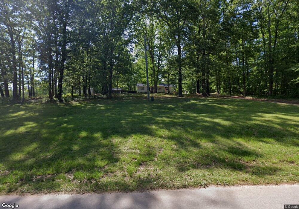
1955 Zeb Bryson Rd Clarkesville, GA 30523
Estimated Value: $278,019 - $397,000
3
Beds
2
Baths
1,456
Sq Ft
$223/Sq Ft
Est. Value
About This Home
This home is located at 1955 Zeb Bryson Rd, Clarkesville, GA 30523 and is currently estimated at $325,005, approximately $223 per square foot. 1955 Zeb Bryson Rd is a home located in Habersham County with nearby schools including Clarkesville Elementary School, North Habersham Middle School, and Habersham Success Academy.
Ownership History
Date
Name
Owned For
Owner Type
Purchase Details
Closed on
Sep 30, 2024
Sold by
Olson Faith
Bought by
Olsen Faith and Olsen Nathaniel
Current Estimated Value
Purchase Details
Closed on
Oct 12, 2023
Sold by
Goss Keith B
Bought by
Olson Faith and Olson Nathaniel
Purchase Details
Closed on
Sep 17, 2019
Sold by
Goss Rebecca Ann Adams
Bought by
Goss Keith B and Goss Rhonda Gail
Create a Home Valuation Report for This Property
The Home Valuation Report is an in-depth analysis detailing your home's value as well as a comparison with similar homes in the area
Home Values in the Area
Average Home Value in this Area
Purchase History
| Date | Buyer | Sale Price | Title Company |
|---|---|---|---|
| Olsen Faith | -- | -- | |
| Olson Faith | -- | -- | |
| Goss Keith B | -- | -- |
Source: Public Records
Tax History Compared to Growth
Tax History
| Year | Tax Paid | Tax Assessment Tax Assessment Total Assessment is a certain percentage of the fair market value that is determined by local assessors to be the total taxable value of land and additions on the property. | Land | Improvement |
|---|---|---|---|---|
| 2025 | $703 | $99,416 | $19,667 | $79,749 |
| 2024 | -- | $66,072 | $9,140 | $56,932 |
| 2023 | $515 | $64,220 | $17,116 | $47,104 |
| 2022 | $723 | $57,520 | $17,116 | $40,404 |
| 2021 | $671 | $51,912 | $15,892 | $36,020 |
| 2020 | $1,062 | $39,500 | $8,528 | $30,972 |
| 2019 | $1,063 | $39,500 | $8,528 | $30,972 |
| 2018 | $370 | $39,500 | $8,528 | $30,972 |
| 2017 | $349 | $36,828 | $8,528 | $28,300 |
| 2016 | $313 | $92,070 | $8,528 | $28,300 |
| 2015 | $303 | $92,070 | $8,528 | $28,300 |
| 2014 | $896 | $90,310 | $8,528 | $27,596 |
| 2013 | -- | $36,124 | $8,528 | $27,596 |
Source: Public Records
Map
Nearby Homes
- 104 Brando Trail
- 124 Signing Tree Ln
- 219 Signing Tree Ln
- 0 Sutton Mill Rd Unit 10644026
- 1955 Alec Mountain Rd
- 3039 Georgia 17
- 715 Ridge Rd
- 555 Highway 197 N
- 111 On Golden Pond Ln
- 1096 Sutton Mill Rd
- 132 James Rd
- 2041 Highway 197 N
- 355 Zeb Bryson Rd
- 4855 Georgia 115
- 220 Hardman Rd
- 4822 Georgia 115
- 166 Poplar Springs Dr
- 350 Kitty Hawk Ln
- 0 Highway 115 Unit 10643669
- 3077 Alec Mountain Rd
- 1957 Zeb Bryson Rd
- 2053 Zeb Bryson Rd
- 1908 Zeb Bryson Rd
- 131 Muleman Rd
- 264 Sunny Brook Trail
- 2135 Zeb Bryson Rd
- 1379 Zeb Bryson Rd
- 672 Bill Ramsey Rd
- 0 Bill Ramsey Rd Unit 3179188
- 0 Bill Ramsey Rd Unit 8454220
- 0 Bill Ramsey Rd Unit 7067529
- 350 Sunny Brook Trail
- 329 Sunny Brook Trail
- 1766 Zeb Bryson Rd
- 1760 Zeb Bryson Rd
- 1754 Zeb Bryson Rd
- 1070 Bill Ramsey Rd
- 1686 Zeb Bryson Rd
- 2310 Zeb Bryson Rd
- 500 Brando Trail
