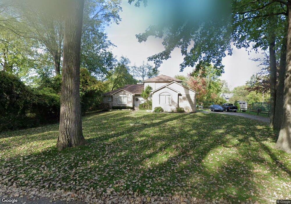
19554 Albany Ave Southfield, MI 48075
Estimated Value: $323,000 - $425,000
--
Bed
3
Baths
2,296
Sq Ft
$155/Sq Ft
Est. Value
About This Home
This home is located at 19554 Albany Ave, Southfield, MI 48075 and is currently estimated at $355,416, approximately $154 per square foot. 19554 Albany Ave is a home located in Oakland County with nearby schools including Dr. Joseph F. Pollack Academic Center Of Excellence, Agbu Alex-Marie Manoogian School, and Corpus Christi.
Ownership History
Date
Name
Owned For
Owner Type
Purchase Details
Closed on
Jul 25, 2025
Sold by
Jones Howard Leon and Jones Howard L
Bought by
Jones Howard L
Current Estimated Value
Home Financials for this Owner
Home Financials are based on the most recent Mortgage that was taken out on this home.
Original Mortgage
$198,000
Outstanding Balance
$197,659
Interest Rate
6.77%
Mortgage Type
New Conventional
Estimated Equity
$157,757
Purchase Details
Closed on
May 6, 2025
Sold by
Jones Howard Leon
Bought by
Jones-Daniel Nicole Patrice
Create a Home Valuation Report for This Property
The Home Valuation Report is an in-depth analysis detailing your home's value as well as a comparison with similar homes in the area
Home Values in the Area
Average Home Value in this Area
Purchase History
| Date | Buyer | Sale Price | Title Company |
|---|---|---|---|
| Jones Howard L | -- | Vylla Title | |
| Jones Howard L | -- | Vylla Title | |
| Jones-Daniel Nicole Patrice | -- | None Listed On Document | |
| Jones-Daniel Nicole Patrice | -- | None Listed On Document |
Source: Public Records
Mortgage History
| Date | Status | Borrower | Loan Amount |
|---|---|---|---|
| Open | Jones Howard L | $198,000 | |
| Closed | Jones Howard L | $198,000 |
Source: Public Records
Tax History Compared to Growth
Tax History
| Year | Tax Paid | Tax Assessment Tax Assessment Total Assessment is a certain percentage of the fair market value that is determined by local assessors to be the total taxable value of land and additions on the property. | Land | Improvement |
|---|---|---|---|---|
| 2022 | $4,248 | $147,990 | $17,040 | $130,950 |
| 2021 | $4,443 | $144,820 | $10,220 | $134,600 |
| 2020 | $4,167 | $114,460 | $10,220 | $104,240 |
| 2018 | $4,000 | $77,360 | $10,220 | $67,140 |
| 2015 | -- | $54,610 | $0 | $0 |
| 2014 | -- | $59,610 | $0 | $0 |
| 2011 | -- | $63,580 | $0 | $0 |
Source: Public Records
Map
Nearby Homes
- 19633 Mahon St
- 19880 Hazelhurst St
- 19910 Albany Ave
- 19780 Mahon St
- 19368 Midway Rd
- 0000 W Nine Mile
- 21450 Evergreen Rd
- 19100 Dorset St
- 18656 Midway Ave
- 20286 Woodburn Dr
- 19241 Melrose Ave
- 20450 Midway Ave
- 20980 Evergreen Rd
- 24139 Philip Dr
- 20619 Midway Ave
- 20210 Westhampton Ave
- 20900 Secluded Ln
- 21105 Midway Ave
- 24153 Evergreen Rd Unit 30
- 24393 Evergreen Rd
- 19580 Albany Ave
- 19520 Albany Ave
- 19555 Saxton Ave
- 19601 Saxton Ave
- 19515 Saxton Ave
- 19553 Albany Ave
- 19221 Albany Ave
- 19521 Albany Ave
- 19585 Albany Ave
- 19630 Albany Ave
- 19631 Saxton Ave
- 19631 Albany Ave
- 19433 Starlane St
- 19566 Hazelhurst St
- 19550 Saxton Ave
- 19428 Birchridge St
- 19434 Starlane St
- 19530 Hazelhurst St
- 19600 Saxton Ave
- 19602 Hazelhurst St