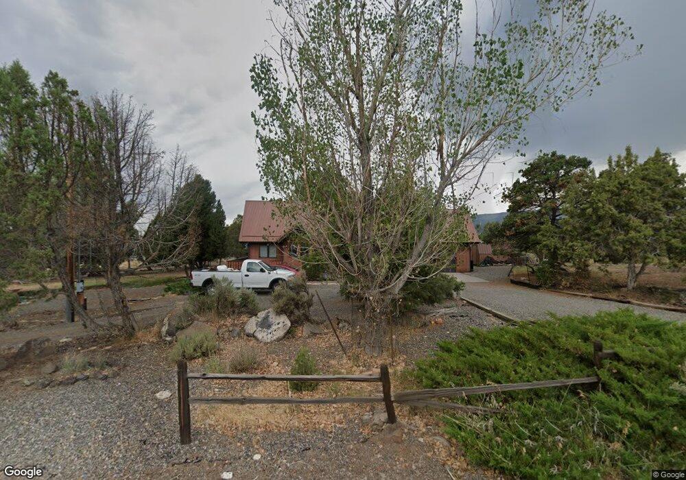
19555 Surface Creek Rd Cedaredge, CO 81413
Estimated Value: $425,000 - $699,000
3
Beds
3
Baths
2,692
Sq Ft
$212/Sq Ft
Est. Value
About This Home
This home is located at 19555 Surface Creek Rd, Cedaredge, CO 81413 and is currently estimated at $571,133, approximately $212 per square foot. 19555 Surface Creek Rd is a home located in Delta County with nearby schools including Cedaredge Elementary School, Cedaredge Middle School, and Cedaredge High School.
Ownership History
Date
Name
Owned For
Owner Type
Purchase Details
Closed on
Sep 22, 2015
Sold by
Lee Shaylene D and Farley Janice K
Bought by
Lee/Harper Family Trust
Current Estimated Value
Purchase Details
Closed on
Jan 30, 2009
Sold by
Cooper Mary Lee
Bought by
Lee Shaylene D and Farley Janice K
Purchase Details
Closed on
Jan 28, 2009
Sold by
Cooper Mary Lee
Bought by
Lee Shaylene D and Farley Janice K
Purchase Details
Closed on
Feb 11, 2008
Sold by
Cooper Richard R and Cooper Mary Lee
Bought by
Cooper Richard R and Cooper Mary Lee
Create a Home Valuation Report for This Property
The Home Valuation Report is an in-depth analysis detailing your home's value as well as a comparison with similar homes in the area
Purchase History
| Date | Buyer | Sale Price | Title Company |
|---|---|---|---|
| Lee/Harper Family Trust | -- | None Available | |
| Lee Shaylene D | $165,000 | None Available | |
| Lee Shaylene D | $165,000 | None Available | |
| Cooper Richard R | -- | None Available |
Source: Public Records
Tax History
| Year | Tax Paid | Tax Assessment Tax Assessment Total Assessment is a certain percentage of the fair market value that is determined by local assessors to be the total taxable value of land and additions on the property. | Land | Improvement |
|---|---|---|---|---|
| 2024 | $2,172 | $35,126 | $9,096 | $26,030 |
| 2023 | $2,172 | $35,126 | $9,096 | $26,030 |
| 2022 | $1,582 | $26,329 | $6,255 | $20,074 |
| 2021 | $1,587 | $27,087 | $6,435 | $20,652 |
| 2020 | $1,538 | $25,847 | $6,078 | $19,769 |
| 2019 | $1,542 | $25,847 | $6,078 | $19,769 |
| 2018 | $1,257 | $20,269 | $4,464 | $15,805 |
| 2017 | $1,257 | $20,269 | $4,464 | $15,805 |
| 2016 | $1,260 | $22,336 | $7,562 | $14,774 |
| 2014 | $1,134 | $20,094 | $6,368 | $13,726 |
Source: Public Records
Map
Nearby Homes
- 24593 Timothy Rd
- 24119 Ute Trail Rd
- TBD SE 3rd Lot 5 Will-O-way Subdivision St
- Unit 13 W Elk Dr
- 18865 Northridge Rd
- 18200 Surface Creek Rd
- 2115 2500 Rd
- 18377 Highway 65
- 23045 T Rd
- 20709 Highway 65
- 17969 Surface Creek Rd
- 22876 Thunder Mountain Ln
- 20856 2300 Rd
- 794 NE Indian Camp Ave
- 17656 2550 Rd
- 17826 & 17830 Hanson Rd
- 635 NE 2nd St
- 470 NE Elder Ct
- 17343 Surface Creek Rd
- 25615 Starner Loop Rd
- 19546 Surface Creek Rd
- 19576 Surface Creek Rd
- 19534 Surface Creek Rd
- 19439 Surface Creek Rd
- 19516 Surface Creek Rd
- 24531 Timothy Rd
- 19628 Surface Creek Rd
- 24565 Timothy Rd
- 24589 Timothy Rd
- 19403 Surface Creek Rd
- 19480 Surface Creek Rd
- 19482 Surface Creek Rd
- 19432 Surface Creek Rd
- 19587 Surface Creek Rd
- 19654 Surface Creek Rd
- 19603 Surface Creek Rd
- 19325 Surface Creek Rd
- 19369 Surface Creek Rd
- 24512 Timothy Rd
- 24657 Timothy Rd
Your Personal Tour Guide
Ask me questions while you tour the home.