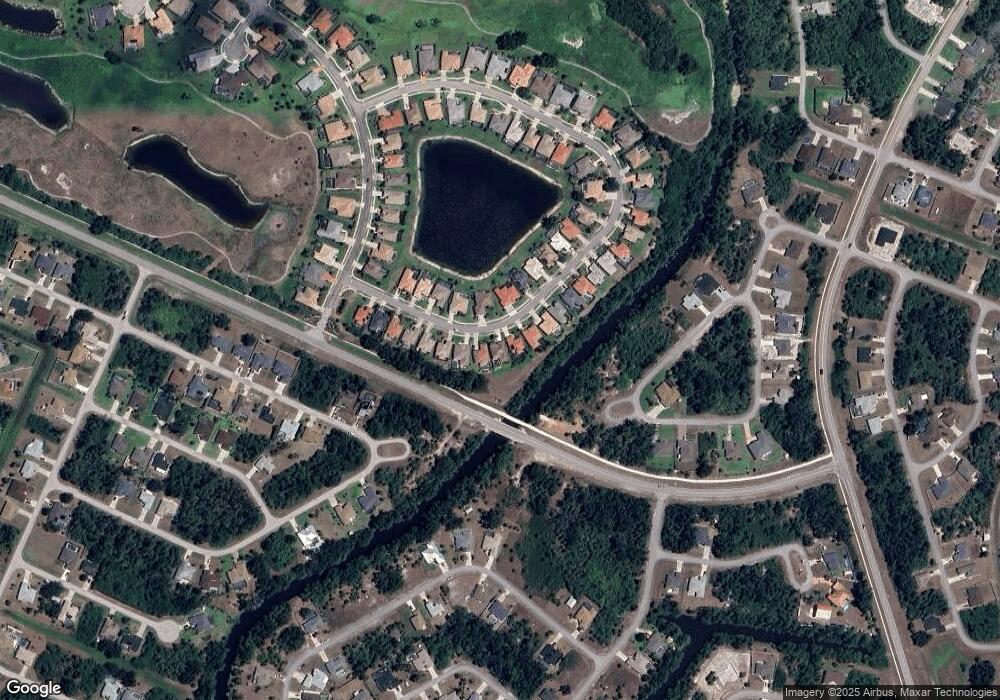
1956 Coconut Palm Cir North Port, FL 34288
Estimated Value: $398,873 - $448,000
3
Beds
2
Baths
2,059
Sq Ft
$208/Sq Ft
Est. Value
About This Home
This home is located at 1956 Coconut Palm Cir, North Port, FL 34288 and is currently estimated at $427,968, approximately $207 per square foot. 1956 Coconut Palm Cir is a home located in Sarasota County with nearby schools including Toledo Blade Elementary School, North Port High School, and Woodland Middle School.
Ownership History
Date
Name
Owned For
Owner Type
Purchase Details
Closed on
Mar 8, 2006
Sold by
Cargor Partners Iv Bobcat Lc
Bought by
Mulcrone Daniel John and Mulcrone Karen A
Current Estimated Value
Home Financials for this Owner
Home Financials are based on the most recent Mortgage that was taken out on this home.
Original Mortgage
$258,000
Outstanding Balance
$144,775
Interest Rate
6.05%
Mortgage Type
Fannie Mae Freddie Mac
Estimated Equity
$283,193
Create a Home Valuation Report for This Property
The Home Valuation Report is an in-depth analysis detailing your home's value as well as a comparison with similar homes in the area
Home Values in the Area
Average Home Value in this Area
Purchase History
| Date | Buyer | Sale Price | Title Company |
|---|---|---|---|
| Mulcrone Daniel John | $426,200 | Attorney |
Source: Public Records
Mortgage History
| Date | Status | Borrower | Loan Amount |
|---|---|---|---|
| Open | Mulcrone Daniel John | $258,000 |
Source: Public Records
Tax History Compared to Growth
Tax History
| Year | Tax Paid | Tax Assessment Tax Assessment Total Assessment is a certain percentage of the fair market value that is determined by local assessors to be the total taxable value of land and additions on the property. | Land | Improvement |
|---|---|---|---|---|
| 2024 | $7,575 | $340,470 | -- | -- |
| 2023 | $7,575 | $366,200 | $58,000 | $308,200 |
| 2022 | $7,154 | $351,700 | $58,000 | $293,700 |
| 2021 | $6,424 | $255,800 | $40,100 | $215,700 |
| 2020 | $6,263 | $243,500 | $52,400 | $191,100 |
| 2019 | $5,965 | $224,000 | $28,600 | $195,400 |
| 2018 | $5,941 | $230,500 | $27,800 | $202,700 |
| 2017 | $5,796 | $229,100 | $29,200 | $199,900 |
| 2016 | $5,705 | $213,300 | $26,800 | $186,500 |
| 2015 | $5,600 | $200,500 | $26,400 | $174,100 |
| 2014 | $5,407 | $194,700 | $0 | $0 |
Source: Public Records
Map
Nearby Homes
- 1840 Bobcat Trail
- 1849 Bobcat Trail
- 4447 Arley Rd
- 0 Kimball Cir
- 2470 Talwood Terrace
- 2478 Talwood Terrace
- 0 Wheeling Ave
- LOT 4 Wheeling Ave
- 0 Chartwell Ave Unit MFRC7513930
- 0 Delwood Dr Unit MFRC7504264
- 0000 Delwood Dr
- 1762 Queen Palm Way
- 0 Triby Terrace Unit MFRNS1084881
- 0 Triby Terrace Unit MFRD6134470
- 3960 S Haberland Blvd
- 0 Derrick St Unit A4560395
- 3940 S Haberland Blvd
- 3331 Bailey Palm Ct
- 3884 Johannesberg Rd
- 0 Johannesberg Rd Unit MFRA4661006
- 1950 Coconut Palm Cir
- 1962 Coconut Palm Cir
- 1944 Coconut Palm Cir
- 1968 Coconut Palm Cir
- 1959 Coconut Palm Cir
- 1938 Coconut Palm Cir
- 1972 Coconut Palm Cir
- 1947 Coconut Palm Cir
- 1971 Coconut Palm Cir
- 1932 Coconut Palm Cir
- 1978 Coconut Palm Cir
- 1935 Coconut Palm Cir
- 1979 Coconut Palm Cir
- 1926 Coconut Palm Cir
- 1982 Coconut Palm Cir
- 1929 Coconut Palm Cir
- 1920 Coconut Palm Cir
- 1988 Coconut Palm Cir
- 1923 Coconut Palm Cir
- 1989 Coconut Palm Cir
