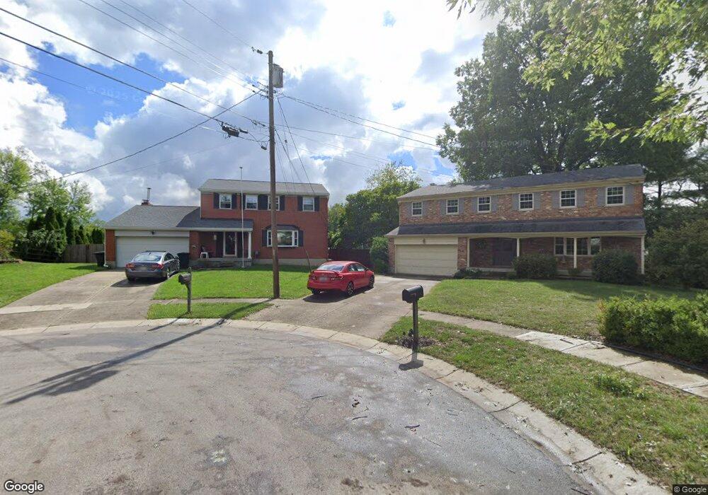
1956 Flintshire Ct Cincinnati, OH 45230
Sherwood NeighborhoodEstimated Value: $314,000 - $378,000
3
Beds
3
Baths
2,271
Sq Ft
$150/Sq Ft
Est. Value
About This Home
This home is located at 1956 Flintshire Ct, Cincinnati, OH 45230 and is currently estimated at $339,959, approximately $149 per square foot. 1956 Flintshire Ct is a home located in Hamilton County with nearby schools including Sherwood Elementary School, Nagel Middle School, and Turpin High School.
Ownership History
Date
Name
Owned For
Owner Type
Purchase Details
Closed on
Apr 30, 2021
Sold by
Futoran Philip L and Futoran Liisabeth Jo
Bought by
Privitar Jamie M and Privitar Jaide
Current Estimated Value
Home Financials for this Owner
Home Financials are based on the most recent Mortgage that was taken out on this home.
Original Mortgage
$188,000
Outstanding Balance
$168,919
Interest Rate
3.1%
Mortgage Type
New Conventional
Estimated Equity
$171,040
Purchase Details
Closed on
Sep 30, 1996
Sold by
Braun Carol A
Bought by
Futoran Philip L and Futoran Lisabeth Jo
Home Financials for this Owner
Home Financials are based on the most recent Mortgage that was taken out on this home.
Original Mortgage
$107,120
Interest Rate
8%
Create a Home Valuation Report for This Property
The Home Valuation Report is an in-depth analysis detailing your home's value as well as a comparison with similar homes in the area
Home Values in the Area
Average Home Value in this Area
Purchase History
| Date | Buyer | Sale Price | Title Company |
|---|---|---|---|
| Privitar Jamie M | $235,000 | Mattingly Ford Ttl Svcs Llc | |
| Futoran Philip L | $133,900 | -- |
Source: Public Records
Mortgage History
| Date | Status | Borrower | Loan Amount |
|---|---|---|---|
| Open | Privitar Jamie M | $188,000 | |
| Previous Owner | Futoran Philip L | $107,120 |
Source: Public Records
Tax History
| Year | Tax Paid | Tax Assessment Tax Assessment Total Assessment is a certain percentage of the fair market value that is determined by local assessors to be the total taxable value of land and additions on the property. | Land | Improvement |
|---|---|---|---|---|
| 2025 | $5,155 | $82,250 | $15,330 | $66,920 |
| 2024 | $5,017 | $82,250 | $15,330 | $66,920 |
| 2023 | $4,768 | $82,250 | $15,330 | $66,920 |
| 2022 | $4,705 | $72,317 | $10,283 | $62,034 |
| 2021 | $4,817 | $72,317 | $10,283 | $62,034 |
| 2020 | $4,763 | $72,317 | $10,283 | $62,034 |
| 2019 | $4,663 | $63,998 | $9,100 | $54,898 |
| 2018 | $4,375 | $63,998 | $9,100 | $54,898 |
| 2017 | $4,181 | $63,998 | $9,100 | $54,898 |
| 2016 | $3,973 | $58,807 | $9,639 | $49,168 |
| 2015 | $3,824 | $58,807 | $9,639 | $49,168 |
| 2014 | $3,820 | $58,807 | $9,639 | $49,168 |
| 2013 | $3,556 | $57,656 | $9,450 | $48,206 |
Source: Public Records
Map
Nearby Homes
- 7157 Grantham Way
- 1453 Verdale Dr
- 7053 Paddison Rd
- 1939 Lady Ellen Dr
- 7061 Clough Pike
- 7179 Lamplite Ct
- 7080 Petri Dr
- 2241 Spinningwheel Ln
- 1395 Tallberry Dr
- 2121 Clough Chase Dr
- 2113 Clough Chase Dr
- 2105 Clough Chase Dr
- 6966 Beechmont Ave
- 7030 Beechmont Ave
- 7712 Stonehill Dr
- 7121 Woodridge Dr
- 7109 Woodridge Dr
- 6985 Beechmont Ave
- 7080 Hunley Rd
- 7158 Dunn Rd
- 1962 Flintshire Ct
- 1957 Flintshire Ct
- 1968 Flintshire Ct
- 1963 Flintshire Ct
- 1953 Wittmeyer Dr
- 1959 Wittmeyer Dr
- 1969 Flintshire Ct
- 1974 Flintshire Ct
- 1965 Wittmeyer Dr
- 1958 Finsbury Ct
- 1977 Flintshire Ct
- 1971 Wittmeyer Dr
- 1980 Flintshire Ct
- 1950 Finsbury Ct
- 1964 Finsbury Ct
- 1977 Wittmeyer Dr
- 1983 Flintshire Ct
- 1986 Flintshire Ct
- 1970 Finsbury Ct
- 1983 Wittmeyer Dr
Your Personal Tour Guide
Ask me questions while you tour the home.