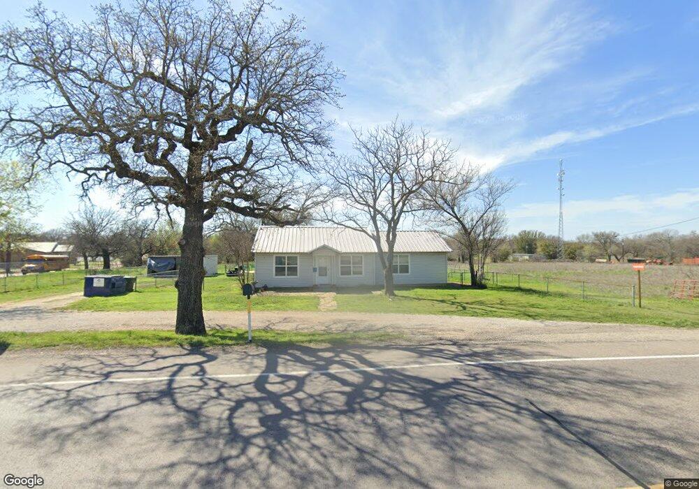
1956 Fm 1189 Weatherford, TX 76087
Estimated Value: $409,226 - $818,000
--
Bed
--
Bath
1,448
Sq Ft
$384/Sq Ft
Est. Value
About This Home
This home is located at 1956 Fm 1189, Weatherford, TX 76087 and is currently estimated at $555,742, approximately $383 per square foot. 1956 Fm 1189 is a home with nearby schools including Brock Intermediate School, Brock Junior High School, and Brock High School.
Ownership History
Date
Name
Owned For
Owner Type
Purchase Details
Closed on
Aug 22, 2016
Sold by
Thornton Robert Leslie and Thornton Robert L
Bought by
Brock Partners Llc
Current Estimated Value
Purchase Details
Closed on
Feb 10, 2006
Sold by
New Tex Land Development Ltd
Bought by
Hayes Tracy and Hayes Heather
Home Financials for this Owner
Home Financials are based on the most recent Mortgage that was taken out on this home.
Original Mortgage
$220,000
Interest Rate
6.18%
Mortgage Type
Purchase Money Mortgage
Purchase Details
Closed on
Jan 1, 1901
Bought by
Brock Partners Llc
Create a Home Valuation Report for This Property
The Home Valuation Report is an in-depth analysis detailing your home's value as well as a comparison with similar homes in the area
Home Values in the Area
Average Home Value in this Area
Purchase History
| Date | Buyer | Sale Price | Title Company |
|---|---|---|---|
| Brock Partners Llc | -- | Providence Title Company | |
| Hayes Tracy | -- | None Available | |
| Brock Partners Llc | -- | -- |
Source: Public Records
Mortgage History
| Date | Status | Borrower | Loan Amount |
|---|---|---|---|
| Previous Owner | Hayes Tracy | $220,000 |
Source: Public Records
Tax History Compared to Growth
Tax History
| Year | Tax Paid | Tax Assessment Tax Assessment Total Assessment is a certain percentage of the fair market value that is determined by local assessors to be the total taxable value of land and additions on the property. | Land | Improvement |
|---|---|---|---|---|
| 2025 | $8,166 | $320,008 | $265,810 | $54,198 |
| 2024 | $8,166 | $441,420 | $300,980 | $140,440 |
| 2023 | $8,166 | $441,420 | $300,980 | $140,440 |
| 2022 | $8,589 | $423,070 | $359,110 | $63,960 |
| 2021 | $9,032 | $423,070 | $359,110 | $63,960 |
| 2020 | $3,844 | $177,580 | $119,700 | $57,880 |
| 2019 | $4,139 | $177,580 | $119,700 | $57,880 |
| 2018 | $4,445 | $189,890 | $119,700 | $70,190 |
| 2017 | $4,369 | $189,890 | $119,700 | $70,190 |
| 2016 | $3,835 | $166,690 | $119,700 | $46,990 |
| 2015 | $3,786 | $166,690 | $119,700 | $46,990 |
| 2014 | $3,712 | $161,740 | $119,700 | $42,040 |
Source: Public Records
Map
Nearby Homes
- 1700 Fm 1189
- 102 Eagle Pass Ln
- 131 Brock Ln
- TBD Grindstone Rd
- 734 Young Bend Rd
- 606 Grindstone Rd
- TBD1 Farm To Market Road 1189
- 2041 Verona Dr
- 4000 Luciano Dr
- 3036 Palermo Dr
- 2004 Verona Dr
- 2007 Verona Dr
- 201 Pritchard Ln
- 2026 Verona Dr
- 2030 Verona Dr
- 2042 Verona Dr
- 304 Red Roan Ridge
- 401 Brock Spur
- 169 Savannah Dr
- 2053 Verona Dr
- 10 Brock Ln
- 9 Brock Ln
- 18 Brock Ct
- 17 Brock Ct
- 16 Brock Ct
- TBD Taylor Rd
- 1957 Fm 1189
- 1965 Fm 1189
- 1903 Fm 1189 Unit 300
- 1903 Fm 1189 Unit 400
- 1903 Fm 1189
- 1903 Fm 1189
- 1891 Fm 1189
- 2001 Fm 1189
- 0 Fm 1189 Unit 10432436
- TBD10 Heritage Springs Dr
- TBD3 Heritage Springs Dr
- TBD Lazy Bend Rd
- Lot 48 Eagles Crest Ln
- Lot 47 Eagles Crest Ln