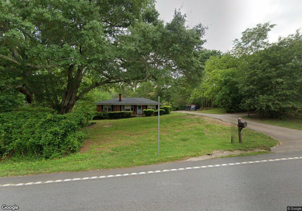
1956 Highway 212 SW Conyers, GA 30094
Estimated Value: $197,000 - $261,000
3
Beds
1
Bath
1,210
Sq Ft
$192/Sq Ft
Est. Value
About This Home
This home is located at 1956 Highway 212 SW, Conyers, GA 30094 and is currently estimated at $231,975, approximately $191 per square foot. 1956 Highway 212 SW is a home located in Rockdale County with nearby schools including Lorraine Elementary School, Gen. Ray Davis Middle School, and Salem High School.
Ownership History
Date
Name
Owned For
Owner Type
Purchase Details
Closed on
Jan 10, 2003
Sold by
Davis Jerry L
Bought by
Kidd Jessica
Current Estimated Value
Home Financials for this Owner
Home Financials are based on the most recent Mortgage that was taken out on this home.
Original Mortgage
$100,000
Outstanding Balance
$43,096
Interest Rate
6.16%
Mortgage Type
New Conventional
Estimated Equity
$188,879
Create a Home Valuation Report for This Property
The Home Valuation Report is an in-depth analysis detailing your home's value as well as a comparison with similar homes in the area
Home Values in the Area
Average Home Value in this Area
Purchase History
| Date | Buyer | Sale Price | Title Company |
|---|---|---|---|
| Kidd Jessica | $115,000 | -- |
Source: Public Records
Mortgage History
| Date | Status | Borrower | Loan Amount |
|---|---|---|---|
| Open | Kidd Jessica | $100,000 |
Source: Public Records
Tax History Compared to Growth
Tax History
| Year | Tax Paid | Tax Assessment Tax Assessment Total Assessment is a certain percentage of the fair market value that is determined by local assessors to be the total taxable value of land and additions on the property. | Land | Improvement |
|---|---|---|---|---|
| 2024 | $1,719 | $75,400 | $22,600 | $52,800 |
| 2023 | $1,162 | $55,840 | $21,520 | $34,320 |
| 2022 | $1,109 | $53,760 | $21,520 | $32,240 |
| 2021 | $1,084 | $50,440 | $18,200 | $32,240 |
| 2020 | $940 | $46,320 | $14,080 | $32,240 |
| 2019 | $800 | $41,000 | $14,080 | $26,920 |
| 2018 | $610 | $34,720 | $9,920 | $24,800 |
| 2017 | $459 | $29,640 | $9,920 | $19,720 |
| 2016 | $424 | $29,640 | $9,920 | $19,720 |
| 2015 | $313 | $25,760 | $9,920 | $15,840 |
| 2014 | $261 | $24,880 | $9,920 | $14,960 |
| 2013 | -- | $31,680 | $12,400 | $19,280 |
Source: Public Records
Map
Nearby Homes
- 1938 Highway 212 SW
- 4530 Wentworth Place SW
- 1861 Crowell Rd SW
- 4275 Troupe Smith Rd SE
- 2621 Crest Valley Dr
- 4290 McClanes Ct
- 2104 Crest Wood Dr
- 2150 Oglesby Bridge Rd SW
- 246 Bridgewood Dr SE
- 1119 Plantation Dr SE
- 2206 Crescent Walk
- 1061 Plantation Blvd SE
- 1706 Little Brook Dr SW
- 2301 Mallory Cir Unit 2
- 1023 Plantation Ct SE
- 1433 Cotton Trail SW
- 210 Cowan Rd SE
- 1976 Highway 212 SW
- 1967 Highway 212 SW
- 1977 Highway 212 SW
- 1977 Georgia 212
- 1994 Highway 212 SW
- 1985 Georgia 212
- 1985 Highway 212 SW
- 4823 Camden Dr SW
- 4819 Camden Dr SW Unit 2
- 1945 Highway 212 SW
- 4821 Camden Dr SW Unit 2
- 1996 Highway 212 SW
- 1929 Highway 212 SW
- 4825 Camden Dr SW Unit 2
- 4817 Camden Dr SW
- 1920 Highway 212 SW
- 4827 Camden Dr SW Unit 2
- 4815 Camden Dr SW
- 4820 Camden Dr SW
- 1997 Crowell Rd SW