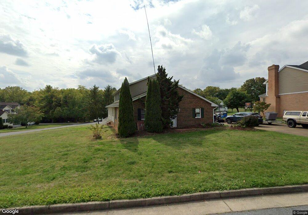
1956 Kimberly Ct Harrisonburg, VA 22801
Estimated Value: $522,000 - $654,000
4
Beds
4
Baths
4,524
Sq Ft
$126/Sq Ft
Est. Value
About This Home
This home is located at 1956 Kimberly Ct, Harrisonburg, VA 22801 and is currently estimated at $571,635, approximately $126 per square foot. 1956 Kimberly Ct is a home located in Harrisonburg City with nearby schools including Bluestone Elementary, Thomas Harrison Middle School, and Harrisonburg High School.
Ownership History
Date
Name
Owned For
Owner Type
Purchase Details
Closed on
Sep 13, 2016
Sold by
Penrod Michael H and Penrod Mary E
Bought by
Minter Erik and Minter Tiffanie
Current Estimated Value
Home Financials for this Owner
Home Financials are based on the most recent Mortgage that was taken out on this home.
Original Mortgage
$232,000
Outstanding Balance
$184,930
Interest Rate
3.45%
Mortgage Type
New Conventional
Estimated Equity
$386,705
Create a Home Valuation Report for This Property
The Home Valuation Report is an in-depth analysis detailing your home's value as well as a comparison with similar homes in the area
Home Values in the Area
Average Home Value in this Area
Purchase History
| Date | Buyer | Sale Price | Title Company |
|---|---|---|---|
| Minter Erik | $290,000 | Main Street Title Group Llc |
Source: Public Records
Mortgage History
| Date | Status | Borrower | Loan Amount |
|---|---|---|---|
| Open | Minter Erik | $232,000 |
Source: Public Records
Tax History Compared to Growth
Tax History
| Year | Tax Paid | Tax Assessment Tax Assessment Total Assessment is a certain percentage of the fair market value that is determined by local assessors to be the total taxable value of land and additions on the property. | Land | Improvement |
|---|---|---|---|---|
| 2025 | $4,398 | $447,400 | $69,300 | $378,100 |
| 2024 | $4,398 | $435,400 | $66,000 | $369,400 |
| 2023 | $3,908 | $407,100 | $66,000 | $341,100 |
| 2022 | $3,246 | $349,000 | $60,000 | $289,000 |
| 2021 | $3,036 | $337,300 | $60,000 | $277,300 |
| 2020 | $2,967 | $337,300 | $60,000 | $277,300 |
| 2019 | $2,873 | $326,400 | $60,000 | $266,400 |
| 2018 | $2,222 | $307,500 | $60,000 | $247,500 |
| 2017 | $2,222 | $302,600 | $60,000 | $242,600 |
| 2016 | $2,222 | $308,600 | $60,000 | $248,600 |
| 2015 | $2,222 | $308,600 | $60,000 | $248,600 |
| 2014 | -- | $308,600 | $60,000 | $248,600 |
Source: Public Records
Map
Nearby Homes
- 2112 Willow Hill Dr
- 2102 Willow Hill Dr
- 2122 Willow Hill Dr
- 2132 Willow Hill Dr
- 2105 Willow Hill Dr
- 1739 Kingston Ct
- 210 W Mosby Rd
- 2414 Millwood Loop Unit 15
- 2020 Shoeshine Ave
- 745 Wingtip Way
- 550 Grommet Dr
- 521 Hickory Grove Cir
- 1435 Bluestone St
- 52 South Ave Unit G
- 100 Monument Ave
- 1450 Bluestone St
- 44 South Ave Unit G
- 21 Port Republic Rd
- 33 Port Republic Rd
- 1309 Bradley Dr
- 1964 Lynne Place
- 1952 Kimberly Ct
- 1926 Lynne Place
- 1929 Lynne Place
- 1925 Lynne Place
- 1970 Lynne Place
- 1935 Lynne Place
- 1934 Kimberly Ct
- 1940 Kimberly Ct
- 1940 Willow Hill Dr
- 89 Rex Rd
- 1917 Lynne Place
- 1922 Lynne Place
- 1910 Willow Hill Dr
- 85 Rex Rd
- TBD Willow Hill Dr
- 1982 Willow Hill Dr
- 2102 Willow Hill Dr Unit 72
- 2094 Willow Hill Dr
- 2112 Willow Hill Dr Unit 71