Estimated Value: $474,000 - $489,000
4
Beds
4
Baths
2,090
Sq Ft
$230/Sq Ft
Est. Value
About This Home
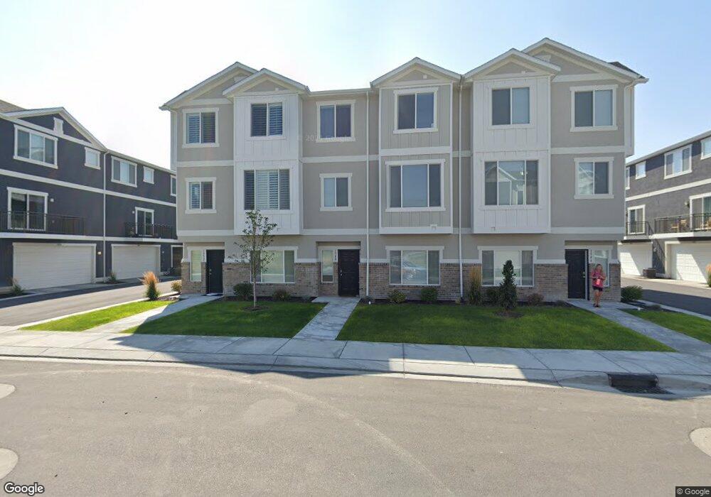
This home is located at 1956 S 1030 W Unit 436, Orem, UT 84058 and is currently estimated at $481,499, approximately $230 per square foot. 1956 S 1030 W Unit 436 is a home located in Utah County with nearby schools including Vineyard Elementary School, Lakeridge Jr High School, and Mountain View High School.
Ownership History
Date
Name
Owned For
Owner Type
Purchase Details
Closed on
Apr 7, 2021
Sold by
Tucker James
Bought by
Avery Shannon
Current Estimated Value
Purchase Details
Closed on
Mar 23, 2020
Sold by
Gold Stream Partners Llc
Bought by
Tucker James
Home Financials for this Owner
Home Financials are based on the most recent Mortgage that was taken out on this home.
Original Mortgage
$237,000
Interest Rate
3.4%
Mortgage Type
New Conventional
Create a Home Valuation Report for This Property
The Home Valuation Report is an in-depth analysis detailing your home's value as well as a comparison with similar homes in the area
Home Values in the Area
Average Home Value in this Area
Purchase History
| Date | Buyer | Sale Price | Title Company |
|---|---|---|---|
| Avery Shannon | -- | Vanguard Title Ins | |
| Tucker James | -- | Platinum Title Services |
Source: Public Records
Mortgage History
| Date | Status | Borrower | Loan Amount |
|---|---|---|---|
| Previous Owner | Tucker James | $237,000 |
Source: Public Records
Tax History Compared to Growth
Tax History
| Year | Tax Paid | Tax Assessment Tax Assessment Total Assessment is a certain percentage of the fair market value that is determined by local assessors to be the total taxable value of land and additions on the property. | Land | Improvement |
|---|---|---|---|---|
| 2025 | $1,955 | $248,050 | $66,300 | $384,700 |
| 2024 | $1,955 | $239,030 | $0 | $0 |
| 2023 | $1,744 | $229,185 | $0 | $0 |
| 2022 | $1,878 | $239,140 | $0 | $0 |
| 2021 | $1,695 | $326,900 | $49,000 | $277,900 |
| 2020 | $1,473 | $279,100 | $46,000 | $233,100 |
Source: Public Records
Map
Nearby Homes
- 1871 S 1030 W
- 1217 W 1860 S
- 1965 N 3050 W
- Kirkwood Scandia Plan at Broadview Shores - Cottages
- Kirkwood Farmhouse Plan at Broadview Shores - Cottages
- Sundance Ballpark Plan at Broadview Shores - Cottages
- Nyborg Plan at Broadview Shores - Cottages
- Goteborg Plan at Broadview Shores - Cottages
- Keystone Scandia Plan at Broadview Shores - Cottages
- 3157 W 1690 N
- 3206 W 1670 N
- 3191 W 1670 N
- 1501 N 3250 W
- 543 W 1770 S
- 1458 N 3300 W
- 537 W 1770 S
- 1825 Garden Plan at Broadview Shores
- 3182 W 1570 N
- 1700 Farmhouse Plan at Broadview Shores
- 2400 Garden Plan at Broadview Shores
- 1954 S 1030 W Unit 435
- 1958 S 1030 W Unit 437
- 1958 S 1030 W
- 1944 S 1030 W Unit 434
- 1944 S 1030 W
- 1942 S 1030 W
- 1942 S 1030 W Unit 433
- 1052 W 1970 S Unit 438
- 1052 W 1970 S
- 1943 S 1080 W Unit 243
- 1941 S 1080 W Unit 242
- 1048 W 1970 S Unit 439
- 1949 S 1080 W Unit 244
- 1937 S 1080 W
- 1937 S 1080 W Unit 241
- 1953 S 1080 W Unit 245
- 1044 W 1970 S Unit 440
- 1938 S 1030 W Unit 425
- 1952 S 1030 W Unit 432
- 1948 S 1030 W Unit 431