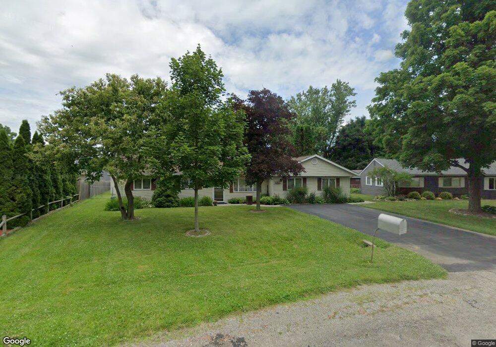
1956 Swaranne Dr West Bloomfield, MI 48324
Estimated Value: $284,660 - $305,000
3
Beds
2
Baths
1,596
Sq Ft
$186/Sq Ft
Est. Value
About This Home
This home is located at 1956 Swaranne Dr, West Bloomfield, MI 48324 and is currently estimated at $296,165, approximately $185 per square foot. 1956 Swaranne Dr is a home located in Oakland County with nearby schools including Haviland Elementary School, Pierce Middle School, and Waterford Mott High School.
Ownership History
Date
Name
Owned For
Owner Type
Purchase Details
Closed on
Feb 19, 2015
Sold by
Nauman Carl Thomas and Naumann Darla Mae
Bought by
Naumann Carl Thomas and Naumann Darla Mae
Current Estimated Value
Home Financials for this Owner
Home Financials are based on the most recent Mortgage that was taken out on this home.
Original Mortgage
$100,000
Interest Rate
3.73%
Mortgage Type
New Conventional
Create a Home Valuation Report for This Property
The Home Valuation Report is an in-depth analysis detailing your home's value as well as a comparison with similar homes in the area
Home Values in the Area
Average Home Value in this Area
Purchase History
| Date | Buyer | Sale Price | Title Company |
|---|---|---|---|
| Naumann Carl Thomas | -- | Fidelity National Title |
Source: Public Records
Mortgage History
| Date | Status | Borrower | Loan Amount |
|---|---|---|---|
| Closed | Naumann Carl Thomas | $100,000 |
Source: Public Records
Tax History Compared to Growth
Tax History
| Year | Tax Paid | Tax Assessment Tax Assessment Total Assessment is a certain percentage of the fair market value that is determined by local assessors to be the total taxable value of land and additions on the property. | Land | Improvement |
|---|---|---|---|---|
| 2024 | $1,520 | $119,160 | $0 | $0 |
| 2022 | $1,450 | $112,930 | $36,000 | $76,930 |
| 2021 | $2,231 | $96,150 | $0 | $0 |
| 2020 | $1,327 | $91,760 | $26,570 | $65,190 |
| 2018 | $2,106 | $76,910 | $21,000 | $55,910 |
| 2015 | -- | $62,970 | $0 | $0 |
| 2014 | -- | $58,330 | $0 | $0 |
| 2011 | -- | $54,620 | $0 | $0 |
Source: Public Records
Map
Nearby Homes
- 1992 Swaranne Dr
- 1837 Henbert Rd
- 6620 Red Cedar Ln Unit 37
- 1811 Henbert Rd
- 6726 Red Cedar Ln
- 1985 Christopher Ct
- 1604 Petrolia
- 2236 Locklin Ln
- 2112 Keylon Dr
- VAC Mercedes Ave
- 6034 Beachwood Dr
- 6057 Beachwood Dr
- VL Tamson St
- 2140 Timberridge Ct
- 1276 Jay St Unit 6
- 6289 Lindsay Ct
- Lot 94 Hiller Rd
- 5699 Applegrove Dr
- 1701 Marylestone Dr
- 9999 Cooley Lake Rd
- 1946 Swaranne Dr
- 1966 Swaranne Dr
- 1936 Swaranne Dr
- 6433 Hermana Rd
- 1978 Swaranne Dr
- 6411 Hermana Rd
- 6455 Hermana Rd
- 1965 Swaranne Dr
- 1926 Swaranne Dr
- 1977 Swaranne Dr
- 1951 Swaranne Dr Unit Bldg-Unit
- 1951 Swaranne Dr
- 6475 Hermana Rd
- 1911 Lochaven Rd
- 1903 Lochaven Rd
- 6387 Hermana Rd
- 1917 Lochaven Rd
- 1941 Swaranne Dr
- 1906 Sarona Ln
- 1921 Lochaven Rd