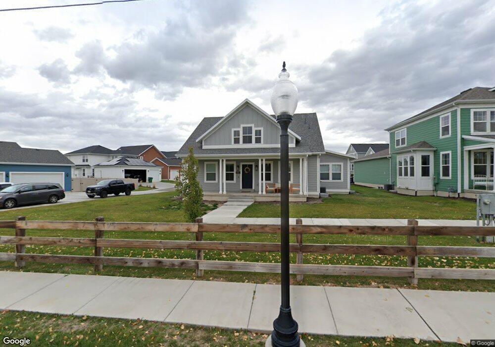
1956 W 200 N Unit 621 Kaysville, UT 84037
West Kaysville NeighborhoodEstimated Value: $804,000 - $914,000
3
Beds
3
Baths
4,415
Sq Ft
$193/Sq Ft
Est. Value
About This Home
This home is located at 1956 W 200 N Unit 621, Kaysville, UT 84037 and is currently estimated at $851,456, approximately $192 per square foot. 1956 W 200 N Unit 621 is a home located in Davis County with nearby schools including Kay's Creek Elementary School, Shoreline Junior High School, and Davis High School.
Ownership History
Date
Name
Owned For
Owner Type
Purchase Details
Closed on
Jul 1, 2024
Sold by
Farrow Anne and Zarem Michael
Bought by
Mesler Anthony and Mesler Kylie
Current Estimated Value
Home Financials for this Owner
Home Financials are based on the most recent Mortgage that was taken out on this home.
Original Mortgage
$766,550
Outstanding Balance
$756,768
Interest Rate
7.02%
Mortgage Type
New Conventional
Estimated Equity
$94,688
Purchase Details
Closed on
Aug 21, 2020
Sold by
Destination Homes Inc
Bought by
Zarem Michael and Farrow Anne
Home Financials for this Owner
Home Financials are based on the most recent Mortgage that was taken out on this home.
Original Mortgage
$475,200
Interest Rate
3%
Mortgage Type
New Conventional
Purchase Details
Closed on
Jul 30, 2019
Sold by
Mountain View Title & Escrow Inc
Bought by
Destination Homes Inc
Home Financials for this Owner
Home Financials are based on the most recent Mortgage that was taken out on this home.
Original Mortgage
$455,676
Interest Rate
3.73%
Mortgage Type
Commercial
Create a Home Valuation Report for This Property
The Home Valuation Report is an in-depth analysis detailing your home's value as well as a comparison with similar homes in the area
Home Values in the Area
Average Home Value in this Area
Purchase History
| Date | Buyer | Sale Price | Title Company |
|---|---|---|---|
| Mesler Anthony | -- | North Star Title | |
| Zarem Michael | -- | Stewart Title Ins Age | |
| Destination Homes Inc | -- | Mountain View Title |
Source: Public Records
Mortgage History
| Date | Status | Borrower | Loan Amount |
|---|---|---|---|
| Open | Mesler Anthony | $766,550 | |
| Previous Owner | Zarem Michael | $475,200 | |
| Previous Owner | Destination Homes Inc | $455,676 |
Source: Public Records
Tax History Compared to Growth
Tax History
| Year | Tax Paid | Tax Assessment Tax Assessment Total Assessment is a certain percentage of the fair market value that is determined by local assessors to be the total taxable value of land and additions on the property. | Land | Improvement |
|---|---|---|---|---|
| 2025 | $3,760 | $414,700 | $177,258 | $237,442 |
| 2024 | $3,760 | $396,550 | $149,371 | $247,179 |
| 2023 | $4,000 | $747,000 | $282,090 | $464,910 |
| 2022 | $4,079 | $427,350 | $155,096 | $272,254 |
| 2021 | $3,669 | $576,000 | $168,969 | $407,031 |
| 2020 | $3,309 | $506,000 | $141,795 | $364,205 |
Source: Public Records
Map
Nearby Homes
- 34 S Preston St
- Brinton Signature Plan at Pintail Estates
- 1845 W Sherri Ln
- 37 S Preston St Unit 10
- 2095 W 200 N
- 71 S Harvs Ln
- 2056 W Phillips St
- 256 Seemore Dr
- 1873 W 75 S
- 51 N Hayfield Cir
- Yalecrest Plan at The Preserve
- Trio Plan at The Preserve
- Timpani Plan at The Preserve
- Tenor Plan at The Preserve
- Octave Plan at The Preserve
- Madrigal Plan at The Preserve
- Interlude Plan at The Preserve
- Harvard Plan at The Preserve
- Harrison Plan at The Preserve
- Fortissimo Plan at The Preserve
- 1956 W 200 N
- 1948 W 200 N Unit 622
- 1951 W Joseph Acres Rd
- 1959 W Joseph Acres Rd Unit 620
- 1935 W Joseph Acres Rd
- 1947 W Joseph Acres Rd
- 1947 W Joseph Acres Rd Unit 618
- 1940 W 200 N
- 1927 W Joseph Acres Rd
- 1943 W Joseph Acres Rd
- 1932 W 200 N
- 1919 W Joseph Acres Rd
- 1930 W Joseph Acres Rd
- 1938 W Joseph Acres Rd
- 1924 Joseph Acres Rd
- 1924 W 200 N
- 1975 W Joseph Acres Rd
- 1911 W Joseph Acres Rd
- 1979 W Joseph Acres Rd Unit 508
- 1979 W Joseph Acres Rd