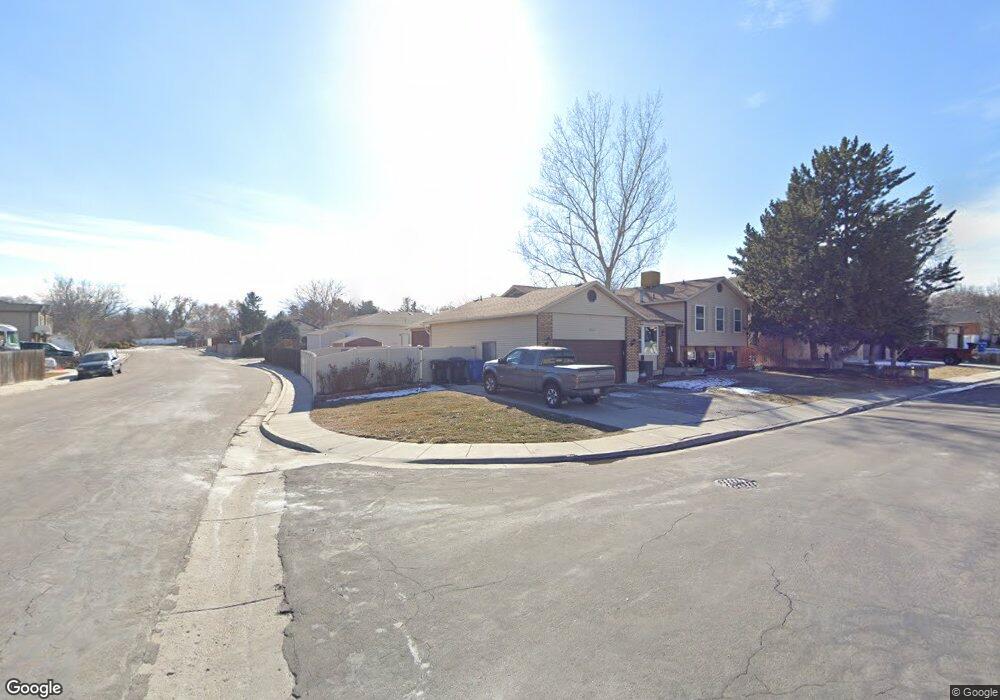
1956 W 5485 S Salt Lake City, UT 84118
Estimated Value: $407,000 - $515,975
4
Beds
2
Baths
2,484
Sq Ft
$191/Sq Ft
Est. Value
About This Home
This home is located at 1956 W 5485 S, Salt Lake City, UT 84118 and is currently estimated at $473,994, approximately $190 per square foot. 1956 W 5485 S is a home located in Salt Lake County with nearby schools including Vista Elementary School, Eisenhower Jr High School, and Taylorsville High School.
Ownership History
Date
Name
Owned For
Owner Type
Purchase Details
Closed on
Feb 7, 2020
Sold by
Briggs Carol
Bought by
Briggurr Properties Llc
Current Estimated Value
Purchase Details
Closed on
Jun 13, 2007
Sold by
Conner Andrew
Bought by
Briggs Carol
Home Financials for this Owner
Home Financials are based on the most recent Mortgage that was taken out on this home.
Original Mortgage
$211,500
Interest Rate
6.21%
Mortgage Type
Purchase Money Mortgage
Purchase Details
Closed on
May 19, 2004
Sold by
Ostler Kory M and Ostler Terri L
Bought by
Conner Andrew J
Home Financials for this Owner
Home Financials are based on the most recent Mortgage that was taken out on this home.
Original Mortgage
$124,000
Interest Rate
5.9%
Mortgage Type
Unknown
Create a Home Valuation Report for This Property
The Home Valuation Report is an in-depth analysis detailing your home's value as well as a comparison with similar homes in the area
Home Values in the Area
Average Home Value in this Area
Purchase History
| Date | Buyer | Sale Price | Title Company |
|---|---|---|---|
| Briggurr Properties Llc | -- | None Available | |
| Briggs Carol | -- | Surety Title | |
| Conner Andrew J | -- | Metro National Title |
Source: Public Records
Mortgage History
| Date | Status | Borrower | Loan Amount |
|---|---|---|---|
| Previous Owner | Briggs Carol | $211,500 | |
| Previous Owner | Conner Andrew J | $124,000 | |
| Closed | Conner Andrew J | $31,000 |
Source: Public Records
Tax History Compared to Growth
Tax History
| Year | Tax Paid | Tax Assessment Tax Assessment Total Assessment is a certain percentage of the fair market value that is determined by local assessors to be the total taxable value of land and additions on the property. | Land | Improvement |
|---|---|---|---|---|
| 2025 | $2,746 | $467,800 | $154,900 | $312,900 |
| 2024 | $2,746 | $450,300 | $149,400 | $300,900 |
| 2023 | $2,605 | $419,000 | $143,700 | $275,300 |
| 2022 | $2,734 | $404,900 | $140,900 | $264,000 |
| 2021 | $2,560 | $328,000 | $108,400 | $219,600 |
| 2020 | $2,392 | $288,900 | $89,600 | $199,300 |
| 2019 | $2,343 | $278,700 | $65,000 | $213,700 |
| 2018 | $2,268 | $255,300 | $65,000 | $190,300 |
| 2017 | $1,901 | $224,200 | $61,100 | $163,100 |
| 2016 | $1,875 | $221,000 | $53,100 | $167,900 |
| 2015 | $1,847 | $202,900 | $51,200 | $151,700 |
| 2014 | $1,713 | $194,800 | $49,700 | $145,100 |
Source: Public Records
Map
Nearby Homes
- 5552 Hew Wood Dr
- 2001 W 5540 S
- 2016 W Hew Wood Ct
- 2127 Cedar Breaks Dr
- 5557 S 2200 W
- 1886 W Champagne Ave
- 2266 W Arches Dr
- 2063 W Chateau Ave
- 2104 W Champagne Cir
- 2320 W 5400 S
- 2503 5520 S
- 5449 S Coastal Ct
- 1891 S Jordan Canal Rd
- 5924 S Jordan Canal Rd
- 1401 Beacon Hill Dr Unit 118
- 5668 Lolene Way
- 1381 Beacon Hill Dr
- 1370 W Telegraph Hill Dr
- 5435 S Break Water Dr
- 1380 W Ocean Ct
- 5465 Hew Wood Dr
- 1957 W 5485 S
- 5474 Hew Wood Dr
- 5455 Hew Wood Dr
- 5460 Hew Wood Dr
- 1987 Hewwood Cir
- 5515 Hew Wood Dr
- 2004 Hewwood Cir
- 2001 Hews Place
- 5445 Hew Wood Dr
- 2056 Hews Place
- 2011 Hewwood Cir
- 5525 Hew Wood Dr
- 2012 W Hewwood Cir
- 2012 Hewwood Cir
- 2015 Hews Place
- 2015 W Hews Place
- 5522 Hew Wood Dr
- 5431 S Hew Wood Dr
- 5431 Hew Wood Dr