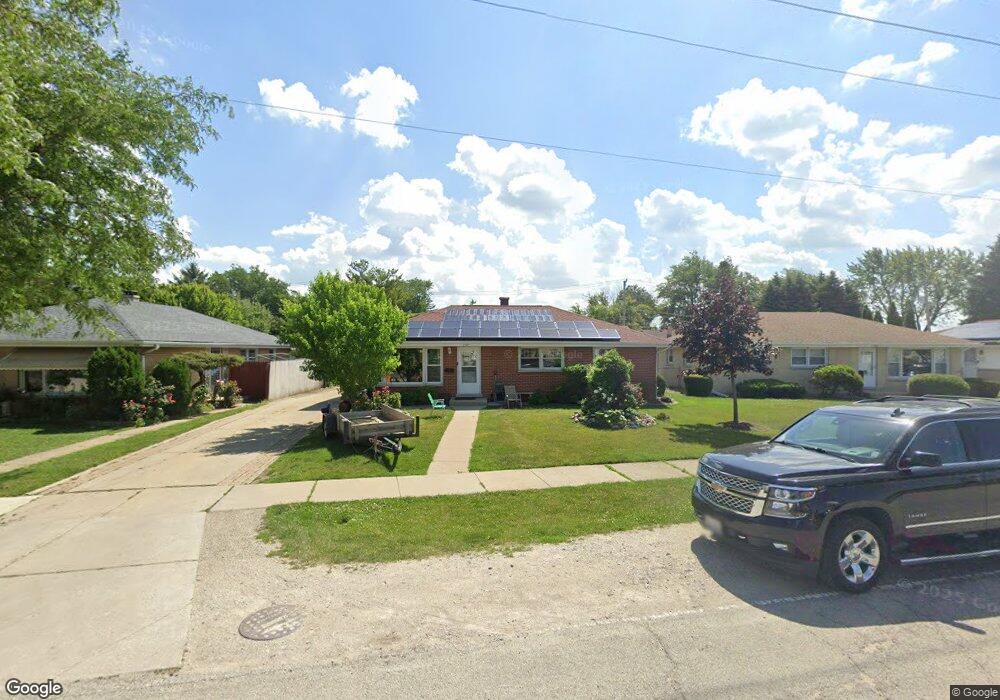
1957 Deane St Des Plaines, IL 60018
Estimated Value: $345,694 - $451,000
3
Beds
2
Baths
1,432
Sq Ft
$285/Sq Ft
Est. Value
About This Home
This home is located at 1957 Deane St, Des Plaines, IL 60018 and is currently estimated at $408,424, approximately $285 per square foot. 1957 Deane St is a home located in Cook County with nearby schools including South Elementary School, Algonquin Middle School, and Maine West High School.
Ownership History
Date
Name
Owned For
Owner Type
Purchase Details
Closed on
Oct 31, 2001
Sold by
Serafin Jesus and Serafin Elisa
Bought by
Serafin Jesus
Current Estimated Value
Home Financials for this Owner
Home Financials are based on the most recent Mortgage that was taken out on this home.
Original Mortgage
$130,000
Interest Rate
6.92%
Create a Home Valuation Report for This Property
The Home Valuation Report is an in-depth analysis detailing your home's value as well as a comparison with similar homes in the area
Home Values in the Area
Average Home Value in this Area
Purchase History
| Date | Buyer | Sale Price | Title Company |
|---|---|---|---|
| Serafin Jesus | -- | -- |
Source: Public Records
Mortgage History
| Date | Status | Borrower | Loan Amount |
|---|---|---|---|
| Closed | Serafin Jesus | $130,000 |
Source: Public Records
Tax History
| Year | Tax Paid | Tax Assessment Tax Assessment Total Assessment is a certain percentage of the fair market value that is determined by local assessors to be the total taxable value of land and additions on the property. | Land | Improvement |
|---|---|---|---|---|
| 2025 | $2,910 | $19,332 | $3,105 | $16,227 |
| 2024 | $2,910 | $13,030 | $2,588 | $10,442 |
| 2023 | $2,824 | $13,030 | $2,588 | $10,442 |
| 2022 | $2,824 | $13,030 | $2,588 | $10,442 |
| 2021 | $3,651 | $13,877 | $2,156 | $11,721 |
| 2020 | $3,631 | $13,877 | $2,156 | $11,721 |
| 2019 | $3,680 | $15,731 | $2,156 | $13,575 |
| 2018 | $2,747 | $11,246 | $1,897 | $9,349 |
| 2017 | $2,709 | $11,246 | $1,897 | $9,349 |
| 2016 | $2,709 | $11,246 | $1,897 | $9,349 |
| 2015 | $2,847 | $10,991 | $1,638 | $9,353 |
| 2014 | $2,797 | $10,991 | $1,638 | $9,353 |
| 2013 | $2,716 | $10,991 | $1,638 | $9,353 |
Source: Public Records
Map
Nearby Homes
- 1445 Everett Ave
- 1370 Fargo Ave Unit E
- 1721 Prospect Ave
- 1696 S Elm St
- 1689 S Elm St
- 2220 S Chestnut St
- 1645 Illinois St
- 1673 Spruce Ave
- 1629 E Touhy Ave
- 1641 E Touhy Ave
- 1754 E Lincoln Ave
- 1640 S River Rd
- 1080 Bogart St
- 1939 E Touhy Ave
- 1700 E Forest Ave
- 815 E Oakton St Unit 311
- 635 Birchwood Ave
- 2646 Maple St
- 1990 Berry Ln
- 1394 Carol Ln
- 1957 Deane St
- 1957 Deane St
- 1965 Deane St
- 1965 Deane St
- 1965 Deane St
- 1947 Deane St
- 1975 Deane St
- 1939 Deane St
- 1958 Illinois St Unit 1
- 1958 Illinois St
- 1944 Illinois St
- 1931 Deane St
- 1981 Deane St
- 1966 Illinois St
- 1960 Illinois St
- 1960 Illinois St Unit 1ST-FLR
- 1960 Illinois St Unit LL
- 1960 Illinois St Unit LOWERLEVEL
- 1932 Illinois St
- 1980 Illinois St
Your Personal Tour Guide
Ask me questions while you tour the home.