Estimated Value: $1,059,000 - $1,127,000
4
Beds
5
Baths
3,374
Sq Ft
$320/Sq Ft
Est. Value
About This Home
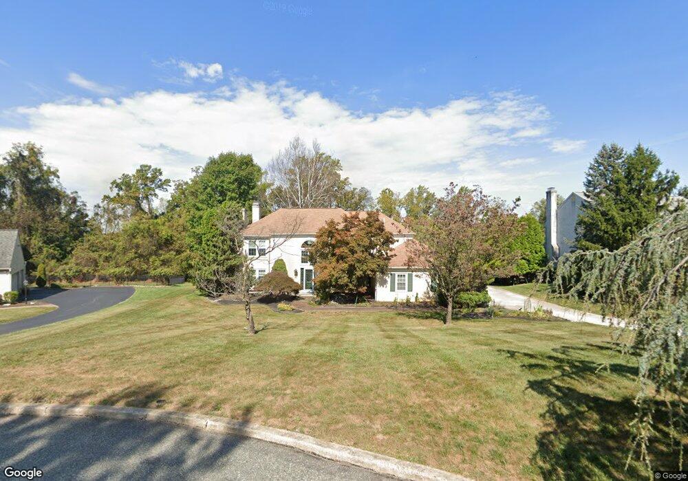
This home is located at 1957 Glenwold Dr, Paoli, PA 19301 and is currently estimated at $1,079,973, approximately $320 per square foot. 1957 Glenwold Dr is a home located in Chester County with nearby schools including Hillside Elementary School, Valley Forge Middle School, and Conestoga Senior High School.
Ownership History
Date
Name
Owned For
Owner Type
Purchase Details
Closed on
Sep 30, 2014
Sold by
Chao Herbert and Chao Joanne
Bought by
Herbert S Chao And Joanne W Chao Family
Current Estimated Value
Purchase Details
Closed on
May 19, 2000
Sold by
Filipski Robert M and Filipski Deborah A
Bought by
Chao Herbert and Chao Joanne
Home Financials for this Owner
Home Financials are based on the most recent Mortgage that was taken out on this home.
Original Mortgage
$160,000
Interest Rate
8.13%
Purchase Details
Closed on
Nov 22, 1995
Sold by
Ingram Billy Joe and Ingram Frankie
Bought by
Filipski Robert M and Filipski Deborah A
Home Financials for this Owner
Home Financials are based on the most recent Mortgage that was taken out on this home.
Original Mortgage
$268,000
Interest Rate
7.25%
Create a Home Valuation Report for This Property
The Home Valuation Report is an in-depth analysis detailing your home's value as well as a comparison with similar homes in the area
Home Values in the Area
Average Home Value in this Area
Purchase History
| Date | Buyer | Sale Price | Title Company |
|---|---|---|---|
| Herbert S Chao And Joanne W Chao Family | -- | None Available | |
| Chao Herbert | $410,000 | -- | |
| Filipski Robert M | $335,000 | -- |
Source: Public Records
Mortgage History
| Date | Status | Borrower | Loan Amount |
|---|---|---|---|
| Previous Owner | Chao Herbert | $160,000 | |
| Previous Owner | Filipski Robert M | $268,000 |
Source: Public Records
Tax History Compared to Growth
Tax History
| Year | Tax Paid | Tax Assessment Tax Assessment Total Assessment is a certain percentage of the fair market value that is determined by local assessors to be the total taxable value of land and additions on the property. | Land | Improvement |
|---|---|---|---|---|
| 2025 | $11,381 | $323,100 | $83,980 | $239,120 |
| 2024 | $11,381 | $323,100 | $83,980 | $239,120 |
| 2023 | $10,690 | $323,100 | $83,980 | $239,120 |
| 2022 | $10,414 | $323,100 | $83,980 | $239,120 |
| 2021 | $10,217 | $323,100 | $83,980 | $239,120 |
| 2020 | $9,935 | $323,100 | $83,980 | $239,120 |
| 2019 | $9,621 | $323,100 | $83,980 | $239,120 |
| 2018 | $9,430 | $323,100 | $83,980 | $239,120 |
| 2017 | $9,206 | $323,100 | $83,980 | $239,120 |
| 2016 | -- | $323,100 | $83,980 | $239,120 |
| 2015 | -- | $323,100 | $83,980 | $239,120 |
| 2014 | -- | $323,100 | $83,980 | $239,120 |
Source: Public Records
Map
Nearby Homes
- 1 Whitworth Ave
- 2175 Swedesford Rd
- 106 N Valley Rd
- 202 Shoreline Dr
- 109 Vincent Rd
- 21 Manor Rd
- 12 Moreland Rd
- 1250 Swedesford Rd
- 29 Manor Rd
- 201 Penns Ln
- 104 Lynbrook Rd
- 114 Manor Rd
- 10 Arlington Rd
- 3 Bryan Ave
- 313 Central Ave
- 0000 the Willis Elite
- 276 Valley View Rd
- 2102 Quail Ridge Dr
- 0000 the Vesper Elite Model
- 229 Miner St
- 1939 Glenwold Dr
- 1975 Glenwold Dr
- 1921 Glenwold Dr
- 1932 Glenwold Dr
- 1884 Glenwold Dr
- 1916 Glenwold Dr
- 1900 Glenwold Dr
- 1868 Glenwold Dr
- 1903 Glenwold Dr
- 1852 Glenwold Dr
- 644 Lyndale Ct
- 1885 Glenwold Dr
- 656 Lyndale Ct
- 647 Lyndale Ct
- 1836 Glenwold Dr
- 1867 Glenwold Dr
- 632 Lyndale Ct
- 1965 Black Rock Ln
- 1947 Black Rock Ln
- 635 Lyndale Ct